Geomagic capture 3d scanner
Geomagic Capture Desktop 3D Scanners
Complete Solution for Scan-Based Design or Quality Assurance
Integrated desktop 3D scanners and software systems for
professional reverse engineering or 3D quality inspection
3D Scanners
Overview
Geomagic Capture 3D scanner delivers accurate and fast blue light 3D scanning technology in a portable, lightweight unit. It can be used as a hand-held scanner and can easily be combined to form a multi-scanner configuration. Whether you need to speed up your product development process by bringing physical objects directly into CAD or automates your 3D inspection process, Geomagic Capture is the solution.
Select from the following packages:
Scan-based Design
Incorporate real-world objects into CAD as a seamless part of the engineering workflow.
View Brochure
Scan-based Inspection
Precise 3D scanning integrated with high-quality inspection tools in a seamless, push-button manner.
View Brochure
Choose a 3D Scanner
For scan-based design or inspection, select one of the small yet powerful 3D scanners that harness the power of blue LED structured light to create highly accurate models.
Capture
Large Field of View
Great for shoebox-size objects. Larger parts can be scanned using the included alignment targets.
Accuracy
60 – 118 microns
Field of View
124 x 120 mm (near)
190 x 175 mm (far)
Data Capture Rate
985,000 points/scan
(0.3 sec per scan)
Capture Mini
Small Field of View
Ideal for small objects, such as electronic components, jewelry, dental models.
Accuracy
34 – 70 microns
Field of View
87 x 68 mm (near)
88 x 87 mm (far)
Data Capture Rate
985,000 points/scan
(0. 3 sec per scan)
Select a Software Package
3D scanning is typically the first part of the process. Geomagic Capture provides a seamless end-to-end solution that transforms 3D scan data for use in computer-aided design or inspection.
Scan-Based Design Software
Scan it, mesh it and surface it in minutes. Use a wide range of point cloud and mesh editing tools, automatic surfacing plus advanced exact surfacing tools. Save to multiple neutral file formats for archive, 3D printing and more.
Advanced Scan-Based Design Software
Powerful scan-based design for the most demanding applications. Create CAD models in Design X and transfer them, with complete feature trees, to Siemens NX, PTC Creo, Pro/E, Inventor and SolidWorks.
Scan-Based Inspection Software
Enables completely automated inspection, with powerful scripting tools that make repeated inspection of multiple parts as simple as a single button click.
Software Plugin for SolidWorks
Ramp up the design process and get products to market faster. By starting with existing objects, create new products or alter old ones without needing to design from scratch.
Request a Demo
Geomagic Capture - Thinglab
Geomagic Capture and Capture Mini are a family of powerful, integrated scanners and software systems for professional Scan-Based Design and quality inspection. They are available in six application-specific configurations, combining the best of Geomagic software with a compact, ultra-precise blue light LED scanner.
Geomagic Capture and Capture Mini enable designers and engineers to incorporate real-world objects into CAD as a seamless part of their engineering workflow. Geomagic Capture scanners for quality inspection deliver precision scanning integrated with Geomagic’s high-quality inspection tools in a seamless, push-button manner. With unprecedented performance and affordability Geomagic Capture scanners usher in a new era of design-to-manufacturing productivity and utility.
contact us
Manufacturers Description
Get to Market Faster with 3D Systems
Streamline your workflow, incorporate quality inspection and deliver products to market faster with the power of 3D Systems’ complete digital thread.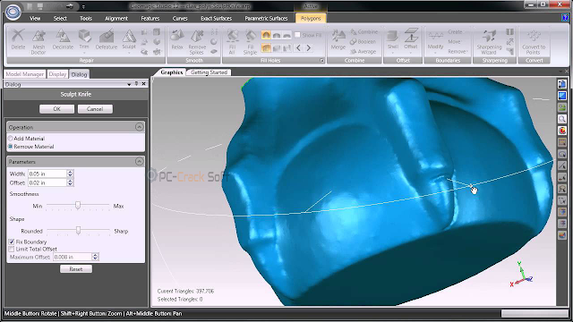 Geomagic Capture delivers a bridge between physical parts and digital software tools for rapid design, engineering, production and quality control. Bring physical objects to CAD, recreate lost or damaged design files, verify dimensions, prepare for 3D printing and manufacture confidently.
Rapidly Recover Lost Design Data
Lost design data? Have an old part with no drawings? Geomagic Capture lets you quickly and easily recreate 3D CAD data for highly complex and broken parts in one seamless scan-based design workflow. From there, you can go directly to 3D printing and manufacturing.
Scan Faster with Multi-Capture Scanning
Quickly set up a multi-Capture array, and you can scan and process accurate 3D data even faster. The software’s advanced automation and scripting tools make repetitive inspections easier than ever.
Reduce Costs and Increase Efficiency
Complete Geomagic Capture systems, including integrated Geomagic software, cost less than other professional 3D scanners. For the first time, you can get the accuracy, the scanning envelope and the advanced software you need from a single vendor.
Design from the World Around You
Geomagic Capture ushers in a new design paradigm where existing objects provide inspiration for innovative new products. Improve upon, learn from, customize and reuse the designs that surround you every day with a 3D scanner for CAD.
Enhance Your Scanning with the Geomagic Capture ProPack
The Geomagic Capture ProPack gives you the power of portable hands-free 360° scanning. This all-in-one addition to your Geomagic Capture scanning experience includes a powered, fully automated rotary turntable plus fixturing arms to hold your parts in place. It’s secured in a form-fitting hard case that has spaces to include your Geomagic Capture scanner and tripod.
Technical Specifications
| Dimensions (L x W x H) | 276 x 74 x 49 mm |
| Weight | 1. 35 kg 35 kg |
| Depth of Field | 180 mm |
| Stand-off Distance | 300 mm |
| Field of View | 124 x 120 mm (near) 190 x 175 mm (far) |
| Data Capture Rate | 985,000 points/scan (0.3 sec per scan) |
| Accuracy | 0.060 mm |
| Resolution | 0.110 mm at 300 mm; 0.180 mm at 480 mm |
| Computer Requirements | Windows 7/8 (64-bit) Operating System, Intel and AMD Quad-core 2-GHz CPU or better, Gigabit Ethernet interface, 4 GB Memory or greater, 512 MB Video Card or better |
Frequently Asked Questions
What is included with Geomagic Capture?
Every Geomagic Capture scanner system comes complete with everything you need for Scan-Based Design or Inspection.
Packages include:
- Capture or Capture Mini Blue light LED 3D scanner
- Geomagic application software (varies based on Capture package purchased)
- 90 day hardware warranty (annual warranty included with maintenance)
- Desktop scanner stand, AC adapter and data cable
What is the included scanner’s accuracy?
The Capture is pre-calibrated at the factory and offers accuracy of 60 microns at the near field (about 0. 3m from the scanner) to 118 microns at the far end of the field (about 0.5m from the scanner).
The Capture Mini is pre-calibrated at the factory and offers accuracy of 34 microns at the near field about 0.3m from the scanner) to 70 microns at the far end of the field (about 0.5m from the scanner).
Do the scanners require targets?
No, the Capture scanners require no targets to align multiple scans.
Can the software work with other scanners?
Yes! We do not limit the software that comes as part of any Geomagic Capture package, so it will work with all 3D scanners.
Do I need a seat of Solidworks or SpaceClaim in order for Geomagic Capture Scanners to work?
Geomagic Capture Scanners for SolidWorks and SpaceClaim require SolidWorks or SpaceClaim to function, which are not included in the package.
For all other Geomagic Capture packages, no additional software is required to create CAD models or inspect parts.
What versions of SolidWorks does the plugin work with?
Versions 2013 and 2014, 32 and 64 bit
Do the Capture scanners also collect color?
No, the Capture scanners are built to collect precision geometric measurements only.
Are the scanners new products, or have they been on the market?
The Capture scanners use proven technology that’s been powering 3D scanners for more than a year.
What about the Sense scanner – how does it compare?
The 3D Systems Sense scanner is a consumer device that costs just a few hundred dollars and is aimed at home users and hobbyists. It’s accurate to a few millimeters, which makes it impractical for most professional uses. More information about the Sense is available at cubify.com/sense.
Want To Know More?
Our team of 3D scanning professionals are just an email or a phone call away.
contact us
Leica RTC360 3D Laser Scanner | Leica Geosystems
- home
- Products/Solutions
- Laser scanners nine0004
- Scanners
- Leica RTC360 3D laser scanner
Use automatic on-site pre-registration of point cloud data for real-time quality control, increased productivity, and more informed decisions on the job site
Document and digitize your environment in 3D with the Leica RTC360 3D reality capture solution. Increase productivity on site and in the office with fast, accurate, portable and easy-to-use hardware and software. With the RTC360 3D Laser Scanner, a skilled technician can overcome any design challenge with accurate and reliable 3D models to unlock the full potential of any site.
- The compact, highly automated, intuitive and user-friendly RTC360 solution includes a high-performance 3D laser scanner, the Leica Cyclone FIELD 360 mobile app for edge computing, such as automatic registration of scanned data in real time, and Leica Cyclone REGISTER 360 software for office work , with which you can easily implement the resulting 3D model into your workflow.
 nine0004
 - Capture scans, including stunning HDR images, in less than two minutes.
- Automatic recording of movements between survey points to pre-register scanned data in the field without manual intervention.
- Augment the collected data with informative tags with hints for optimal planning and information about the real conditions on the site, which will help your colleagues to better understand the situation.
- Upload collected data from Cyclone FIELD 360 directly to Leica TruView Cloud to quickly share design data before import and registration. nine0004
Fast
The new Leica RTC360 laser scanner captures reality in 3D at a speed never seen before. Capturing up to 2 million points per second and using advanced HDR image capture, the scanner generates colorful 3D point clouds in less than two minutes.
 Automated, labelless data logging in the field based on VIS technology and convenient automatic data transfer from site to office further speed up field work and increase productivity. nine0015
Adaptive
Thanks to its portable design and foldable tripod, the compact and lightweight Leica RTC360 fits into a regular backpack. On the object, one click of a button is enough to scan the environment without any additional settings.
Fine
nine0035 Low noise in the acquired data means better image quality – you get crisp, detailed scans that are ready for a variety of industries. Combined with the Cyclone FIELD 360 automated data logging software in the field, the Leica RTC360 delivers amazing accuracy that can be verified on site.
Pre-registration in the field
The Cyclone FIELD 360 app, part of the RTC360 solution, bridges the gap between on-site 3D data collection and on-site registration of laser scan data in the office with Cyclone REGISTER 360.
 User can automatically capture, register, and control scan and image data on site . The easy-to-learn and user-friendly graphical interface offers visual aids for complex calculations, making it easy for even beginners to master. nine0015
 Previous Next
Scanning options
The RTC360 3D Laser Scanner automatically captures movement between survey points to pre-register scanned data on the spot. Juergen Mayer spoke about the latest developments in an interview with The Reporter.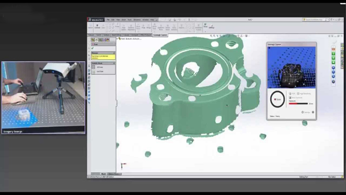 nine0015
Introduction to the RTC360
The latest Leica RTC360 3D reality capture solution, unveiled at HxGN LIVE 2018, combines a high-performance laser scanner with a mobile application for capturing and pre-logging real-time scan data.
From hardware to software
Geosystems specialists optimize every link of the workflow in both software and hardware solutions to increase the efficiency and productivity of field work and data processing in the office. nine0015
Leica RTC360: 3D reality capture solution
Leica Cyclone FIELD 360 mobile-device app
Downloads
Videos
EXPERT ADVICE
nine0062 Examples of using
Podcasts
Introducing the Leica RTC360 3D Laser Scanner
3D environments in a matter of minutes - an outlook on recent reality capture technology
3D reality capture - new opportunities, greater understanding
Transforming Ayacucho into a digital city
nine0062 Services
myWorld Customer Portal
Active Customer Care
Customer Support Packages
Related Products
Laser scanners
Leica BLK360 laser scanner
Leica ScanStation P40 / P30
Leica ScanStation P50
Software
Leica Cyclone
Leica Cyclone REGISTER
Leica Cyclone REGISTER 360
Leica CloudWorx
Leica TruView
Leica JetStream
Accessories
Accessories for 3D laser scanners 9015
contact-for-laser-scanning
As of v7. 0.1, Safari exhibits a bug in which resizing your browser horizontally causes rendering errors in the justified nav that are cleared upon refreshing. nine0015
As of v7.0.1, Safari exhibits a bug in which resizing your browser horizontally causes rendering errors in the justified nav that are cleared upon refreshing.
CONTACT US
The High-Definition Surveyor - Blog
Learn how Leica Geosystems laser scanning solutions are helping professional to shape the future of our world. nine0015
Learn how Leica Geosystems laser scanning solutions are helping professional to shape the future of our world.
Read More
Scanning power
Quality is a tradition, built deep within our DNA. We have a commitment to excellence and exceptional attention to detail. nine0015
Scanning power
Quality is a tradition, built deep within our DNA. We have a commitment to excellence and exceptional attention to detail.
WATCH NOW
Educational articles and analytics
What is 3D Reality Capture and how is it applied in your industry? nine0015
What is 3D Reality Capture and how is it applied in your industry?
learn more
Comparison table of laser scanners
Which laser scanner is right for you?
Which laser scanner is right for you?
download now
Reality Capture Newsletter
Click here to subscribe to our regular newsletter and stay up-to-date on all the latest reality capture news. nine0015
Click here to subscribe to our regular newsletter and stay up-to-date on all the latest reality capture news.
Subscribe
Online learning
Leica Geosystems has developed an online learning platform to further educate customers on how to maximize the functionality of their instruments. nine0015
Leica Geosystems has developed an online learning platform to further educate customers on how to maximize the functionality of their instruments.
App Store: 3d Scanner App™
Description
3D Scanner App for Mac is a desktop tool for processing photos and videos into 3D models using the power of Photogrammetry. Perfect for 3D Design, CAD, Architecture, Games Assets, AR, VR, XR. Share USDZ models via iMessage to let friends and family see your models in Augmented Reality. nine0035 Photogrammetry is done using the new Object Capture API on supported hardware.
Version 1.1.4
ux improvments
Ratings and reviews
1 rating
How do they annoy
How pissed off people are with devices without lidar and who write about things that don't work for them...
They simply take and underestimate the rating with their ignorance of the application.
Dimasik san
Great application, crashes when processing large objects, but it's understandable.
the application is still raw
I have already scanned the whole house)
I think if you make it so that objects could be shared on social networks or somewhere else, it would blow up the Internet))
Everything cool!
nine0214 ONLY SUITABLE FOR DEVICES WITH A LiDAR SCANNER!
Thanks for the developers for a great free app
Developer Laan Labs has indicated that, in accordance with the application's privacy policy, data may be processed as described below. Detailed information is available in the developer's privacy policy.
Unrelated with user data
The following data may be collected, which is not related to the user's identity:
- Usage data
- Diagnostics
Sensitive Data may be used differently depending on your age, features involved, or other factors.


