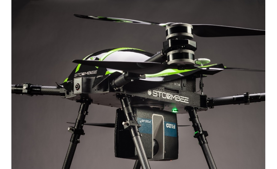
Drone 3d scanner
Skydio 3D Scan Drone Mapping Software
Adaptive Scanning for Autonomous Inspection Data Capture
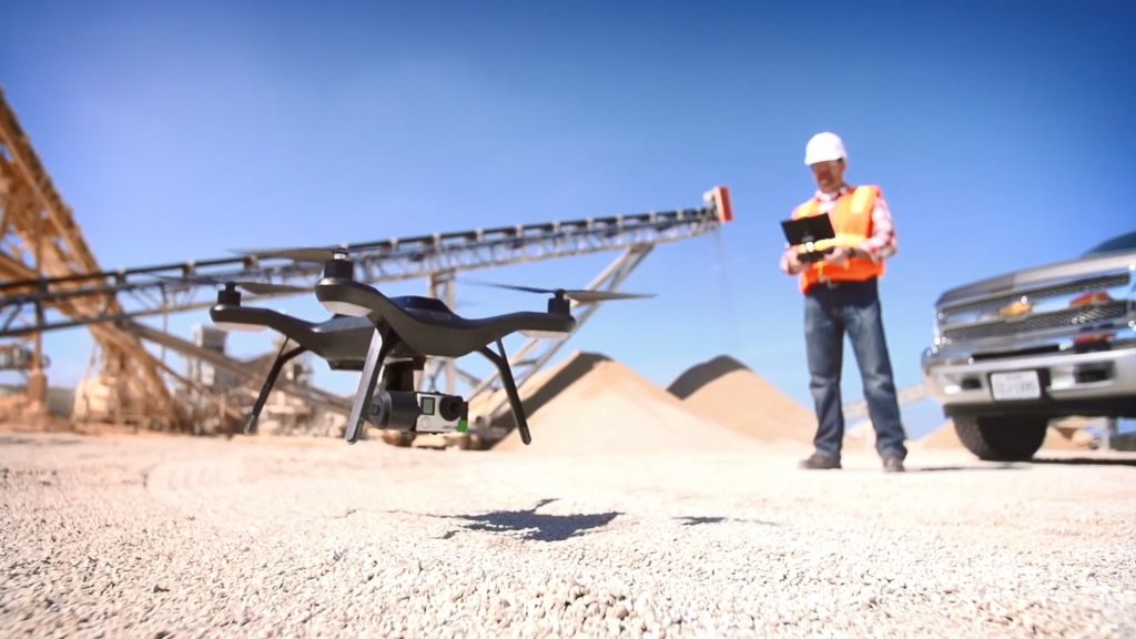
Contact UsSkydio 3D Scan™ is a first-of-its-kind adaptive scanning software to automate the data capture process needed to generate 3D models with comprehensive coverage and ultra-high resolution. Perform higher quality inspections faster with minimal pilot training.
DATA CAPTURE
Up to 75% faster
REINSPECTION RATE
Up to 30% reduced
VEHICLE & SENSOR COST
Up to 50% lower
Human Inspections
Tower climbs, snooper trucks, and other human-based inspection methods are expensive, time-consuming, and dangerous.
Manual Drone Inspections
Manual drones are expensive and have untrustworthy obstacle avoidance, requiring many hours of pilot training to avoid crashes.
Perform Rapid Field Assessments
Skydio 3D Scan generates complete, indexed photo sets in minutes for assessment in field
Create Digital Twins
Use your current 3D reconstruction software to produce 3D models of structures, scenes, or assets
Deliver Detailed Inspection Reports
Deliver more detailed models to repair teams and asset managers
Document Crime & Accident Scenes
Skydio 3D Scan automates capture in close proximity to increase speed and data quality
Setup the Scan
Select one of the capture modes and follow the on-screen workflows to start the autonomous 2D or 3D scan
Start the Scan
The drone autonomously flies to capture the scene. Monitor the scan in real-time using AR Coverage and AR Observer features
View Data On-Site
Operator assesses data in field instantly using the Edge Model Viewer to easily click around the scanned scene
3D Capture 2D Capture
“With 3D Scan, we are going to be able to efficiently capture high-quality images for 3D Reconstruction, saving us tons of time and energy in the field. It’ll be easier for the pilots, safer for our assets, and faster for our teams.”
Jarvis Worton, Global Platform Technology Analyst
Jacobs Engineering
Skydio 3D Scan Pricing
Skydio 2+: $
2,999 (drone/year)Skydio X2: $4,199 (drone/year)
Contact Us
Online Training
Skydio’s interactive, self-guided 3D Scan online training program is the perfect way to prepare your pilots to generate value from 3D Scan quickly. Operators can explore dynamic visuals, test their knowledge with interactive quizzes, and receive a completion certificate for 3D Scan training in just a few hours.
Skydio Academy
Reduce ramp-up time
Increase your confidence in flight
Receive an operator certificate for Skydio 3D Scan
3D Tower Capture: 3D Scan Gets Smarter
View Article
2D GPS Capture: A new capture mode for Skydio 3D Scan
View Article
How Skydio Drones with 3D Scan Work for Public Safety
View Article
Capture Digital Twins of Tactical Environments
View Article
Interested in building 3D models? Try this free drone scanning software.
Interested in building 3D models with your drone but can’t afford the Skydio 3D software license of $2,999 per year? Or $99 per month for SkyBrowse or some of the other neat but expensive photogrammetry packages? How about free drone scanning software?
Then you really should try out Meshroom. The Windows and Linux-based program has been out there for a while, but it’s not been widely adopted by the drone community. I’ve been playing around with it for the past week and I’m impressed. Basically, you take a 360-degree video of the object you hope to scan. Meshroom then looks at the individual frames and figures out what the object must look like in 3D space.
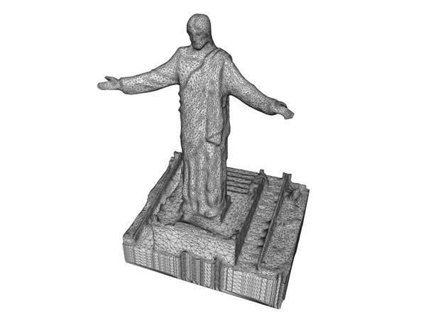
My plan was to scan one of Toronto’s downtown statues. But the authorities are getting testy about flying drones around people, so I went to a sculpture garden where they store old architectural ornamentation. And I scanned this guy.
Admittedly I could have done it will a cellphone but not as neatly as you can with a DJI Mini2. And the Quickshot Circle function is your best friend here. In a couple minutes I had a nice 360-degree video of the old man. I took a few close-ups of his face for good measure. Meshroom apparently works better without dark shadows, so here’s a good reason to fly your drone on an overcast day.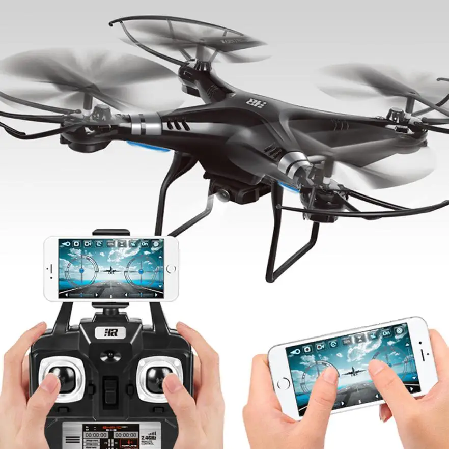
Free drone scanning software
Meshroom builds its model out of a series of stills. How do you convert a video into stills? If the video is short enough, you can use a (free!) tool like Online Convert . I used After Effects, which is decidedly NOT free, but it’s what I’m used to. When you render your video, just do it as a JPEG sequence.
This will generate a LOT of stills, so be sure to store them in a folder where you can keep track of them. Mine are DJI_0190_0 to DJI_0190_495.
Now, download and open Meshroom. It may seem daunting at first, but it’s surprisingly simple. All those nodes at the bottom of the screen look intimidating, but beginners can safely ignore them. However, if you DO get lost, there’s a good Youtube tutorial here.
What we want to do is drag all the relevant stills into the box on the left where it says Images. Meshroom says the more photos, the better. But 495 pictures seems excessive. Prusa recommends about 100 photos if you’re planning on making a 3D print.
I dragged over roughly every tenth picture by selecting all the files with a “5” in them. It seemed to work fine. And I also included a few close-ups of the face as well. Meshroom can actually make sense of this. Amazing.
And now, press Start. Meshroom will ask where you want to save the project. Remember to keep track of this; it will be important later. Press Start again. And then go make lunch. This is when the magic happens, but it’s slow magic, depending on how many stills you’ve dragged over. Eventually, the green line at the top will completely cross the screen and you’re done. Meshroom outputs the scanned file as an .obj file, but isn’t terribly forthcoming where it stores it. That’s why you should remember where you saved the project. Turns out its in a subfolder of a folder called Texturing, but it may be easiest just to use the search window and look for a file with the suffix .obj.
If all you want is the 3D scan, you’re done!
But many people would like a 3D print of their hard work, so the next step is to remove everything you don’t want to print; the trees, the grass, the photographer.
There’s probably lots of ways to do this, but in Part Two I’ll show you how I did it. In the meantime, look around for something to scan because your drone plus Meshroom turns the entire physical world into just another page of Thingiverse.
Oh, if you don’t already have it, download another program called Blender (free!) because we’ll need its subtle alchemy to help turn our data abstractions into reality.
FTC: DroneDJ is reader supported, we may earn income on affiliate links
Subscribe to DroneDJ on YouTube for exclusive videos
Guides
About the Author
David MacQuarrie
David MacQuarrie is a 35 year+ veteran of the Canadian Broadcasting Corporation. He worked in St. John’s, Ottawa, Toronto, and Beijing where he worked as a news writer, reporter, producer for the national and local television and radio networks. His stories on science and technology won ACTRA and Columbus awards.
{{ title }}
{{ username }}
·
{{ time }}
Top Comment
{{/values}} {{#isDisplay}} {{/isDisplay}}{{#isAniviewVideo}} {{/isAniviewVideo}}{{#isSRVideo}} {{/isSRVideo}}What you need to know about the first DJI Zenmuse L1 Scanner
DJI The Zenmuse L1 is a sensor designed to meet the growing demand from DJI drone users in construction, architecture, engineering and surveying. Powerful yet affordable drone scanner.
Although laser scanning technology (LiDAR) has been around for more than half a century, the explosive effect of this technology has only been felt by specialists in various industries in the last decade. In geodesy, laser scanning is recognized as the most important technology for creating accurate three-dimensional models.
In low light conditions or in areas with dense vegetation, aerial photogrammetry methods cannot determine the true surface of the Earth. Even under such conditions, a laser scanner mounted on a drone can create accurate models of complex structures and surfaces in the form of a three-dimensional point cloud.
Compared to aerial photogrammetry, the adoption of laser scanning technology for industrial drones has been very slow. The main reason is the lack of lightweight, but highly functional and inexpensive airborne scanners or the complexity of post-processing and classification of ultra-dense data. Despite all the difficulties, airborne laser scanning technology has won its place under the sun.
Technology advances and everything is changing before our eyes. Launching in early 2021, the first DJI Zenmuse L1 drone scanner will be a major breakthrough in democratizing laser scanning technology through its efficiency, accuracy and cost-effectiveness.
1.
 Integrated inertial navigation system for superior accuracy
 The inertial measurement system (INS) measures the triaxial acceleration and angular velocity of the drone in real time, thereby calculating the speed, position and angles of the sensor. A high-precision ANN is critical to capturing quality scan data because without it, your point cloud would be nothing more than an arbitrary collection of points.
Zenmuse L1 uses an industrial grade ANN. In typical usage scenarios, the Zenmuse L1 provides an INS accuracy of 0.025° (roll/pitch) / 0.08° (heading). For greater reliability and accuracy, a video sensor for more accurate positioning and a dual-frequency GNSS receiver were included in the solution. This allows the Zenmuse L1 to achieve a 5 cm geodetic class relative accuracy and 10 cm absolute accuracy when flying at an altitude of 50 m.
2. 3-axis stabilized gimbal to close data gap
While most other drone scanners on the market require you to purchase stabilization solutions separately, the Zenmuse L1 comes with a 3-axis stabilized gimbal as a complete solution. This means that any unintended rotational movement of your drone (pitch, roll, or yaw) is dynamically stabilized within ±0.01°, ensuring even dot distribution even at very high scan speeds. Thus, the risk of data gaps is significantly reduced, which reduces the costs associated with re-flying.
Since the gimbal is integrated with DJI's flight control system, you get fully automatic rig control, increased data collection efficiency, and perfectly matched images for accurate geo-referenced aerial survey flights.
3.1" 20 MP CMOS Sensor for High Resolution Photogrammetry
As customer requirements become ever more demanding, it's impractical to force surveyors to choose between scanned data and RGB images, and it's unwise to spend twice as much time and money getting true-color point cloud models. That's why DJI's new all-in-one and cost-effective drone scanner solution, the Zenmuse L1, integrates a 1" 20MP CMOS sensor on board to perform essential functions such as taking photos and recording videos, as well as providing real-time color information.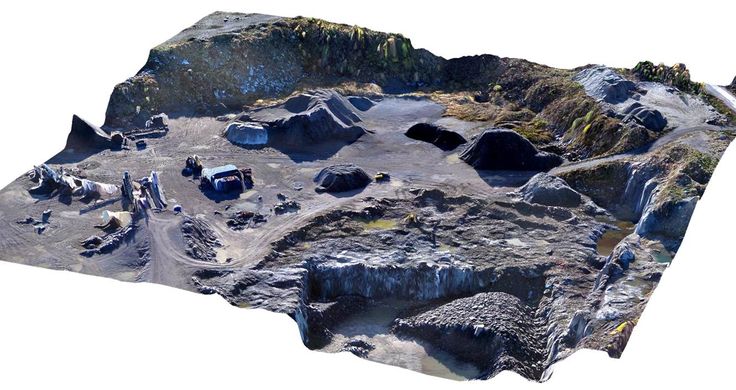 time for each point in the 3D cloud. This allows the Zenmuse L1 to capture true-colored point clouds and create 3D models.
The 1-inch 20MP CMOS sensor features a distortion-free mechanical shutter. This is the same sensor used in the most popular DJI Phantom 4 RTK mapping drone. And, like the DJI Phantom 4 RTK RTK, the Zenmuse L1 delivers images with about 2.74 cm of detail (pixel size) at 100 meters - that's if you choose to use it for photogrammetry.
4. Supports registration of up to 3 pulse reflections to penetrate dense foliage
With a scanning range of up to 450 meters, the Livox LiDAR Zenmuse L1 module provides an effective speed of up to 240,000 points per second. But the Zenmuse L1 can capture up to 3 echoes per laser pulse, which means the throughput can reach 480,000 points per second with two or three reflections.
This capability allows users of Zenmuse L1 LiDAR drones to easily create sets of spatial data on the height of dense forest and “clean up” the digital elevation model from distortion due to vegetation. The use of multiple reflections also makes it easier to classify the point cloud, highlighting different types of objects in the point cloud, such as overhead wires or various objects on a construction site.
5. Non-repetitive scan mode for full coverage
Zenmuse L1 is the only airborne scanner that supports both linear scanning and non-repeating scanning, a unique technology developed by Livox. In this mode, as the survey time increases, the scanned area within the field of view (FOV) increases, and the point cloud becomes denser. Following this technique increases the likelihood of detecting objects and other details within the field of view. And the longer the drone's LiDAR sensor scans an area, the higher the resolution of the data becomes (compared to conventional line scanning).
The non-repeating scan mode allows the DJI Zenmuse L1 to provide full coverage of an area of interest in a very short time and allows the sensor to collect data in any direction rather than along a specific plane.
6. IP44 certified for reliable performance
The Zenmuse L1 is IP44 rated, allowing it to fly in a wide range of adverse weather conditions including snow, smoke and fog. In addition, the LiDAR L1 module is an active sensor that uses its own radiation to work. Thanks to this, it can scan the area and receive point clouds at night or in low light conditions.
7. Complete mapping solution
Combining the Zenmuse L1 scanner with DJI's flagship Matrice 300 RTK industrial drone platform and DJI Terra post-processing software gives you an integrated, complete solution for accurate 3D data acquisition. At a flight altitude of 100 m and a speed of 10 m/s, a single flight with the DJI Matrice 300 RTK and Zenmuse L1 can cover an area of about 2 square meters. km.
To view a point cloud, simply use the Point Cloud LiveView feature to make sure you capture everything you need without landing and waiting for post-processing, and save yourself from re-flying and reworking. And once you have the right data, DJI Terra is your all-in-one post-processing solution. The software seamlessly combines INS and GNSS data to calculate cloud point coordinates and visible image positions so you can easily create 3D terrain models and get detailed accuracy reports.
Air scanners - what's next?
DJI aims to pave the way to the sky for affordable and scalable laser technology solutions. When unmanned laser scanning data becomes readily available, its applications will go far beyond engineering, geodesy, and conventional 2D surveys. For example, environmental monitoring agencies and companies can use laser scanning data to obtain information on tree canopy dimensions, estimate vegetation density, calculate stock levels, and calculate growth trends. High-risk industries such as oil and gas, mining and telecoms can benefit from detailed asset modeling for automated controls and more. And first responders, meanwhile, can use colored point clouds for real-time situational awareness, even at night in poor visibility.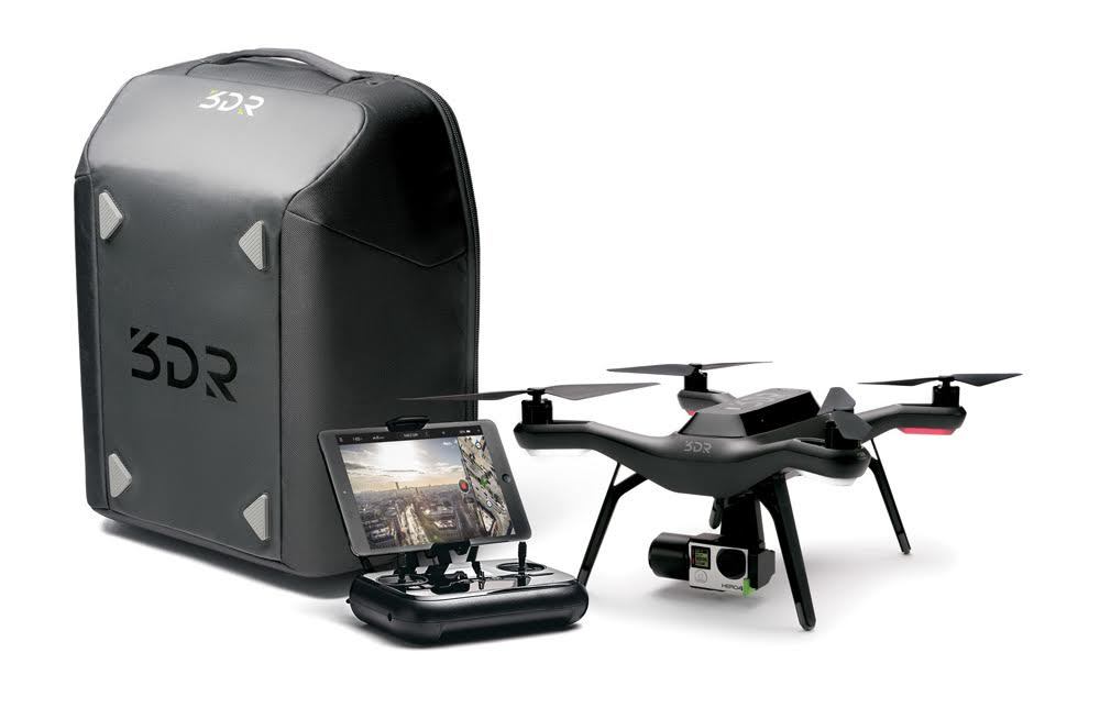
Zenmuse L1 will be available for order in early 2021
For purchase, setup and technical support of DJI drones, please contact ArtGeo by phone +7 495 781 7888 or by e-mail [email protected].
3DR drone for 3d terrain scanning
Pelevin N. 0 Comments 3d scanning, Autodesk, ReCap, quadcopters, Soft
3DR is a California company that develops and manufactures unmanned aerial vehicles for commercial and multifunctional purposes. One of the latest developments of the manufacturer is called Solo - UAV with built-in intelligence.
Currently, 3DR has already published on its website software designed to control the Solo. The user, with the help of a minimum number of actions, will be able to collect data, process it and send it to any of the popular programs for working with 3d data: AutoCAD, Civil 3D, InfraWorks or Revit.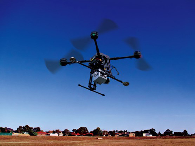 At the same time, the company provides a convenient online service through which data processing is carried out. For example, in Autodesc ReCap 360, you can create three-dimensional digital terrain models, as well as correct point cloud data obtained during the scanning process.
How does it work?
One of the main advantages of the Solo is that it is ready to use right out of the box, plus the user will receive a simple controller with two joysticks, which has a special holder for a tablet or any other compatible screen. On board the controller are camera controls and a Wi-Fi hub. If the video quality is not enough, you can also connect an external display here using the HDMI connector.
To create 2D or 3D digital images, you need to launch a special application and select the appropriate tool. Further, all the necessary data will be loaded automatically, and a snapshot of the territory where the user is located will appear on the screen. Here he draws a contour - the flight path, and also chooses the quality of the resulting image. In addition to the usual scanning and creating a point cloud, the user has the ability to capture a photorealistic, three-dimensional terrain model.
Regardless of the choice of 3d scanning method, Solo will automatically take a series of photos of the area that is located along the flight path, after which the drone will return to the place where it took off.
The resulting images will then be automatically processed in ReCap 360 PRO, where all the necessary binding of coordinates to the data cloud will be performed. The processed images will be available to users almost immediately.
Solo software can currently produce:
- observation of the area;
- measurement of volumes of individual terrain objects, as well as tracking their movement;
- creating contour maps with the collection of height data;
- image capture from all points that are specified by the user during the construction of the flight path and much more.
Solo UAV Capabilities
Modern construction companies almost always use traditional methods for calculating geodetic data and the amount of material needed to build a building. This process itself is quite lengthy, since a pause must be made between each stage, not to mention the costs for a team of surveyors and other specialists. Depending on the size of the project, calculations can be made in hours or even weeks, which translates into a round sum directly for the company itself. What can we say about the risks to which researchers and representatives of the construction organization are exposed. They go up and down for days on end, dragging huge piles with expensive equipment behind them. At the end of the measurements on the ground, the surveyors return to the office, where they process the received data.
If you use the Solo drone for similar operations, the process takes only a few minutes, while all the necessary tasks are planned directly by the user in the software shell.