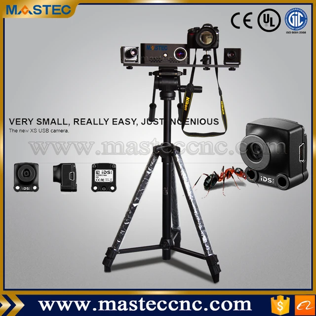
3D laser scanner surveying price
Terrestrial laser scanners (long-range scanning): A complete guide
What is terrestrial laser scanning?
Terrestrial laser scanning (TLS) is a form of 3D scanning in which tripod-mounted laser scanners are used to capture large objects and environments. The technique is widely used in construction, surveying, forestry, and other disciplines.
Also known as long-range laser scanning, TLS involves deploying a scanner in a static location, whereas other laser scanners may be handheld or mounted to vehicles to capture data from a greater number of vantage points. TLS produces more accurate scans than mobile scanning — at the expense of speed and simplicity.
These 3D scanners are often generically called LiDAR scanners, though terrestrial scanners aren’t the only type of scanner to use the technology.
Depending on their range, speed, and features, terrestrial laser scanners generally cost between $20,000 and $100,000. Most are bundled with dedicated software packages that allow the user to process the scanned data for specific use cases.
This guide compares some of the leading models of terrestrial laser scanners from brands like Leica Geosystems and FARO, in addition to explaining how the scanning technology works and who uses it.
Terrestrial laser 3D scanner selection
| Brand | Product | Accuracy | Country | Price Approximate starting prices based on supplier-provided information and public data. Prices may vary by region, over time and do not include additional products or services (taxes, shipping, accessories, training, installation, …). | |
|---|---|---|---|---|---|
| Leica Geosystems | Leica BLK360 | 4 mm0.157 in | Switzerland | $ 18,50016 000 €15,397 £2,489,860 ¥ | Quote |
| FARO | Focus S 70 | – | United States | $ 35,00030 000 €29,129 £4,710,545 ¥ | Quote |
| Trimble | X7 | 2 mm0.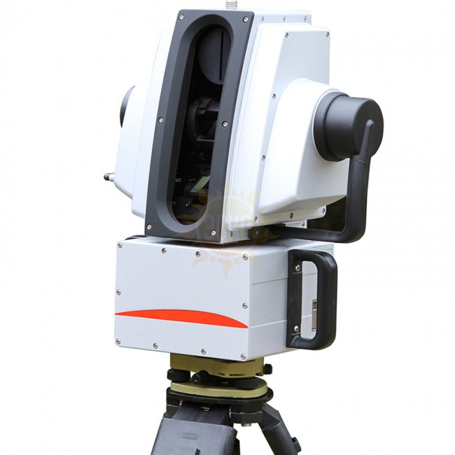 079 in 079 in | United States | $ 35,00035 000 €29,129 £4,710,545 ¥ | Quote |
| Artec 3D | Ray | 0.7 mm0.028 in | Luxembourg | $ 60,00056 000 €49,936 £8,075,220 ¥ | Quote |
| Teledyne Optech | Polaris | – | Canada | $ 65,00065 000 €54,097 £8,748,155 ¥ | Quote |
| Zoller + Fröhlich | Z + F IMAGER 5016 | – | Germany | $ 85,35880 000 €71,041 £11,488,127 ¥ | Quote |
| Leica Geosystems | Leica RTC360 | – | Switzerland | $ 80,00053 000 €66,581 £10,766,960 ¥ | Quote |
| Surphaser | 100HSX | 0.3 mm0.012 in | United States | $ 90,00076 000 €74,904 £12,112,830 ¥ | Quote |
| RIEGL | VZ-400i | – | Austria | $ 120,000112 467 €99,872 £16,150,440 ¥ | Quote |
| Maptek | SR3 | – | Australia | upon request | Quote |
| Topcon | GLS-2000 | – | Japan | upon request | Quote |
Expand to see more specs
The products in the table are ranked by price (low to high).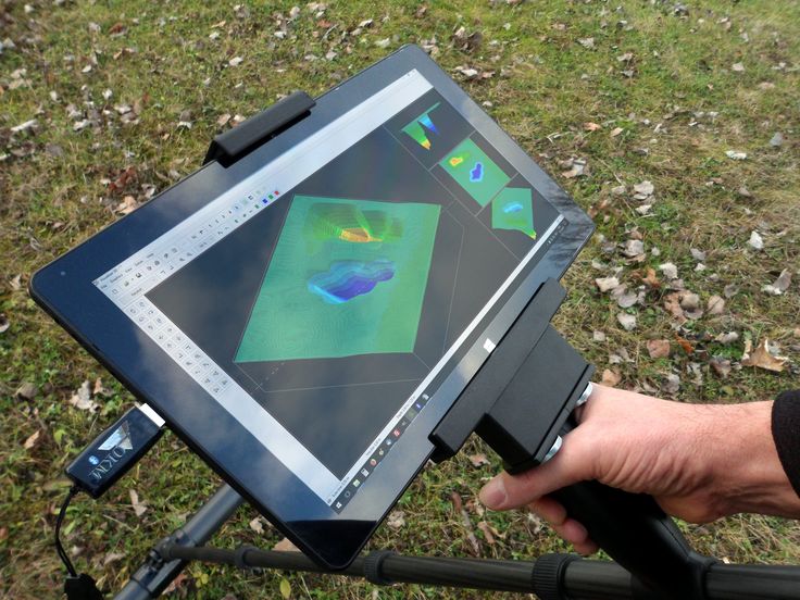
| Product | Brand | Country | Price Approximate starting prices based on supplier-provided information and public data. Prices may vary by region, over time and do not include additional products or services (taxes, shipping, accessories, training, installation, …). | |
|---|---|---|---|---|
| Leica BLK360 | Leica Geosystems | Switzerland | $ 18,50016 000 €15,397 £2,489,860 ¥ | Get a quote |
| Focus S 70 | FARO | United States | $ 35,00030 000 €29,129 £4,710,545 ¥ | Get a quote |
| X7 | Trimble | United States | $ 35,00035 000 €29,129 £4,710,545 ¥ | Get a quote |
| Ray | Artec 3D | Luxembourg | $ 60,00056 000 €49,936 £8,075,220 ¥ | Get a quote |
| Polaris | Teledyne Optech | Canada | $ 65,00065 000 €54,097 £8,748,155 ¥ | Get a quote |
| Z + F IMAGER 5016 | Zoller + Fröhlich | Germany | $ 85,35880 000 €71,041 £11,488,127 ¥ | Get a quote |
| Leica RTC360 | Leica Geosystems | Switzerland | $ 80,00053 000 €66,581 £10,766,960 ¥ | Get a quote |
| 100HSX | Surphaser | United States | $ 90,00076 000 €74,904 £12,112,830 ¥ | Get a quote |
| VZ-400i | RIEGL | Austria | $ 120,000112 467 €99,872 £16,150,440 ¥ | Get a quote |
| SR3 | Maptek | Australia | upon request | Get a quote |
| GLS-2000 | Topcon | Japan | upon request | Get a quote |
Overview of the best terrestrial laser scanners
Here we provide a deeper look into each terrestrial 3D scanner from our list.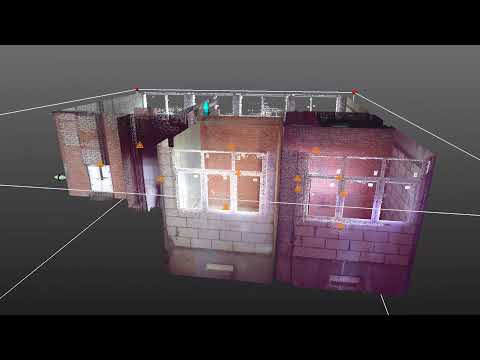
Described by Leica Geosystems as the smallest and lightest laser scanner in the world, the BLK360 weighs just 1 kg and is only 165 mm tall.
The low price point of the BLK360 is reflected in its slower scanning speed compared to the RTC360, but unique benefits include push-button functionality and thermal imaging capabilities.
The hardware works with the Leica Cyclone FIELD 360 mobile app and Cyclone REGISTER 360 (BLK Edition).
Contact manufacturer Get a quote Add to comparison
Florida-headquartered Faro, a specialist in 3D capture, designed its FOCUS S series for the fast and straightforward scanning of complex objects.
The FOCUS S 70 is the company’s best-selling model, and includes a touch-screen interface, 8-megapixel camera, and a sealed design to guard against high temperatures and challenging outdoor environments.
With a range of 70 meters, the S 70 is the most affordable scanner in the FOCUS S series, and suitable scanning objects include architectural facades, production facilities and accident sites.
Contact manufacturer Get a quote Add to comparison
The Trimble X7 is a high-speed laser scanner offering automatic calibration, self-leveling, and automatic registration Californian company Trimble provides a two-year warranty for the X7, which is greater than the industry standard.
This laser scanner is one of the easiest to use, and doesn’t require in-depth skills or knowledge of 3Dscanning. Point clouds are automatically exported in common file formats (e.g. RCP for Autodesk), eliminating the need to convert the data via intermediary software.
Trimble’s Perspective software provides 3D visualization tools, automatic registration, and a user-friendly interface.
Contact manufacturer Get a quote Add to comparison
The Maptek SR3 is a terrestrial laser scanner designed for underground surveying and mapping. Its 600-meter range is long by most standards, but still makes it the shortest-range scanner in the Maptek R3 series.
Maptek designed the SR3 to be smaller, lighter, and faster than previous models.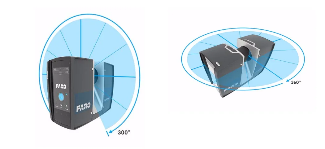 The scanner also offers IP65 protection, keeping out dust and debris when scanning voids, drives, and tunnels underground.
Features include an optional 147-megapixel HDR panoramic camera, automated survey registration, and web-enabled remote survey control.
Contact manufacturer Get a quote Add to comparison
The Japanese-made Topcon GLS 2000S is the shortest-range laser scanning solution in Topcon’s GLS 2000 series.
The GLS 2000S is a compact and lightweight system that captures a full 360° scan in under three minutes. It offers selectable laser modes (Class 3R to Class 1M), a multiple lens array system, and automatic temperature adjustment.
All scanners in the GLS 2000 series come with MAGNET Collage software.
Contact manufacturer Get a quote Add to comparison
The Artec Ray is a long-range 3D scanner designed for capturing large objects. Its sub-millimeter distance precision and angular accuracy produce clean, low-noise data capture.
Artec, based in Luxembourg and well-known for producing some of the best handheld 3D scanners, recommends the Ray 3D laser scanner for applications like reverse engineering, inspection, and construction, on objects like buildings, propellers, vehicles, and turbines.
The high-accuracy scanner is lightweight, compact, and portable, and works in conjunction with the popular Artec Studio software suite. Computer-free scanning is made possible using the Artec Remote app.
Contact manufacturer Get a quote Add to comparison
Canadian company Teledyne Optech designed the Polaris for scanning applications like construction, forensic analysis, and shoreline mapping.
The terrestrial laser scanner boasts features like an integrated high-resolution camera, inclinometers, a compass, a GPS receiver, and weather-proof housing. The Polaris HD model offers the highest scanning speeds in the Polaris series.
In-field geo-referencing tools and automatic target recognition serve to reduce setup time, while one-button surveying makes the system accessible to unskilled operatives.
Contact manufacturer Get a quote Add to comparison
The IMAGER 5016 is a compact and lightweight 3D laser scanner from German company Zoller + Fröhlich.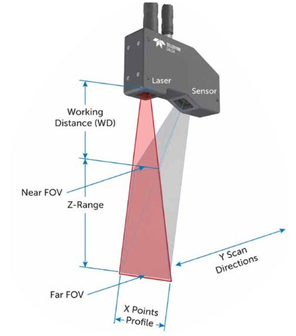
Equipped with an integrated HDR camera, internal lighting, and a dedicated positioning system, the IP54-rated scanner has a maximum range of 360 meters and returns accurate results even at long distances.
The IMAGER 5016 also offers scanning speeds of up to a million points per second.
Contact manufacturer Get a quote Add to comparison
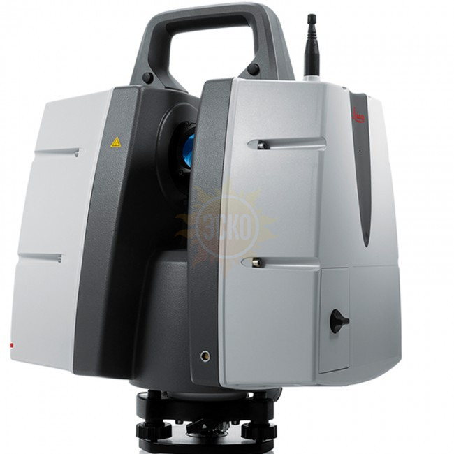
The Leica RTC360 from Switzerland’s Leica Geosystems — a market leader in terrestrial laser scanning — is a portable and highly automated laser scanning solution.
The high-end system allows users to pre-register point cloud data in the field to quickly conduct quality control checks, and offers an impressive scanning speed of two million points per second.
The RTC360 works with the Leica Cyclone FIELD 360 mobile app and Leica Cyclone REGISTER 360 office software.
Contact manufacturer Get a quote Add to comparison
The 100HSX from Washington’s Surphaser is a portable, low-noise laser scanner offering sub-millimeter accuracy and a range of up to 50 meters. One version of the scanner can be configured to prioritize either range or noise reduction depending on the application.
Features include a robust construction, an optional camera system with 60-megapixel-equivalent color images, and an optional PC controller.
The bundled Surphaser software provides automatic target extraction, self-calibration, and real-time acquisition/analysis and preview scanning.
Contact manufacturer Get a quote Add to comparison
The Riegl VZ-400i justifies its high price point with its innovative processing architecture and, to a lesser extent, its unusually long range.
This Austrian-made long-range scanner uses dual processing platforms: one for simultaneous acquisition of scan/image data, waveform processing, and system operations; another for automatic on-board registration, geo-referencing, and analysis.
Features include a high laser pulse repetition rate, high-precision ranging, and compatibility with user-developed python apps.
Contact manufacturer Get a quote Add to comparison
How does long-range laser scanning work?
Many terrestrial laser scanners use a technology known as LiDAR (Light Detection and Ranging), which consists of shining lasers at an object and measuring the reflections with a sensor.
This technology analyzes laser return times and wavelengths to determine the position and dimensions of the object or environment.
The practice of terrestrial laser scanning involves setting up one of these LiDAR-based scanners, usually on a tripod, in or near the scanned object or environment. Then, the scanner captures the data in the form of a point cloud — a set of spatial, 3D data points.
The scanner must be moved and set up at different static locations in order to collect scan data from multiple angles. To obtain an accurate 3D scan of a building, for example, you need to scan it from more than one side.
If multiple large areas are being scanned, the software is used to perform point cloud registration, which combines the separate data sets (point clouds of four different facades of a building, for example) into one complete set.
Types of terrestrial laser scanners
Although “long-range laser scanning” is often used synonymously with TLS, some terrestrial laser scanners are defined as “short-range” or “mid-range” in relation to other models of a brand’s product line.
In practice, these distinctions may not be critical, since most applications do not make use of the hardware’s full scanning range.
Short range
Short-range terrestrial laser scanners may be used to capture targets like building facades, crash sites, crime scenes, and minor construction sites. They should not necessarily be considered entry-level scanners, since their accuracy and speed may be greater than long-range models.
Mid range
Mid-range terrestrial laser scanners may be used to capture targets like larger building facades, larger construction sites, and vehicles such as aircraft.
Long range
Long-range terrestrial laser scanners may be used to capture expansive outdoor environments like forests and urban areas, especially if there are obstacles that prevent operators from setting up near the scanned object.
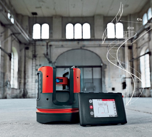
A terrestrial laser scanner from Leica Geosystems. Source: AMMTerrestrial laser scanning software
Software plays an important role in the terrestrial laser scanning workflow, both in the field and in the office.
When we talk about laser scanning software, we often mean the computer software that stitches together multiple point clouds in a process known as point cloud registration.
But software may also include 3D modeling and visualization tools, and even programs within the scanning hardware itself — for real-time feedback on a built-in interface, for example.
Comprehensive software suites may include individual applications for all of the above. Leica Cyclone, for example, comprises 10 separate modules for different tasks and applications.
Functions of TLS software may include:
- Registration of point cloud data (automatic or manual)
- Noise filtration
- Target identification
- Tagging
- Geo-referencing
- Report generation
- Error reporting
- 3D modeling
- Texturing
- Sharing files to the cloud
Some field software packages created for use on mobile devices can provide real-time scan data feedback, which is useful for on-site inspection and quality control tasks that must be completed within a set time period.
Point cloud registration with Leica Cyclone software. Source: Leica GeosystemsMost long-range scanners come with a dedicated software package, but there are also suites that are not hardware-specific, such as Autodesk’s ReCap Pro.
Common TLS software suites include:
- Leica Cyclone
- FARO SCENE
- Artec Studio
- ESRI ArcGIS
- Innovmetric Polyworks
- Riegl RiSCAN PRO
- Autodesk ReCap Pro
Mobile laser scanners vs terrestrial laser scanners
An alternative to terrestrial laser scanning is mobile laser scanning, in which the 3D scanner is carried around by an operative or mounted to a vehicle like a car or a drone.
There are advantages to both mobile and terrestrial laser scanning, and it is even possible to combine the two.
Why go mobile?
Mobile mapping systems (MMS), which combine laser scanning with positioning technology like GPS, GNSS, or SLAM (simultaneous localization and mapping), are a faster means of acquiring data than TLS since operatives simply need to move the scanner around the surveyed area in order to gather data. There is no need for multiple tripod setups.
Additionally, a lower level of skill is required to use a handheld or backpack-mounted scanner. Most devices just need to be powered up and moved around.
Operating a vehicle does require some skill, but mobile laser scanners mounted to aerial vehicles like drones can reach new vantage points, while car-mounted scanners can capture large urban areas in very little time.
Furthermore, many mobile laser scanners — mostly iMMS (indoor mobile mapping systems) — use SLAM algorithms. This enables them to be used in indoor and covered spaces since they determine their own location based on their surroundings rather than relying on a GPS or GNSS signal.
Why go terrestrial?
Terrestrial laser scanning may seem like a more old-fashioned form of data capture, but static scanning still offers important benefits.
Usually, and as long as setup and registration are performed correctly, TLS produces much more accurate scans with more dense and complete point clouds than those created by MLS. Furthermore, TLS devices tend to offer HDR imagery, while many MMS devices do not (yet).
Terrestrial laser scanning is therefore preferable when accuracy takes precedence over mobility.
TLS may also be favored for economic reasons since little additional equipment is required, whereas mobile mapping systems may require the purchase of a drone or the use of extra operatives to drive or pilot a vehicle.
Combining the two
If a company has sufficient resources, it may benefit from the use of both terrestrial and mobile laser scanners for the same project.
For example, a terrestrial laser scanner can be used to capture high-quality point clouds from the ground level, while a drone-mounted mobile laser scanner surveys the upper regions of a site from the sky.
The drone-captured data will be less accurate, but registering the two data sets will provide a more complete picture of the site than what would be possible with either scanning technique on its own.
Besides their level of accuracy, there is no fundamental difference between point clouds collected by TLS and point clouds collected by MMS, so most software suites are capable of combining disparate data.
Combining both terrestrial and airborne scanning data. Source: MDPIApplications of long-range laser scanning
Terrestrial laser scanners are used to capture visual data in many industries, where sub-centimeter accuracy is required. Applications and industries include:
- Architecture, engineering, and construction (AEC), Land surveying, Mining
- Geomorphology, Forestry, Topography
- Quality control, Metrology, Deformation measurement
- Reverse engineering, Industrial design, Customization
- CGI, Fashion, Video games
 Source: Maptek
Terrestrial laser scanner price
The cost of a terrestrial laser scanner can range from under $20,000 for starter models to over $100,000 for the most high-end systems.
Models at the lower end of the spectrum are still suitable for many professional applications.
Terrestrial laser scanner prices may depend on technical factors like range and accuracy, as well as features like integrated GPS receivers, HDR imaging, on-site registration and compensation, software packages, and any included accessories.
FAQ
What is the best 3D laser scanner?
Different 3D laser scanners are suited to different applications. For example, the Leica RTC360 excels in scan speed, while the Riegl VZ-400i has an exceptional range. Meanwhile, the Maptek SR3 is designed specifically for underground applications.
What is 3D laser scanning in construction?
Construction professionals often use 3D laser scanners to better understand the layout and features of a construction site. Scanners can be used for monitoring land deformation, surveying buildings, measuring elevation, and much more.
Should I buy a mobile laser scanner or a terrestrial laser scanner?
Handheld mobile laser scanners are easy for non-specialists to use, while vehicle-mounted mobile scanners offer a greater level of access and flexibility. However, terrestrial laser scanners are more accurate and can be less expensive.
What does “terrestrial” mean?
In the 3D scanning and mapping industry, the term “terrestrial” mainly refers to long-range laser 3D scanners that are mounted on tripods.
3D laser scanner cost and when is it the right investment?
How much does a 3D laser scanner cost and when is it the right investment?
From construction to medical research, civil engineering to manufacturing, we are seeing an increase in the application of 3D scanners. Widespread adoption of cloud computing services, shifts to remote working, as well as digital planning and modular construction, are expected to further growth opportunities in the market.
The 3D laser scanner options open to reality capture professionals are numerous, with an increasing amount of considerations essential before any purchase, including software. Not all scanners are compatible with every software solution, so thinking about the software you’re using today and may use in the future, is essential.
Considering variables amongst the different types of scanner is also important. Once you’ve looked at the capabilities of scanners currently available on the market, you can begin to align your desired outcomes with the options you have. That’s not the end of the journey, however. As with every purchase, pricing inevitability comes into the equation. Scanner prices will vary, depending largely on your outcomes. You could pay as much as £1,000,000, or as little as £10,000 in some cases.
Here, we’re going to take a look at the 3D laser scanner market. First, by examining the outcomes and variables referenced above, then by walking through the different types of scanner, their subcategories, and the all-important price ranges associated with each. So, let’s get started.
Suggested reading: If you want to learn more about trends in 3D surveying, take a look at our blog — 2021 Trends in 3D Surveying and Reality Capture.
Focus on outcomes first
Only you know what you need from your scanner, and what capabilities you need to introduce into your workflow. Start with the outcomes you want to achieve and work backwards to select a scanner that will enable these. You might want to:
1. Introduce more mobility into your workflows.
Consider using: SLAM or vehicle-based scanners paired with terrestrial laser scanners.
2. Make precise measurements at long range.
Consider using: Long-range terrestrial laser scanners.
3. Capture a huge territory in a short period of time at a low level of detail.
Consider using: Aerial- or vehicle-based scanners.
4. Take precise and repeatable object measurements in a controlled environment.
Consider using: Arm scanners or terrestrial laser scanners.
5. Deliver engineering-grade measurements at a medium range.
Consider using: Medium range terrestrial laser scanners.
Consider using: Terrestrial laser scanners with dual access compensation.
Each of these outcomes requires a different scanner. What’s more, you need to consider how your existing scanner impacts that choice — with regards to both compatibility and overlapping capabilities.
To focus on the right outcomes, consider variables like:
- Range: At what distance are you trying to make measurements — or what size of object are you measuring?
- Accuracy: How much detail do you need to capture? For example, do you need to take engineering-grade measurements based on your scans, or is it just to provide a visual representation of an area?
- Mobility: Do you need mobile workflows, or can you accommodate static scans? This normally comes down to the speed and complexity of scanning.
 But mobility can come at the cost of accuracy, so it’s important to consider multi-scanner workflows if you’re looking to introduce more mobility into your operation.
- Weight: Do you need something light and portable? Or something solid and steady? A light scanner will be agile but more prone to movement (and resulting error) from environmental factors.
- Features: Do you need to capture colour or thermal data? Are things like dual access compensators needed to take measurements from a moving platform?
- Your existing solutions: What equipment do you already have? How does that impact compatibility and what capabilities do you need to add to your workflow?
The 4 Types of 3D Laser Scanner
3D laser scanners cover various instruments operating on differing principles, in distinct environments and with multiple levels of precision and accuracy.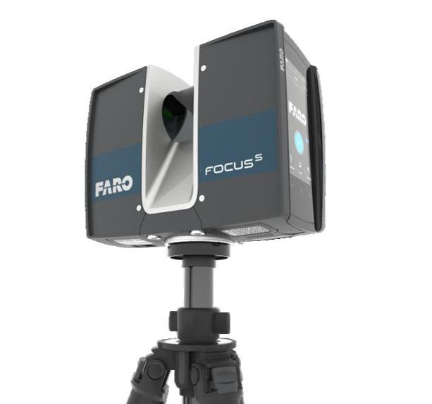 Although there are hundreds (if not thousands) of scanners on the market, there are only four distinct types of laser scanner, each with their own subcategories.
We’ve delved into these categories, looking at their use cases and prices, to help you align capabilities with outcomes and make a functional, well-informed purchasing choice.
Type 1: Terrestrial Laser Scanners (TLS)
Terrestrial laser scanning (TLS) uses multiple static scans to provide detailed and accurate mapping in both indoor and outdoor environments. They require deliberate workflows but are the most versatile and (arguably) cost-effective scanners available.
Other than a few select scenarios, the real question is what other types of scanners can you use to augment the capabilities of your TLS.
The differences between TLS systems (in terms of cost and functionality) mostly comes down to range and accuracy. However, things like a scanner’s ability to pair with third-party software in a multi-scanner workflow are important to consider when comparing different models.
Short-range TLS | Price point | Accuracy | Instrument Range |
| £15k - £30k | +/- 5mm - 10mm | <30m | |
| Use cases: Capture targets like facades, crash sites, crime scenes and minor construction sites. Examples: Faro Focus 70, Leica BLK360 | |||
Medium-range TLS | Price point | Accuracy | Instrument Range |
| £40k - £65k | +/- 2mm - 10mm | 100m - 400m | |
| Use cases: These all-purpose work-horse scanners are ideal for gathering high-detail information in indoor and outdoor spaces. Examples: Faro focus 150/350; Leica P30/40/RTC360; Z+F Imager 5016 | |||
Long-range TLS | Price point | Accuracy | Instrument Range |
| £85k - £150k | +/- 5mm - 15mm | 1km - 6km | |
| Use cases: The go-to solution for civil engineering, topography and mining. Long-range scanners are used to measure large areas — e.g. forests and urban areas — especially if obstacles prevent operators from setting up near the scanned object. Examples: Riegl VZ-2000i, VZ-4000, VZ-6000; Maptek XR3, LR3; Leica P50 | |||

Type 2: Mobile Mapping Systems (MMS)
Mobile mapping systems provide greater flexibility and faster reality capture capabilities than their static counterparts.
MMS has three main components: camera(s), LiDAR, and positioning system (e.g. SLAM, IMU, GNSS, or some combination). In terms of capabilities and use cases, there is a significant degree of variation within this category.
Vehicle scanners | Price point | Accuracy | Instrument Range |
| £250k - £500k | +/- 20mm - 40mm | 120m - 360m | |
| Use cases: Scanners mounted on vehicles are ideal for mobile and large-scale registration. Often used for auditing and monitoring road and rail assets; checking telecommunication asset inventories; creating and verifying elevation models; creating 3D city models. Examples: Riegl VMX-2HA, Trimble MX-9, Pegasus II | |||
Trolly scanners | Price point | Accuracy | Instrument Range |
| TBC | +/- 2mm - 10mm | 30m - 360m | |
| Use cases: Trolly scanners bundle sensors on a device that can be pushed or propelled to capture scans. Examples: Leica ProScan, Faro Focus Swift, NavVis M6 | |||
Wearable scanners | Price point | Accuracy | Instrument Range |
| £20k - £60k | +/- 6 - 30mm | 25m - 100m | |
| Use case: Designed to be held or worn, wearable scanners enable rapid indoor scanning for small to medium-sized spaces. Great for repetitive scan requirements or restricted-access sites. However, the limited accuracy of mobile mapping (and SLAM specifically) means that these scanners are not suited to every job. Examples: Leica BLK2GO, NavVis VLX, GeoSLAM Zeb Horizon | |||
 These are valuable for indoor and outdoor scanning but have some mobility and site limitations. Often used for railway track checking and BIM build progress monitoring.
 Type 3: Metrology scanners
Metrology scanners have very specific use cases and deliver highly accurate, repeatable measurements used for 3D geometrical surface inspection.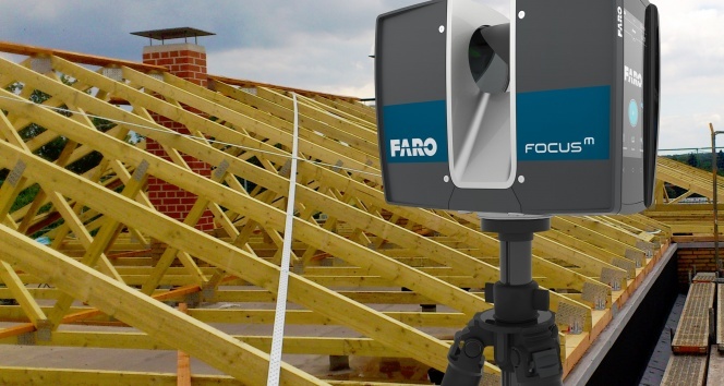 Arm mounted scanners are ideal in manufacturing contexts and capturing detailed information on a small scale.
Arm scanners | Price point | Accuracy | Instrument Range |
| > £100k | 0.004mm | max 2m - 3m | |
| Use case: Ideal for cross-checking manufacturing production with planning with high accuracy. For example, looking for defects in an automated quality checking process or reverse engineering. Examples: Faro Quantum Scan Arms, Faro Super 6DoF TrackArm | |||
Structured light scanners | Price point | Accuracy | Instrument Range |
| £10k - £27k | +/- 0. | TBC | |
| Use case: Widely used within heritage restoration and archaeology, their range limits use within broader reality capture contexts. However, it’s possible to stitch location-specific data from white light scanners into more comprehensive reality capture data sets of an entire scene — if you deploy the right software solution. Examples: Faro Freestyle 2, Artec Eva, Creaform HandyScan 3D | |||
 02mm - 0.11mm
Type 4: Aerial Scanners
Aerial scanners are long-range, sophisticated and, unsurprisingly, expensive devices. These scanners can combine data from multiple inputs and are often used for global mapping — mounted to both drones and conventional aircraft.
Due to the financial and logistical considerations associated with aerial scanners, renting is often more appropriate than buying one outright.
Aerial (long-range) | Price point | Accuracy | Instrument Range |
| > £1m | +/- 0. | Kilometres | |
| Use case: Can deliver rapid and vast scene coverage, best suited to large-scale outdoor mapping, including use in navigation, meteorology, land surveys and cartography. Examples: Riegl VQ-1560 II, Leica CityMapper 2 | |||
Aerial (short-range) | Price point | Accuracy | Instrument Range |
| £45k - £100k | +/- 30mm | Kilometres | |
| Use cases: Short-range aerial scanners provide similar capabilities on a smaller scale and lower price point. This makes them great for city planning, area mapping, ecological surveys and more. Examples: Emesent Hovermap, mdLiDAR1000-aaS | |||
 5m - 10m
Pricing is important, but so are outcomes. The first task in your purchasing decision should be to consider the variables which allow you to identify outcomes. Then you can align your use cases by thinking about workflow first.
Before rushing into a new scanner purchase, you also need to think about how your existing hardware investments could be augmented by software changes. It’s important to consider the long-term impact of different purchases, and how interoperability influences future workflow options.
In order to prosper in a software-driven world, it's imperative to make flexible hardware choices. Partnering multiple scanner types with third-party processing software provides agility, flexibility and speed.
Here at Vercator, we believe in using software to drive hardware-based outcomes. If you’re interested in how Vercator Cloud can help transform your existing laser scanners, get in touch with us today.
Laser 3D scanning of premises with a laser, prices for three-dimensional scanning
Laser 3D scanning of premises for various purposes
The GlavGeOSyomka company offers laser scanning services for premises. Our specialists are ready to assist you in the implementation of your ideas of design, decoration, as well as in such delicate and complex works as the restoration and reconstruction of architectural monuments. These works will also be indispensable in industrial construction.
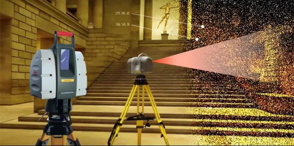
The basic essence of laser scanning. Laser scanning is a relatively new direction in geodesy. Its appearance is associated with the rapid development of technology, as well as with the desire of a person to automate his work process. For laser scanning, a special device is used - a 3D scanner. The laser rangefinder, rotating 360 degrees, in reflectorless mode with the help of a laser beam, manages to capture all the details within the boundaries of the work specified by the operator. Thus, spatial coordinates in three-dimensional space are determined. The scanner creates a point cloud with a clear structure and density. These parameters are set by the surveyor, and the higher the density of points, the more often the device surveys, and this increases the detail of the survey. The output is a 3D model that can be used for various purposes.
Laser scanning in architecture and design. Laser scanning is especially popular with architects and designers. Imagine a situation where a person orders the design of his apartment. In order to get started, the specialist needs a detailed plan of the premises in which the work will be carried out. But what if the room is not typical, and it is replete with a large number of details? Or do you need the design of an entire apartment or a country house? In this case, a laser surveyor can help. It can take a lot of time and effort to accurately measure and sketch rooms using traditional methods. The scanner will do all the work for you, producing the most detailed 3D model in a matter of hours, which will be extremely convenient to work with in the future. In addition, such a result will be the most visual, and you will be able to demonstrate to the customer any details of the future interior of his choice. For restorers, laser scanning is also an equally important and energy-intensive process. The rooms inside ancient buildings that need to be repaired and recreated in their original form are often rich in various architectural delights. In order to accurately indicate the scope of work and make detailed estimates, a 3D model is essential. This will help to avoid any inaccuracies and miscalculations, especially when it comes to architectural monuments, where every detail is important.
Laser scanning of premises in industry and construction
In conditions of extreme cramped workshops and premises of various plants and factories, a 3D scanner can create a detailed diagram of all units and assemblies, while not taking up much space. When designing, reconstructing or building new structures at industrial facilities, laser scanning is simply irreplaceable. This type of work can significantly save time and reduce labor costs. A point cloud, which will be used to build a three-dimensional projection of all components and assemblies, can be obtained in a few days after the end of the field stage, which will not take much time. While the production of a model created by the usual measurements and sketches can take weeks, moreover, the accuracy will be extremely rough. This survey method is most relevant for large industrial premises. Do not forget about the use of laser scanning in construction. It is not always possible to create a detailed plan of a building under construction due to the inaccessibility of serif points or the complexity and laboriousness of laying a tacheometric traverse. In such cases, the use of a scanner will be a way out of this situation. Based on the results of his work, you can get a model, which can then be used in the form of a floor plan.
Applications and types of laser scanning
So, laser scanning makes it possible to obtain detailed digital models of terrain and structures. But where does it apply and in what cases is it cost-effective? Popular areas are architectural and restoration work, the creation and updating of GIS materials, the digitization of complex engineering and industrial equipment, as well as a number of other tasks. Why is it beneficial to use this technology in such cases? As mentioned earlier, when working with a total station or laser rangefinders, the speed of obtaining data is low - in one working day, a surveyor can take the coordinates of less than 1000 points.
What if the façade of a building, premises or some equipment is replete with a huge number of elements of complex shapes? It is extremely difficult to transfer them in digital form. The laser scanner processes up to 1 million measurements per second, creating a dense point cloud that clearly repeats all contours and lines of any complexity. As a result, the surveyor receives an almost photographic model, which can be conveniently manipulated and all the information can be seen very clearly. This is relevant for those professionals whose work involves precisely such details - restorers, architects, designers, design engineers, inventories. With the help of geodetic data, it is possible to design the repair or installation of new equipment or structures, taking into account all possible factors and risks, as well as to carry out high-quality restoration and renovation work with historical accuracy, having previously calculated the appearance and functional content.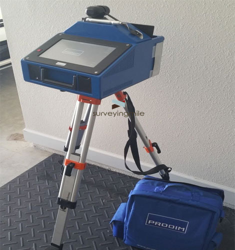 The advantage of laser scanning is the possibility of not only static (ground) data processing, but also mobile (the scanner is installed on a moving vehicle) and even aerial (the device is attached to the UAV). This allows you to collect information from a larger area and a larger number of objects, significantly reducing labor costs. Thus, the list of scanning possibilities is extended to obtain digital models of roads, open spaces, power lines, pipelines for various purposes, and much more.
Three-dimensional modeling based on the results of scanning
The most responsible and complex is the office processing of scanned data. For correct operation, not only high-class specialists are required, but also powerful PCs with pre-installed modern software. After transferring data from the device to the computer, the surveyor must stitch together disparate arrays of points, called clouds or scans. This can be done either by coordinated or numbered marks, fixed in advance on the object, or by characteristic points.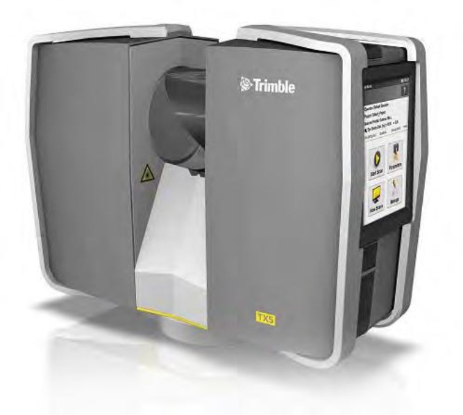 It is advisable to use the latter option if the object does not abound with many complex shapes or the number of scans is small, otherwise the probability of an error increases. The result is a "raw" model, a workpiece that requires processing. Artifacts are removed from there - foreign objects and points that arose clearly due to a technical error of the scanner. This is more complicated than it seems - a lot of unnecessary information always gets into the "frame", and the surveyor's task is to carefully study the array of points for the presence of such defects. A model freed from artifacts is considered ready, and further post-processing depends on the requirements of the customer. The terms of reference may include the creation of sweeps and sections of specific sections, geometric models by drawing the contours of equipment and structures with primitives, and even the imposition of photographic materials on a 3D model to increase visual clarity. What is beneficial for such products is relevance and detail.
 Often there is a situation when the available materials do not reflect reality - something is not taken into account, changes were not made at the time of modernization, or the data is simply erroneous. A spatial model obtained in the shortest possible time will help to update the information, and we can talk about both a small room, a specific node or part of the facade, or an entire factory complex, a park and palace ensemble, or an extended line of power lines. That is, laser scanning is not just automatic data processing using a modern device. This is also the painstaking work of professional surveyors at the office stage, which will result in a clear digital model applicable not only for visual, but even for metrological and deformation monitoring. Any mistake can be very expensive, so it is important to entrust this process to the masters of our company - we will carry out all the work in full and with maximum accuracy so that the final product will satisfy all your requests.
Laser scanning of buildings and structures, cost from 25 rubles/m2
Thanks to the rapid development of technology, geodetic work has become more accessible, detailed and accurate than a dozen or two years ago. To date, one of the most progressive and modern devices for this purpose is a laser scanner. This device was the next link in the evolution after the total station, removing human error from the equation and including incredible speed and accuracy of work. Suffice it to say that the scanner can acquire the coordinates of about one million points per second - for an electro-optical specialist, this would take several years of continuous work. Moreover, the 3D model resulting from the survey will convey all the contours, borders and elements with maximum detail so that the customer does not miss a single detail.
These positive aspects are especially relevant in the construction of buildings and structures, geodetic works on which are associated with the solution of specific problems. Thanks to the laser scanner, it is possible to obtain three-dimensional models of the most complex structures, while not a single detail escapes the watchful eye of the machine. Moreover, this will be done with amazing speed - it will take significantly less time for the field and cameral stages of processing than if the work were carried out with a total station.
Digitization of existing cartographic data, diagrams, plans and sketches can take a lot of time, and the reliability of the source materials and the accuracy of the final result may be questionable. To avoid these shortcomings and prepare the necessary documentation based on up-to-date data, you should contact our company, whose first-class specialists will help you using the most modern and accurate equipment.
Scanning Applications and Tasks
Currently, many services and companies are actively switching or have already switched to the use of 3D models for their needs. Most often, such products are used by restorers, archaeologists, designers, as well as supervisory authorities that control the condition of architectural monuments. All these specialists need spatial computer models with high detail and maximum display accuracy so that people can examine facades, rooms, various elements and structures for defects or deformations. This is necessary for the timely adoption of measures to preserve cultural heritage sites.
Laser scanning will be an excellent solution in this case, since in such situations we are talking about complex geometric shapes and many architectural elements - columns, stucco, arches, bay windows and much more. Even door and window openings that seem perfect at first glance can actually be irregular in shape. It may not be as noticeable to the human eye, but it is very important for restorers. The surveyor behind the total station can miss such trifles, and therefore it is better to trust the scanner operator, who will quickly take the necessary surveys and produce a three-dimensional model that can be easily manipulated and used for any purpose.
Not only restorers and archaeologists need such products - it is much easier for designers to develop the interior and exterior of buildings and structures, having a three-dimensional scheme on their computers. Its manufacture using an electro-optical device will take days, and possibly weeks, depending on the scope of work and geometric features. With a laser scanner, there will be no such problems. Moreover, he is able to capture those nuances that are simply not paid attention to, but they can play a very important role in the future. Updating and digitizing archival data is also the responsibility of a surveyor with a laser scanner. With its help, you can draw up schemes of internal premises and full-fledged models of buildings that will be used for various purposes - supervisory authorities to monitor their safety, employees of museums and exhibitions, landlords to conduct virtual tours of various premises, and so on. Construction of floor plans, observation of deformations, restoration of historical buildings, facade photography and much more - all these tasks are solved with the help of a laser scanner in the shortest possible time.
Result of 3D scanning work and requirements for measurement accuracy
Accuracy requirements directly depend on the final result of the survey. Depending on this, a laser scanner is also selected, which may neglect accuracy in favor of capturing a larger area, or vice versa. For example, when reconstructing and restoring historical buildings or structures, increased accuracy is required so that the end result meets the needs of the customer. It is required to take the coordinates of each defect, each damage that can potentially cause irreparable damage. In this case, the processing and compilation of a three-dimensional model will take more time, as more thorough work will be required.
And if it is required to carry out laser photography for the installation of curtain walls, then the most important components here are the corners of the building, as well as door and window openings, while architectural elements may not be photographed in such detail. Then the final data processing will take much less time. As a result, a three-dimensional model should be obtained, which will be built according to all the requirements of the technical assignment. If you need to make two-dimensional drawings on paper, for example, for non-digital archives or for the production of working documentation, then additional geodetic work is carried out.