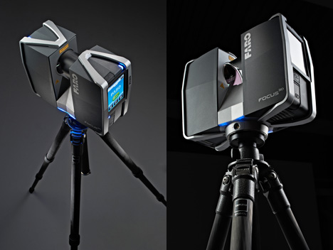
Faro 3d scanner system
Faro 3D S120 Laser scanner
KEY FEATURES: • Medium cost solution • Small and portable • Compass, height sensor, dual axis compensator • Touch screen display
Request a Quote
Add to wishlist
SKU: RFLS-30001 Category: Rentals
Download Catalog
Description
FARO Focus3D
The FARO Focus3D is small and compact. Weighing just 5 kg (11 lb), it is the smallest 3D laser scanner ever built. With an intuitive touchscreen display, users can control all of the scanner functions with the easy-to-use interface.
– Distance accuracy up to ±2mm
– Range from 0.6m up to 120m
– Measurement rate up to 976,000 points/sec
Features of the Focus3D
The FARO Focus3D is a revolutionary, non-contact laser scanner for 3D modeling and documentation that can be operated simply and intuitively via an integrated touchscreen display. In addition to the touch interface, features such as its minimal size and weight make the Focus3D easy to use and allows you to save up to half the scan time compared with conventional 3D laser scanners.
The Focus3D is a high-speed 3D laser scanner for detailed measurement and documentation. With a touch operated screen to control scanning functions and parameters, the Focus3D uses laser technology to produce incredibly detailed threedimensional images of complex environments and large scale geometries in only a few minutes. The resulting image is an assembly of millions of 3D measurement points that provide an exact digital reproduction of existing conditions.
The Focus3D offers the most effcient method for three-dimensional documentation of building construction, excavation volumes, façade and structural deformations, crime scenes, accident details, product geometry, factories, process plants and more. Given its minimal size and weight as well as touch interface, the Focus3D is easy to work with and saves up to 50% of scan time compared to conventional scanners
FARO Focus 3D S120 Features:
- Intuitive touchscreen display: Control all scanner functions with a touch interface for unparalleled ease of use and control
- Small and compact: With a size of only 9.
 5 x 8 x 4in and a weight of just 11lbs, the Focus3D is the smallest 3D scanner ever built
 - Integrated color camera: Photorealistic 3D color scans due to an integrated color camera featuring an automatic 70 megapixels parallax-free color overlay
- High-performance battery: Integrated lithium-ion battery provides up to fve hours of battery life and can be charged during operation
- Data management: All data is stored on a SD card enabling easy and secure transfer to a PC. Using SCENE WebShare, images can be shared on the internet
- Compass: An electronic compass is now included within the unit to associate directional data to your scans and facilitate the auto-registration process
- Height Sensor (Altimeter): Each scan now includes height information which can be used to scan different foor levels in a building. The data can then be used to differentiate the ?oors
- Dual Axis Compensator: To minimize the number of targets needed, the dual axis compensator enables every scan to have integrated level information
- WLAN (WiFi): WLAN remote control permits you to start, stop, view or download scans at a distance
FARO Focus 3D S120 Perfomance Spesification
Ranging Unit
- Unambiguity interval: 153.
 49m (503.58ft)
 - Range Focus3D 1201: 0.6m – 120m indoor or outdoor with low ambient light and normal incidence to a 90% re?ective surface
- Range Focus3D 20: 0.6m – 20m at normal incidence on >10% matte re?ective surface*
- Measurement speed: 122,000 / 244,000 / 488,000 / 976,000 points/sec
- Ranging error2: ±2mm
Color Unit
- Resolution: Up to 70 megapixel color
- Dynamic color feature: Automatic adaption of brightness
Detection unit
- Vertical feld of view (vertical/horizontal): 305° / 360°
- Step size (vertical/horizontal): 0.009° (40,960 3D pixels on 360°) / 0.009° (40,960 3D pixels on 360°)
- Max. vertical scan speed: 5,820rpm or 97Hz
Laser (Optical transmitter)
- Laser power (cw Ø): 20mW (Laser class 3R)
- Wavelength: 905nm
- Beam divergence: Typical 0.19mrad (0.011°)
- Beam diameter at exit: 3.0mm, circular
Data handling and control
- Data storage: SD, SDHC™, SDXC™; 32GB card included
- Scanner control: Via touch-screen display
- New WiFi(WLAN) access: Remote control, Scan Visualization and download are possible on mobile devices with Flash®
Multi-Sensor
- Dual axis compensator: Levels each scan with an accuracy of 0.
 015° and a range of ±5°
 - Height sensor: Detects the height relative to a fxed point via an electronic barometer and adds it to the scan
- Compass: Electronic compass gives the scan an orientation. A calibration feature is included
Hardware Spesification
- Power supply voltage: 19V (external supply), 14.4V (internal battery) Cable connector: Located in scanner mount
- Power consumption: 40W and 80W respectively (while battery charges) Weight: 5.0kg
- Battery life: Up to 5 hours Size: 240x200x100mm3
- Ambient temperature: 5° – 40°C Maintenance calibration: Annual
- Humidity: Non-condensing Parallax-free: Yes
Reviews (0)
Only logged in customers who have purchased this product may leave a review.
Top 5 terrestrial laser scanners of 2022
The more information you have in your hands, the better decisions you make regarding your industrial or architectural project. That is why, in recent years the use of a 3D Laser Scanners has become one of the measurement tools with the greatest recognition and purchase in each country worldwide. A 3D scanner is a product that can be considered in measurements and other activities or to take a decision.
We invite you to continue reading to discover how technology has advanced through the top 5 terrestrial laser scanners that are gaining territory. The service for people of the industry and its clients due to its precision, speed, scope, price and many other advantages.
What is 3D Laser Scanning?Before introducing you to the various types of scanners, you must be clear about what a 3D laser scanner is and how it works. In itself, laser scanning is a process based on a technology known in English as Light Detection and Ranging, LiDAR. A massive position measurement system that, remotely and with a laser scanning sensor, emits pulses to generate digitization. These pulses emitted by the device touch various surfaces in the environment that are recorded as points. The same ones are used to obtain information and generate a three-dimensional image of the space that is being scanned.
What would happen if we left the traditional methods and started using new technologies like laser scanning? Find the answer in our variety of articles, for example in our article What is 3D Laser Scanning? you will find the answer.
The top 5 terrestrial laser scannersIf you are looking for scope, precision and versatility, it is time to leave traditional methods behind and focus your attention on the new trends behind 3d mapping of spaces. Below we present the best tools that will allow you to capture a real environment in 3D.
FARO Focus SThis brand has become one of the most reliable worldwide in terms of measurement and generation of 3D scans. Being the BIM/CIM construction industry one of the most beneficial thanks to its technological advances. In addition, this great tool is ideal for use in extreme scanning conditions by offering protection against external agents such as rain, fog, or dust. Not to mention, it has a built-in field compensation routine, perfect for ensuring accuracy in each of your scanning projects.
Leica RTC360
If you are looking for a solution that quickly and agilely captures the 3d layout of spaces, this is your best option. One of the great advantages that this scanner offers you is that it has Leica Cyclone FIELD 360, an application for your smartphone that records what you scan automatically and in real-time. And not only that but the Leica Cyclone Register 360 software integrates all your 3D models directly into your workflow. With certainty an alternative that allows you to visualize all the necessary details for the optimal planning of your projects.
https://leica-geosystems.com/es-mx/products/laser-scanners/scanners/leica-rtc360
The scan includes height information using a sensor called an altimeter, for use when inspecting multiple floors on the ground within the structure.These data are then used for different soil types.
Trimble X7This solution has an automatic self-leveling system that ensures data consistency, a crucial aspect when carrying out topographic or construction surveys. In addition, and thanks to its Trimble X-Drive technology, there is no need to perform an annual calibration of the equipment. Which also translates into the optimization of your resources.
Topcon GLS-200Leader in long-range scanners, but with multiple options according to your needs. Its three models; short, medium and long-range, they allow you to capture the current condition of your areas of interest through their multiple lenses that quickly modify the focal length settings to offer you information not otherwise achievable. This is one of the most resistant and versatile 3d laser scanning solutions that you can find on the market today.
https://www.topconpositioning.com/es/escaneo/esc%C3%A1neres-l%C3%A1ser/gls-2000
Maptek SR3With a range of 600 meters, this system is focused on precision behind mine surveying. It also enables the ability to measure stopes, leads and tunnels more easily and accurately. It also offers a scanning window of -40° to 90° vertically and 360° horizontally to make it possible to capture all surfaces regardless of direction. And to visualize the real scope of the project, it offers you a functionality that allows; via the tablet driver, import CAD lines and surfaces for real-time comparison between scans and your geological model.
https://mundogeo.com/es/2018/03/20/nuevo-escaner-laser-subterraneo-sr3-de-maptek/
As you have seen, these are 5 of the most distinguished 3D laser scanning technology solutions. And although they can all meet specific requirements; such as topographical surveys, mining surveys and even risk studies, all of them are focused on saving you money, mitigating risks, offering pinpoint accuracy and, not least, streamlining processes so that you save time.
FARO Focus 3D laser scanner from Vivtech. For 3D scanning of large objects Tel. in Moscow +7(495) 755-91-45
Is that right?
YesChange city
High-speed laser scanner FARO Focus allows you to get a three-dimensional digital model (point cloud) of the surrounding space within a few minutes. Two modifications of the device are designed for an operating range of up to 20m and 120m. The received data contains millions of points (scan speed up to 967000 points per second) and the most detailed detailed information about the environment. Thanks to a special technology, it is possible to combine several scans into a single point cloud, which makes it possible to obtain the geometry of objects whose size exceeds the working area of the device.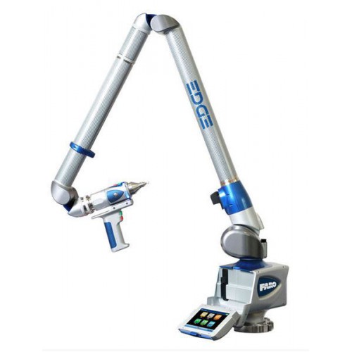
Applications:
- Reverse engineering
- High-precision scanning of industrial objects
- Criminalistics
- Architecture scanning
- Digitization of tunnels
- Measurement of linear and angular dimensions of large items
- Control and analysis of complex curved surfaces by comparison with a CAD model.
Features:
- Millimeter precision
- Scanning speed 976,000 points per second
- Color scans possible with built-in camera
- Complete autonomy. Li-Ion battery allows you to work up to 5 hours. No additional devices required for scanning
- Wireless control capability via WiFi
- Built-in touch display and intuitive interface make it easy to operate the scanner
- Compass and altimeter are built into the FARO Focus 3D scanner to simplify the stitching of point clouds
- All data is stored on an SD card and can be easily transferred to a computer.

Application example of laser scanning of an architectural object using FARO Focus
Scan result
Example of industrial scan
Using the Faro Focus scanner to fix DTP
The result of scanning production premises
scanning halls of the museum museum. FARO SCENE software interface
Specifications of the FARO Focus 3D laser scanner:
Measuring unit
- Working area:
- Model Focus 3D 120: 0.6m to 120m
- Model Focus 3D 20: 0.6m to 20m (indoor/outdoor with ambient light and 90% reflective surfaces).
- System error: ±2 mm when measuring from 10 m to 25 m, at reflectance from 10% to 90%
- Acquisition rate: 122000 / 244000 / 488000 / 976000 points per second.
Digital camera unit
- Resolution: up to 70 MP
- Dynamic color: Automatic brightness adaptation
- Parallax: None.

Optics
- Horizontal field of view: 360°
- Vertical field of view: 305°
- Vertical pitch: 0.009° (40.960 3D pixels at 360°)
- Horizontal pitch: 0.009° (40.960 3D pixels at 360°)
- Max vertical scan speed: 5,820rpm or 97Hz.
Laser
- Laser power : 20 mW (Laser class 3R)
- Wavelength: 905 nm
- Beam Divergence: Typical 0.16mrad (0.009°)
- Output beam diameter: 3.8mm.
General specifications:
- Dimensions: 240 x 200x 100mm
- Weight: 5.0kg
- Calibration: Yearly
- Biaxial Deviation Sensor: Accuracy 0.015°; Range ±5°
- Voltage: 19V (from external power supply), 14.4V (from battery)
- Power: 40W and 80W (with battery charging)
- Battery life: up to 5 hours
- Ambient temperature: 5° - 40°C
- Humidity: Non-condensing.
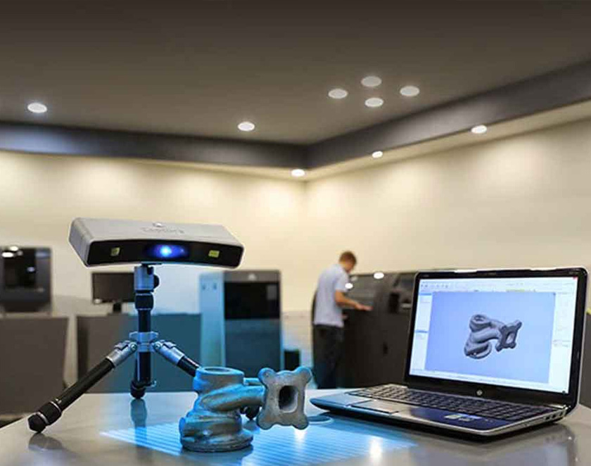
FARO SCENE software - designed to work with the FARO Focus 3D laser scanner. It allows you to view high resolution point clouds. Stitch several clouds into a single one, process it and export it to other CAD programs for further processing.
3D scanner FARO Focus S150 at the manufacturer's price with delivery - "TopStanok"
General characteristics
| Feature | FF-S350 | FF-S70 | FF-S150 | FF-M70 |
|---|---|---|---|---|
| Specifications | ||||
| Battery life, h | 4. 5 5 | 4.5 | 4.5 | 4.5 |
| Firmware | Autodesk Recap Pro, Autodesk Revit, FARO BuildIT, FARO Scene | Autodesk Recap Pro, Autodesk Revit, FARO As-Built, FARO BuildIT, FARO Scene | Autodesk Recap Pro, Autodesk Revit, FARO As-Built, FARO BuildIT, FARO Scene | Autodesk Recap Pro, Autodesk Revit, FARO As-Built, FARO BuildIT, FARO Scene |
| Laser wavelength, nm | 1550 | 1550 | 1550 | 1550 |
| Permissible systematic measurement error (3), no more than | 0. 9 mm at 15 m 9 mm at 15 m | 0.9 mm at 15 m | 0.9 mm at 15 m | 0.9 mm at 15 m |
| Laser class (IEC EN60825-1:2007) | Class 1 | Class 1 | Class 1 | Class 1 |
| Mass of scanner with battery, kg | 4.2 | 4. 2 2 | 4.2 | 4.2 |
| Field of view (vertical/horizontal), ° | 300 / 360 | 300 / 360 | 300 / 360 | 300 / 360 |
| Dimensions (L×W×H), mm | 230x183x103 | 230x183x103 | 230x183x103 | 230x183x103 |
| Recommended working range, m | 0. 6-350 6-350 | 0.6-70 | 0.6-150 | 0.6-70 |
| Scanning speed, points per second | 976000 | 976000 | 976000 | 488000 |
| Compatible software | Advanced Tubular Technologies (VTube-LASER), Autodesk (Inventor, Alias, 3ds Max, Maya, Softimage), DeZignWorks, Ghost3D, InnovMetric (PolyWorks), Metrologic, Mitutoyo, New River Kinematics (Spatial Analyzer), Pointools, Rapidform, Rhino3D Verisurf | Advanced Tubular Technologies (VTube-LASER), Autodesk (Inventor, Alias, 3ds Max, Maya, Softimage), DeZignWorks, Ghost3D, InnovMetric (PolyWorks), Metrologic, Mitutoyo, New River Kinematics (Spatial Analyzer), Pointools, Rapidform, Rhino3D Verisurf | Advanced Tubular Technologies (VTube-LASER), Autodesk (Inventor, Alias, 3ds Max, Maya, Softimage), DeZignWorks, Ghost3D, InnovMetric (PolyWorks), Metrologic, Mitutoyo, New River Kinematics (Spatial Analyzer), Pointools, Rapidform, Rhino3D , Verisurf | Advanced Tubular Technologies (VTube-LASER), Autodesk (Inventor, Alias, 3ds Max, Maya, Softimage), DeZignWorks, Ghost3D, InnovMetric (PolyWorks), Metrologic, Mitutoyo, New River Kinematics (Spatial Analyzer), Pointools, Rapidform, Rhino3D Verisurf |
| Scan temperature, °С | -20 to +55 | -20 to +55 | -20 to +40 | -20 to +55 |
| Angular uncertainty (2 sigma), arc sec. | 19 | 19 | 19 | 19 |
| Noise level at 10% reflectance (no filtering) | 0.5 mm at 25 m | 0.5 mm at 25 m | 0.5 mm at 25 m | 0.8 mm at 25 m |
| Noise level at 10% reflectance (filtered) | 0. 25 mm at 25 m 25 mm at 25 m | 0.25 mm at 25 m | 0.25 mm at 25 m | 0.4 mm at 25 m |
| Noise level at 90% reflectivity (no filtering) | 0.3 mm at 25 m | 0.3 mm at 25 m | 0.3 mm at 25 m | 0.7 mm at 25 m |
| Noise level at 90% reflectance (filtered) | 0.15 mm at 25 m | 0. |


