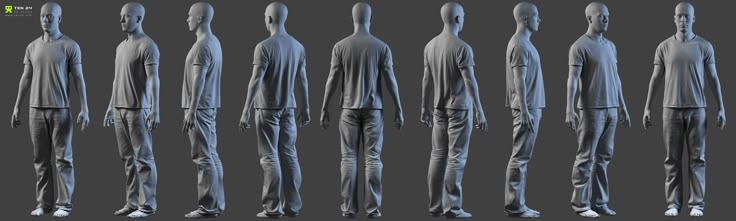
3D scanner from photos
PhotoModeler Scanner – PhotoModeler
Please note - PhotoModeler Scanner product is no longer offered. It has been replaced by PhotoModeler Premium. You can find out more about the replacement here.
PhotoModeler Scanner provides the tools for you to create accurate, high quality 3D models and measurements from photographs. The process is called photo-based 3D scanning.
PhotoModeler Scanner is a 3D scanner that provides results similar to a 3D laser scanner. This 3D scanning process produces a dense point cloud (Dense Surface Modeling, DSM) from photographs of textured surfaces of virtually any size.
The PhotoModeler Scanner software has all the capabilities of the base PhotoModeler product plus the capability to do Dense Surface Modeling (DSM), 3D scanning and SmartMatch. See the chart on the product overview page for a quick comparison of the products.
PhotoModeler Scanner is a sophisticated tool to build accurate Dense Surface Models and get measurements from your photos. Use PhotoModeler Scanner to build:
- Dense Surface Models where a large number of 3D points are needed.
- Models that traditionally would require a 3D laser scanner
- Scale-independent object modeling - model small objects or big scenes
- Perform measurements over time with the Motion capability.
Read about a new way to 3D Scan
PhotoModeler Scanner is widely used in these areas:
Surveying, Construction, Mining, Geology | |
| |
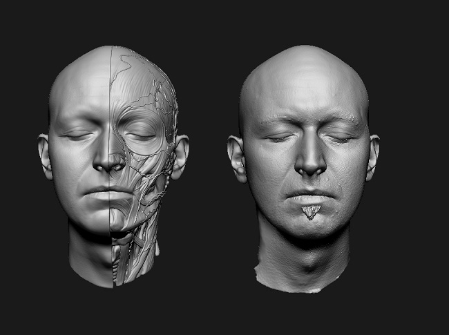
Forensics, Biology, Medicine | |
| |
Architecture | |
| |
Archaeology, Curatorial | |
| |
Films, Gaming, Animation | |
|
PhotoModeler Scanner's main features
- SmartMatch: Automatic feature detection and matching.
 Use SmartMatch generate a low density point cloud, and to orient your photos.
 - DSM: Produces dense point clouds and detailed triangulated surfaces of textured objects in photographs without the use of a laser, projected light, or targets.
- Motion. Produce data tracking changes over time.
PhotoModeler Scanner also comes with the Idealize capability used for back-plate matching in gaming and film.
...and it includes all of PhotoModeler's main features:
- Easy to Use and Learn: Includes an advanced Windows user interface, Wizards for easy project set-up, extensive multimedia tutorials (over 4 hours playing time!), printed user guide, and extensive on-line help.
- Modeling Tools: Create models using PhotoModeler's Point, Line, Curve, Edge, Cylinder, and Shape marking tools.
- Surface Tools: Add surfaces to features defined by Points, Lines, Curves, and Edges. Create NURBS Surfaces from Lines, Edges, and Curves.
- Photo-textures: Add photo-textures and colors to surfaces. Export textures with 3DS, OBJ, VRML, and 3DM.
- 3D Viewer: View, measure, select objects, and interactively rotate the created 3D models with full photo-textures.
- Measurement Tools: Perform point, distance, length and area measurements right within PhotoModeler.
- Coded Targets: Automate the setup (initial marking and referencing) of the project, or the extraction 3D data points using targets with a special code ring that the software recognizes in the images. See Automation and Coded Targets.
- Scale/Rotate/Translate: This feature provides you the ability to apply proper scale to your project and set your model in the proper coordinate system for exporting.
- Export Capabilities: Export your model to Autodesk DXF (2D and 3D), 3D Studio 3DS, Wavefront OBJ, VRML (1&2), IGES, OpenNURBS/Rhino, StereoLithography STL, RAW, Maya Script, Max Script, FBX, and Google Earth’s KML and KMZ. See the Exports page.
- Import Capabilities: Import 3D data for use as control points, affine (coordinate systems), mesh comparison, or photo projection. See Export / Imports page.
- Photograph Handling: Work with any number of photographs, add new photographs at any time, and import many different image formats. * Image Control: Use extensive Zoom Tools for accurate sub-pixel marking, Photo Rotate for easier viewing, and Image Enhancement for increased visibility.
- Camera Support: Use images from digital, film, or video cameras. Automatic Camera Orientation determines the position of the camera when the image was taken.
 Use different cameras in the same project.
 - Camera Calibrator: Accurately measure your camera's focal length, principal point, digitizing aspect ratio and lens distortion.
- Photo-Projections: Check project quality by projecting 3D data onto your photos.
- Customizable Interface: Control the layout and appearance of your PhotoModeler screen. Customizable items include toolbars, short cut keys, and colors for items such as 3D objects, Projections, and the 3D Viewer.
< Return to the Products Overview
Best photogrammetry software in 2022: The ultimate guide
Using photogrammetry technology
What is photogrammetry?
Photogrammetry is a science of making a measurement from photographs. This method is using the parallax obtained between several pictures, taken from different points of view. Photogrammetry can be used to record complex 2D and 3D motion fields.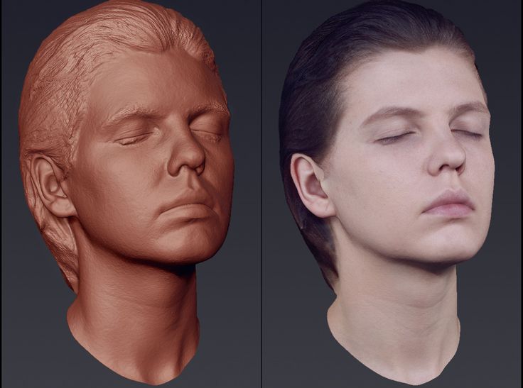 It is imitating the stereoscopy of the binocular human vision, and it is actually used to get all the information of existing physical objects. Indeed, this process collects the data regarding the shape, the volume, and the depth of the subject that you are trying to scan. This is the method used to turn several pictures into an accurate 3D design. If we take a look back at the history of photogrammetry, we can see that the first experiments of projective geometry are not that new! Indeed, back in 1480, Leonardo Da Vinci was trying to determine the painter’s eye point from perspective painting.
How does photogrammetry work?
Photogrammetry works by extracting the geometric information of a two-dimensional image. By combining a lot of pictures, you will be able to create a three-dimensional image. Photogrammetry is the process used to create the 3D scan of an object, using multiple images. Indeed, it is possible to make the 3D model of an object with several pictures of this object, ingeniously taken from different points of view, in order to get a complete representation of the object.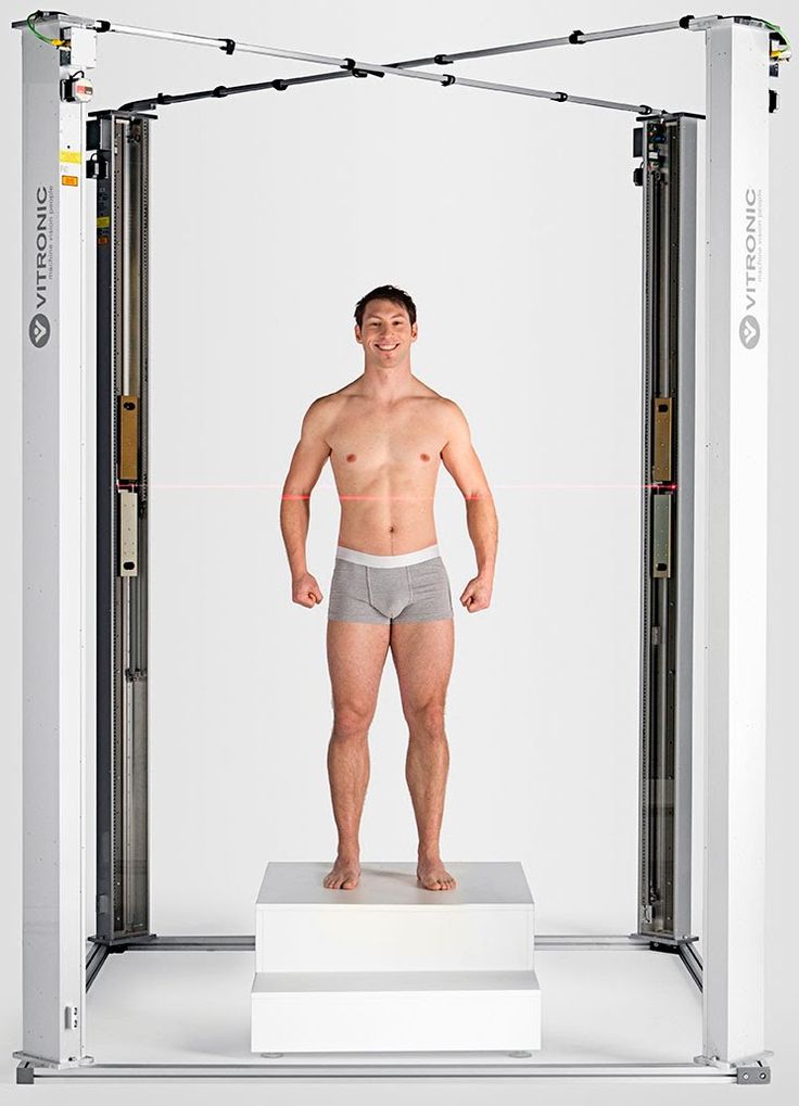 For this, you don’t necessarily need to use a 3D scanner, a simple smartphone, a tablet or a good camera can be used, with good image stabilization!
Thanks to photogrammetry, and a series of complex algorithms, you will get a digital 3D model using multiple photos of the original real-world object thanks to a powerful reconstruction process. The more pictures you have, the more precise your 3D design will be. It is also possible to turn one picture into a 3D model, but obviously, you will not get an optimized result with only one picture.
What is photogrammetry used for?
Photogrammetry is allowing to scan large objects or landscapes that would be impossible to scan otherwise. Thanks to this technique, it is possible to get maps out of aerial photos. It is an important tool for architects, engineers, or anyone needing to create topographic maps, architecture, geology, point clouds. Photogrammetry is used in the military, for land surveying, or real estate. There are a lot of software tools dedicated to aerial photos, photogrammetry is really useful for geographical use.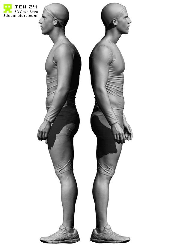 For instance, archeologists are also using it to create plans of complex and remote sites.
Why should you use a photogrammetry software?
3D scanning could be useful for various applications. It can be used to get a viable 3D model and make the most of the 3D printing technology using an online 3D printing service such as Sculpteo. But having a great 3D design is also an amazing tool for visualization.
If you prefer to use a smartphone application, check out our blog post on how to 3D scan with a smartphone to see what are the different possibilities and the best programs to create a viable 3D scan.
source: http://www.aamspi.com/services/aerial-photogrammetry/
What are the 20 best photogrammetry software in 2021?
While choosing a photogrammetry software, you will have a huge choice. You will have to choose your software according to your expectations: Do you need to upload several images? Do you want to focus on aerial images? Do you have experience? Do you want to try photogrammetry for the first time with free software? Let’s discover what is the best solution for you! We will start our photogrammetry software selection for 2020 by presenting you the best free photogrammetry tool, and then we will continue with more professional options.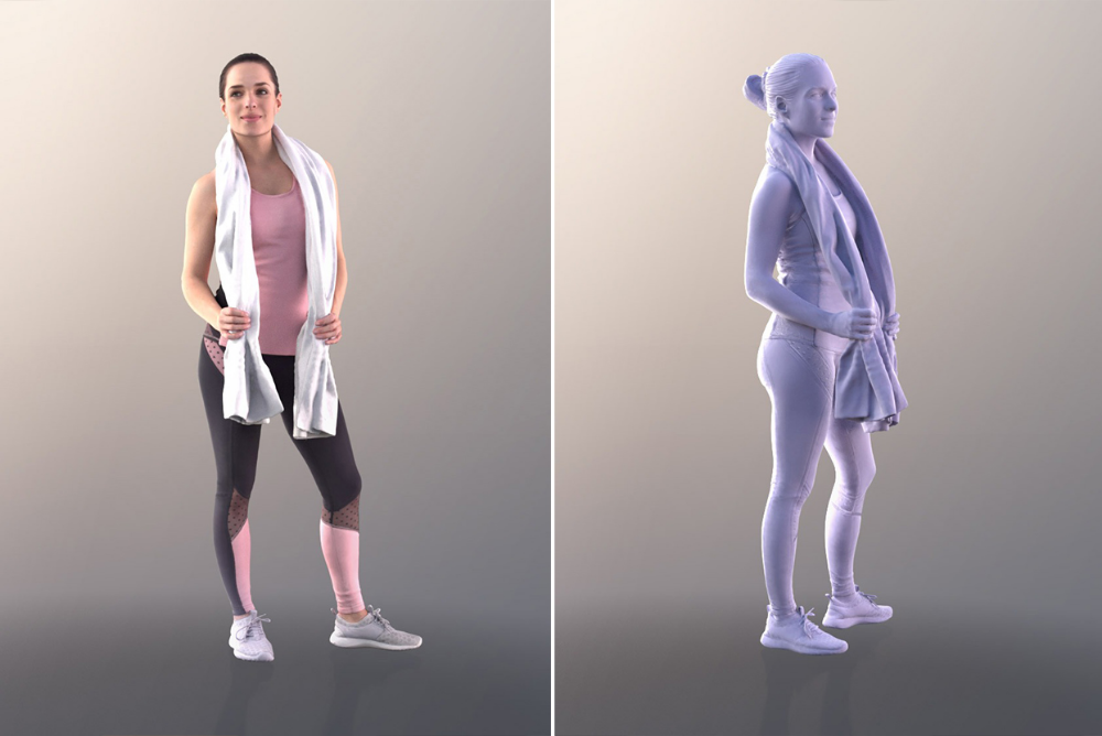
The best free photogrammetry software
- Agisoft Metashape
Agisoft Metashape, previously named Agisoft Photoscan, is a stand-alone software. This software offers many interesting features like photogrammetric triangulation, point cloud data, measurements for distances, volumes and areas, 3D model generation and textures, for example. Agisoft Metashape appears to be a complete software, useful for various applications such as cultural heritage documentation or visual effects production. You will have the choice between the professional version and the standard version. The standard edition is still quite complete, you will get all the basic software tools that you need! It is one of the most used photogrammetry software tools.
If you already used this software before, you should certainly give it another try, because a few improvements have been made, such as processing times and the overall quality of captures.
- MicMac
MicMac is an open-source photogrammetry software developed by the IGN (French National Geographic Institute) and ENSG (French national school for geographic sciences). Even if it’s a free solution, MicMac is more adapted to experienced or academic users. This software is useful for projects involving environmental protection, cultural heritage imaging and preservation or forestry. From close-range to aerial footage, MicMac can process anything.
- Meshroom
Meshroom is a free and open-source software offered by AliceVision, a photogrammetric computer vision framework.
This 3D reconstruction software is easy to use, it allows you to run the whole photogrammetric pipeline. You just have to put your images and the software generates 3D models and textured mesh automatically, using a node-based workflow. It cannot be more simple!
- 3DF Zephyr Free
Here is the free version of the software 3DF Zephyr, a very complete and efficient software for photogrammetry. This software now has a free version specially made for beginners and personal use! It could be the best solution if you are just beginning with this 3D process and need to learn with great software. This free version of 3DF Zephyr is offering all the 3D reconstruction tools and basic editing tools that you will need as a beginner.
- Visual SFM
Visual SFM is a 3D reconstruction tool, using structure from motion (SFM). This GUI application is an easy photogrammetry software to use, you will just have to add your images, match them and make the automatic reconstruction. It is a quite simple software tool with an automatic process. This digital photogrammetry tool is free for personal use.
Get a little demo in the video below:
- Colmap
Colmap is a general-purpose Structure-from-Motion (SfM) and Multi-View Stereo (MVS) pipeline You can use it with its graphical user interface, or with its command-line interface. You can choose what is more convenient for you. You will access all the basic tools needed to create a 3D model using one or several photographs.
- Regard3D
Regard3D is a free and open-source structure-from-motion program, allowing you to generate great 3D models from a series of photographs. This program is offering powerful tools and it might take you a while to really master it. All the tutorials available on their website are really useful to get started.
- Open MVG
“Keep it simple, keep it maintainable” is the credo of OpenMVG (Multiple View Geometry). This library for photogrammetry, popular in the computer-vision scientists and Multi-View Geometry community. OpenMVG offers tools mainly focused on the SfM technique. Everything they offer is tested, making sure that all the features are 100% reliable in real situations.
Paid photogrammetry software tools
- ContextCapture
ContextCapture (previously Acute 3D) is developed by Acute3D, a Bentley Systems company. The goal of this software is to create a finished 3D model with photographs, without any human intervention. This process is easier than 3D scanning and more precise than 3D modeling, you don’t need to be an expert to recreate a perfect 3D digital image. This photogrammetry solution allows working on large infrastructure projects such as cityscapes. It is possible to use both photogrammetry and laser scans for a higher level of accuracy and get reality meshes, perfect to provide precise real-world digital context construction or operations decisions. Moreover, this program includes the ContextCapture Editor, which enables users to edit 3D meshes, generate cross-sections, and extract ground and break-lines.
You can get a Context Capture 3D demo right here if you are not familiar with this software.
- Reality Capture
Reality Capture is a complete photogrammetry solution, it’s easy to use thanks to its great and friendly user interface and offering everything you need for photogrammetry. Reality Capture claims to be 10 times faster than any other photogrammetry solution with its brand new version.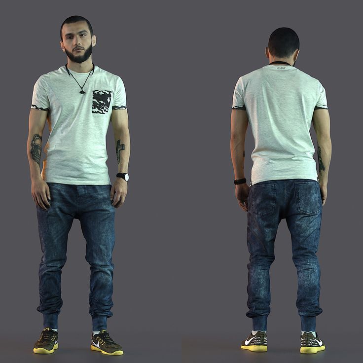 This program has great quality and speed, is able to calculate meshes and textures, and allows working with a lot of different file formats. It will allow you to work on geo-referencing, reality scenes, orthographic projections using images and laser scans! It is also possible to work on small sized objects while using this complete software.
- 3DF ZEPHYR
This software allows reconstructing a 3D digital representation with images. Everything is automatic, you don’t have to interfere in the process thanks to its efficient reconstruction technology. As we saw in our previous section, this software has a basic and free version. But depending on your needs and on your project, you will have the choice between different versions of 3DF Zephyr: Lite, Pro, and Aerial. These advanced versions are allowing you to go further and get laser-scanned objects for example, or to work more precisely with aerial photographs.
- Autodesk ReCap Pro
A few years back, a free software called 123D Catch was developed by Autodesk, helping to turn a picture into a 3D model. This software is not available anymore, but Autodesk still has some interesting solutions for photogrammetry. Autodesk ReCap (previously Autodesk ReMake) is a reality capture software developed by Autodesk, allowing you to create really accurate 3D models using reality captures. You can access advanced photogrammetry possibilities such as aerial photogrammetry, and you can measure and edit point cloud data. With Autodesk ReCap you can also access a wide range of tools and, for instance, clean the unwanted objects to work more specifically on a precise object!
Autodesk ReCap Pro 2019 Free Download
- Trimble Inpho
Trimble Inpho is a photogrammetry software really dedicated to a geospatial use. It will transform your aerial images into precise points cloud and surface models. It is a professional software, perfect if you have a geo-referencing or a geo-modeling project, using aerial photography. This software is really complete and offers a wide range of modules.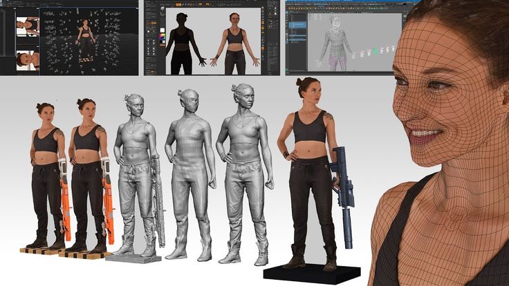 If you choose to use Inpho, you will certainly find the tools that you need.
- WebODM
WebODM is a drone mapping software running on your computer, and even available offline. This software uses drones to create textured 3D models, geo-referenced maps and point clouds. Its features include the ability to get orthorectified maps, 3D models and point clouds in a variety of formats. but also the possibility to create and use GCPs for additional accuracy.
- iWitnessPRO
iWitnessPRO is a professional photogrammetry software, developed to be as accurate as possible. This software supports both close-range photogrammetry and aerial photogrammetry. You can choose the right process, according to the geometry of your object. This program is easy to use, supports GCPs (Ground Control Points) and allows us to generate orthoimages and digital surface models (DSMs).
- Pix4Dmapper
Pix4Dmapper is a software dedicated to drone-based mapping. It is a professional software turning your images into really precise georeferenced 2D maps and 3D models thanks to an advanced digital reconstruction technology. It is quite a useful tool if you need to visualize your project. Indeed, you can render your project and work on textures. It is a good software for aerial images but also for close-range images.
Watch the video below for a presentation of this professional photogrammetry software:
- Photomodeler Pro 5
Photomodeler Pro 5 is not a stand-alone solution, it is a plugin available with the 3D modeling software Rhino. If you are using this advanced 3D software, this plugin could be the perfect solution as you could access all your tools with only one program. Thanks to Photomodeler Pro 5, you will be able to create realistic and accurate models from pictures.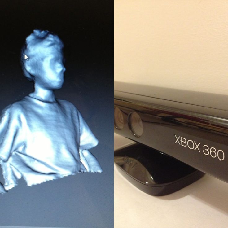 The PhotoModeler photogrammetry software extracts measurements and models from images taken with ordinary cameras!
- SOCET GXP
SOCET GXP is presented as an advanced geospatial intelligence software solution, developed by BAE Systems, a defense, security and aerospace company. This program is using imagery from satellites and aerial sources, which allows identifying, analyzing, and extracting ground features. This advanced software combines image analysis, geospatial production, photogrammetry tools, and remote sensing into one package, already used for homeland security, disaster relief, and humanitarian efforts.
- DroneDeploy
DroneDeploy is a cloud-based drone software, helping businesses get accurate 2D and 3D maps ready for analysis. They are specialized in aerial photography. This solution is made of two different apps. One is used to control the drone, and the other one creates your 3D models with all the images from the drone.
- Correlator3D
Correlator3D is a mapping software developed by Simactive. All of its terrain modeling and aerial photography features will help you with your projects. This end-to-end user-friendly photogrammetry software can help you produce dense Digital Surface Models (DSM). Digital Terrain Models (DTM), dense point clouds, orthomosaics and great vectorized 3D features.
We hope that you found the perfect photogrammetry software thanks to our selection. Keep in mind that once your 3D design is ready, in the proper file format for 3D printers, you can upload your 3D file on our online 3D printing service and get your 3D printed object.
review of the 10 best programs for 3D scanners: the most popular software for 3D scan
04/30/2021
Content
-
- PhotoModler Scanner
- Rapidform 9000 Rangevision Scancenter
- GEOMAGIC CONTROL CONTROL CONTROL
- FARO Scene
- 3DF Zephyr
- Colmap
- PolyWorks
- Vxmodel
- Artec Studio
- Conclusion
-
by setting the parameters manually;
-
automatically, from already laid beacons;
-
from a point cloud from overlapping images.
-
XOS - designed to regulate and control 3D scanning, as well as processing the resulting images.
-
XOR - widely used in design, as it has a huge number of tools for 3D modeling. With its help, you can create high-precision three-dimensional models (on a cloud of points) of almost anything.
-
XOV - allows you to control the quality of the resulting three-dimensional image, which makes it possible to maximize its detail.
- Basics What is 3D printing?
- Basics What is a 3D model?
- Active 3D scanners that emit a beam of directed waves onto an object and record their reflection.
 Possible types of radiation include x-rays, ultrasound, and light;
 - Passive 3D scanners that capture ambient radiation reflected from an object, most often light.
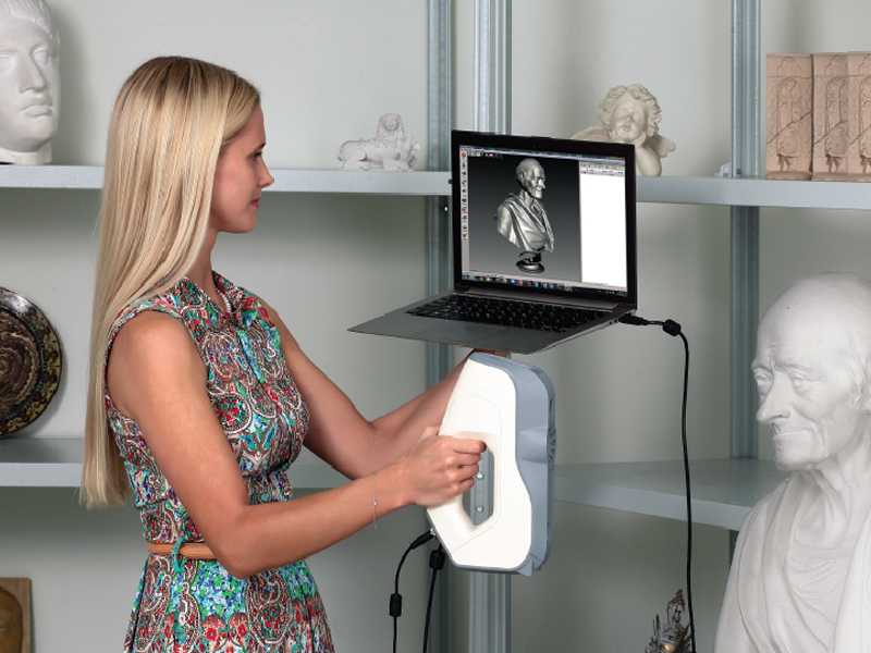
1 3D printers have long ceased to be a curiosity for Russians.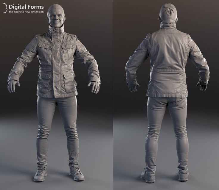 Increasingly, these devices can be found not only in manufacturing plants and in companies involved in engineering and design. They are actively used by consumers both for personal needs (creating souvenirs, figurines) and for work purposes, moreover, in various fields - medicine, construction, science, car manufacturing, etc. However, all this would be impossible without 3D scanners that transfer data about a physical object into digital format and, using special computer programs, create a three-dimensional model, which can later be sent for printing. Scanning, in fact, is only the first stage of work, but the main part of it falls on the processing of the collected information.
Specialized software not only analyzes the information received and creates a virtual copy based on it, but also helps to eliminate possible errors and errors made during the scanning process and much more.
Today we will talk about the most popular programs for 3D scanners that allow you to solve almost any user task.
Photomodeler Scanner
Very simple and functional software that can create 3D models of varying degrees of complexity. Almost everyone can understand it and learn how to use it to recreate virtual copies of anything, even a person.
You can set the characteristics of a future object in Photomodeler Scanner using 3 methods:
In the latter version, the user will also need to indicate the position of the camera during the shooting process and mark control points on the images, linking them together.
Creating a 3D model with Photomodeler Scanner
With Photomodeler Scanner, you can create all kinds of diagrams, graphs, different planes, expand a 3D line, and much more.
This application is very affordable and at the same time allows you to get professional results with a minimum of effort.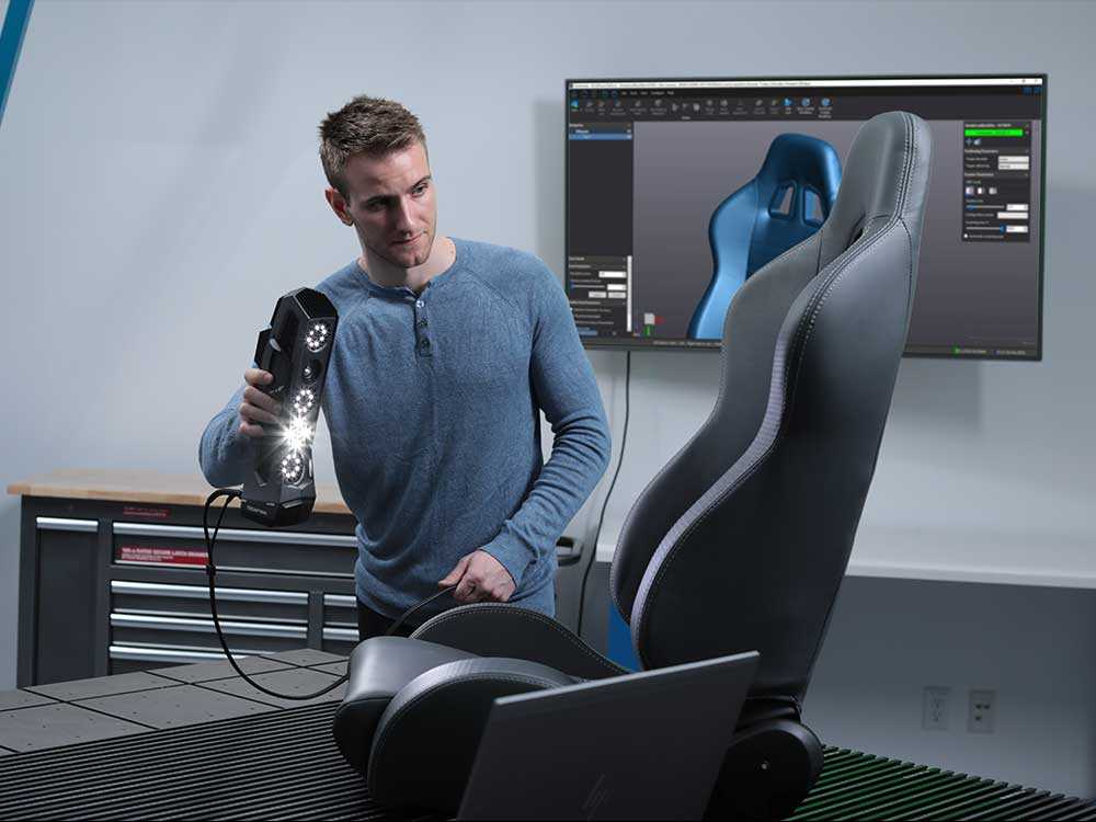
RapidForm
One of the most frequently used and convenient programs. It is distinguished by its quality and versatility, as it is suitable for many models of 3D printers.
It analyzes the data received using a 3D scanner and creates an accurate three-dimensional model. If you need to make any changes, then it will be quite easy to do this, since the program is very simple and straightforward to use.
Example of work in Rapid Form
RapidForm has several types of programs:
RangeVision ScanCenter
Software that provides the user with a huge selection of functions and tools for creating a high-precision digital three-dimensional copy of an object of any complexity. For data analysis, unique algorithms are used that make it possible to convey as clearly as possible not only the geometry of the scanned object, but also its color (up to shades, including white) and texture. At the same time, anyone can understand the RangeVision ScanCenter, as it is intuitive and easy to use.
Screenshot of the process of creating a 3D model in Range Vision
It can work in various scanning modes: free, with markers and on a turntable. The resulting file can be exported to all popular formats.
All actions of the program are automated as much as possible (calibration, adjustment, analysis of the quality of scans), which greatly simplifies the task and at the same time gives the best result at the output.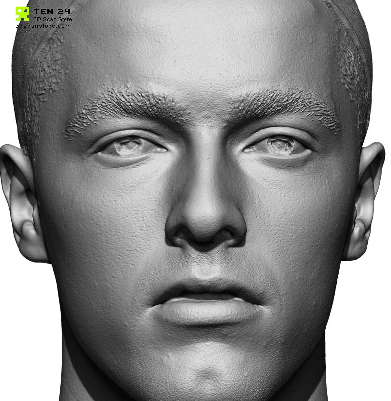
Geomagic Control X/Design X/Wrap
Geomagic professional 3D scanning software is available in 3 versions: Wrap, Control X, Design X. They use the latest topological shape recognition technologies. They can not only project a three-dimensional image of an object, but also analyze the degree of its possible wear and deviations. Often used in reverse engineering.
Geomagic Design X 3D reverse design software. Provides the ability to combine CAD processing and 3D scan data based on a design, resulting in detailed CAD models. This can be done both automatically and manually by setting parameters and editing the processing of point clouds and polygonal meshes.
Geomagic Control X - software for quality control and geometry of 3D models. Provides users with a wide range of tools to enhance their scanning experience with reporting and data analysis capabilities.
Wrap : Used for processing point clouds and meshes, used in modeling and design.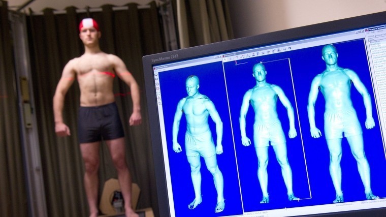 It works quickly and accurately, making it possible to optimize the resulting model without losing the original properties of the object, such as texture and texture. After processing the scan data with Wrap, the created 3D project can be printed. Suitable for both small and large items.
How to create a 3D model in Geomagic Wrap
The Geomagic software package, like other analogues, allows you to control the quality of scans and export 3D models created on their basis to various formats.
FARO Scene
Faro is a world famous manufacturer of 3D scanners, which also produces one of the most advanced software for them. One such program is Faro Scene. It is suitable for working both with "native" devices of the same brand, and for many others.
Faro Scene is widely used to create 3D models of various buildings
It is very effective in processing scans: it can combine them, carry out all kinds of measurements, visualize data, etc.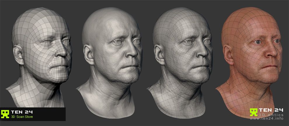 In addition, thanks to the advanced functions of the program, it is possible to transfer color from a photo to a finished model by overlaying and further balancing it.
3DF Zephyr
Perhaps the most popular program among users, due to its convenience and simplicity. The interface is so clear that it is not difficult to understand it.
3D-Zephyr will not cause problems even for beginners
Suitable for both amateurs and professionals. The latter will especially like a large selection of tools and settings, including the ability to transfer the resulting three-dimensional model to CAD software.
Colmap
Indispensable in cases where you need to quickly and easily create a 3D copy of an object. Colmap makes it possible to use a 3D mesh both from one camera and from several. This approach is very convenient where you need to scan a large number of items in a short time.
Colmap example
The “minus” is that editing 3D models will not work without additional software.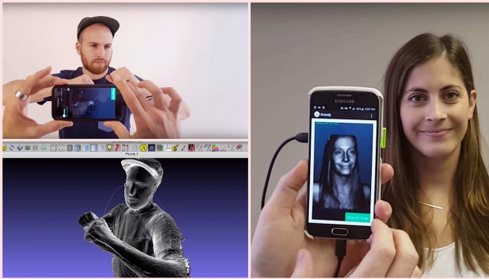 However, the quality of such 3D images is quite acceptable.
PolyWorks
The capabilities of the program allow you to analyze the accuracy of the resulting three-dimensional copy, as well as its quality.
3D object created in PolyWorks
PolyWorks is widely used in areas where maximum detail of a 3D object and its accurate reproduction are required: medicine, automotive, construction, design, etc.
Vxmodel
Software created specifically for reverse engineering products, as well as finalizing 3D scan data. It has the function of editing a polygonal model, its alignment, extraction of primitives, construction of surfaces and export of objects.
Vxmodel can create 3D models of various parts
It can process information from any 3D scanners and translate it into CAD and prepare it for 3D printing, so it is very convenient to use. Manufactured by Creaform.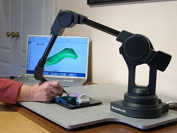
Artec Studio
Quality software with a wide range of tools. At the same time, you can use it even if you do not have the skills to work with such programs. Especially for such users, the "Autopilot" mode was developed, which simplifies the process of processing 3D scanning data as much as possible, independently selecting algorithms based on the user's answers.
3D model obtained with Artec Studio
Allows you to control the quality of the 3D model not only at the processing stage (compatible with Geomagic Control X), but also in the process, giving a color signal about how close / far the operator is from the object when scanning.
The program itself is able to select the degree of sensitivity of the scanner, as it can analyze the type and complexity of the surface. This makes it possible to digitize even dark and shiny objects.
Well determines the colors and configuration of the scanned object, making it unnecessary to apply markers. Suitable for formatting scans for CAD.
Artec Studio easily handles large amounts of data, making it ideal for 3D scanning of various buildings and structures, etc. All operations are performed very quickly and efficiently.
Conclusion
All the programs for 3D scanning discussed above have good tools and a sufficient amount of options to perform tasks of any degree of complexity. They are suitable for both professionals and ordinary users who do not have experience with such software, since they have a high degree of automation and have a fairly understandable interface.
Each major manufacturer of 3D scanners releases its own software for them, which is constantly updated and improved. However, many of these programs can easily be used on third-party devices without loss of quality. You can use any of the listed 3D modeling software.
If you need equipment for 3D printing, but it is difficult to make a choice on your own, contact Tsvetnoy Mir.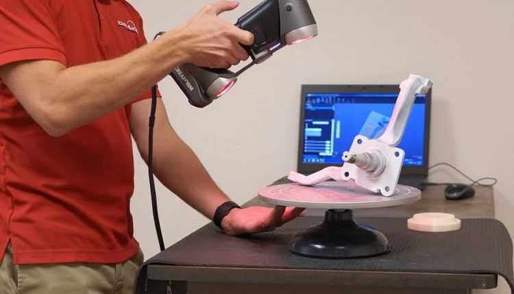 The specialists of our company know absolutely everything about the process of creating three-dimensional models and will help you choose a 3D printer or scanner based on your tasks and capabilities. It is important to us that our customers get exactly what they need.
Call: +7 (495) 287-41-45, 8(800) 550-02-09 and we will answer any of your questions!
Add to compare
Product added to compare Go
| Manufacturer | Shining 3D |
Add to compare
Product added to compare Go
| Manufacturer | Shining 3D |
Add to compare
Product added to compare Go
| Manufacturer | Range Vision |
Add to compare
Product added to compare Go
| Manufacturer | Range Vision |
#Useful
Expert in the field of additive and subtractive technologies, 3D equipment and CNC machines with over 10 years of experience.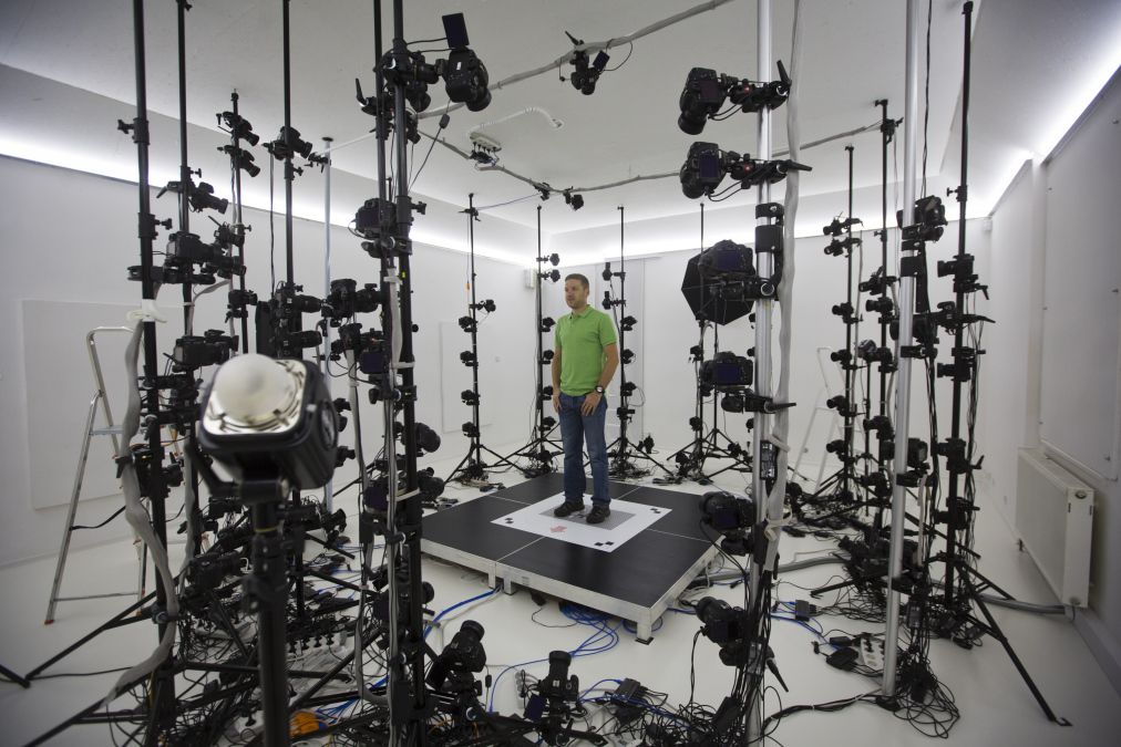
Share
all materials
3D scanning of objects - accuracy and quality of 3D models
3D scanning of objects
One of the components of 3D technologies is the 3D scanning technique, which allows you to quickly and easily obtain a digital model of the desired product. In short, 3D object scanning is the process of transforming the physical form of a real object into a digital form. This preserves the texture and even the color of the original sample. Thus, a 3D model of the required product can be obtained without any extra effort. 3D scanning of objects helps to prepare the necessary model for 3D printing and in some cases can play a decisive role in building a digital product.
The key device in the process of 3D scanning is a 3D scanner - a device that reads the physical parameters of objects and creates a 3D model based on them.
3D scanning of objects can be useful in the design of any complex elements, 3D modeling of which manually is extremely laborious.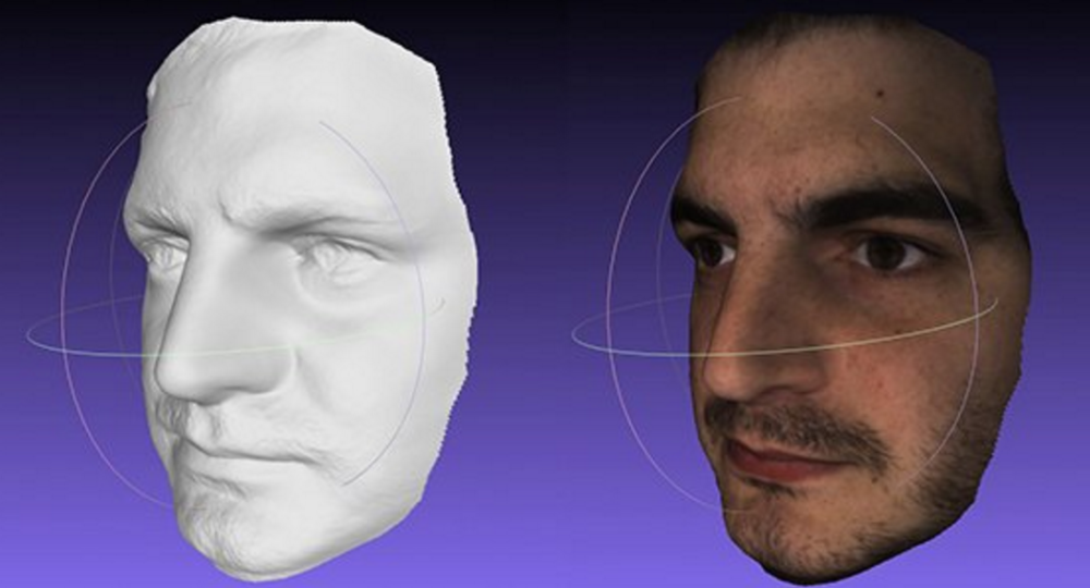 In particular, 3D scanning is useful for modeling various fixtures, components, main and spare parts. Often it is used in the absence of drawings and other documentation for the product, as well as when it is necessary to convert figured surfaces into a digital form, including art forms and casts.
3D scanning process
The 3D scanning process generally resembles a human three-dimensional vision system. The process of obtaining data with a 3D scanner resembles the formation of a three-dimensional image seen in the human brain. To do this, the 3D scanner compares two images that are offset from each other. The required accuracy of building a 3D model is achieved through the use of additional technological methods, for example, a periodic flash or laser illumination.
As for scanning accuracy, it depends both on the specific device and on the characteristics of the original product. It is possible to carry out 3D scanning of objects from 1 cm (with all the details), the maximum dimensions are not limited.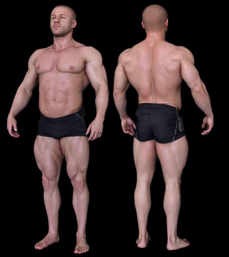 To achieve the best detail, upon completion of the 3D scanning process, the 3D model is subjected to additional refinement by a specialist. Thus, thanks to 3D scanning of objects, digital models are almost flawless. Error for 3D scanning of objects with a surface area of 100 cm 2 is 1 mm and can be eliminated with subsequent refinement. 3D scanning of large objects can be implemented by batch processing of object photos from all sides.
Other questions and answers about 3D printers and 3D printing:
3D scanning methods
For a better understanding of the technology, it would not hurt to list the existing 3D scanning methods. There are two of them: contact and non-contact. The first one requires direct contact of the 3D scanner with the object. The non-contact method divides peripherals into two types:
All 3D scanning methods have their advantages and disadvantages, which affect the cost of 3D scanners, the speed and accuracy of scanning, as well as the range of objects available for scanning. When buying your own 3D scanner, it is recommended to study this issue in more detail, but it is better to get high-quality advice from professionals. The 3DDevice team is ready to help you with this and recommend the best 3D scanner model.
3D scanning and 3D printing
3D scanning and 3D printing complement each other, since the scanned 3D models are most often used for subsequent reproduction on a 3D printer. At the moment, 3D scanning is used for a variety of purposes and industries. Using a 3D scanner, 3D models of real people are created, which can then be reproduced through full-color 3D plaster printing.