What is a 3d laser scanner
What Is 3D Laser Scanning Technology?
What Is 3D Laser Scanning Technology?
Duncan Parnell
For those in the industrial manufacturing sector and other relevant industries, 3D laser scanning services are quickly becoming standard in many facets of 3D laser scanning processes. From the design process to inspection and distribution of products, 3D scanning services are a must-have.
Before you learn how to use a 3D printer step by step, you should first understand how the 3D laser scanning process works, how it can benefit your company, its various applications and the trends in the industry today.
What Is 3D Laser Scanning?
3D laser scanning is a technology that employs lasers to measure an object's geometry to craft a digital 3D model. This technology is used throughout a number of industries and settings, as 3D laser scanning can capture three-dimensional data of objects, regardless of their surface features or size.
As the scanning is done with lasers, the objects do not need to be physically touched to take precise records of the existing dimensions of the object. From these scans, you'll be able to generate a model using 3D imaging software.
What Is 3D Imaging?
Essentially, 3D imaging is the ability to create an illusion of depth in a 2D image. A program manipulates the data in a 2D image to make it appear in a 3D format. Practically, 3D imaging is useful if you need to construct an object digitally, and it can also be helpful when you need to print out a 3D model.
The 3D models generated by laser scanning are constructed by capturing measurements from a variety of viewpoints with laser points or lines. The thousands of data points captured by the lasers and computer software are grouped into point clouds. These point clouds contain coordinates that all have x, y and z values, with x standing for easting, y for northing and z for elevation. The amount of detail and information contained in these point values allows users to build the most accurate models possible digitally.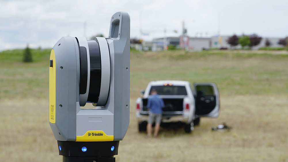
Top 4 Applications of 3D Laser Scanning
There's a reason 3D laser scanning is used throughout the industrial manufacturing industry. It's useful in a variety of applications that can provide a significant amount of value to a company. Below, you'll find some of the most important ways companies use 3D laser scanning:
1. 3D Modeling, Design and Printing
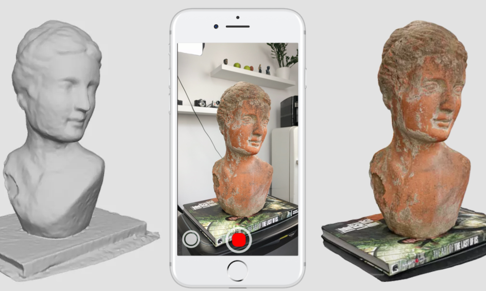
Once you've made a 3D laser scan, you'll have several different ways you can use the data. For example, one of the most common applications of a 3D laser scan is to turn it into a digital model. Often, these digital models are converted into 3D CAD formats, using 3D software such as Artec Studio. In the program, you can view and interact with the model, which is perfect for companies that want to make adjustments to an existing product.
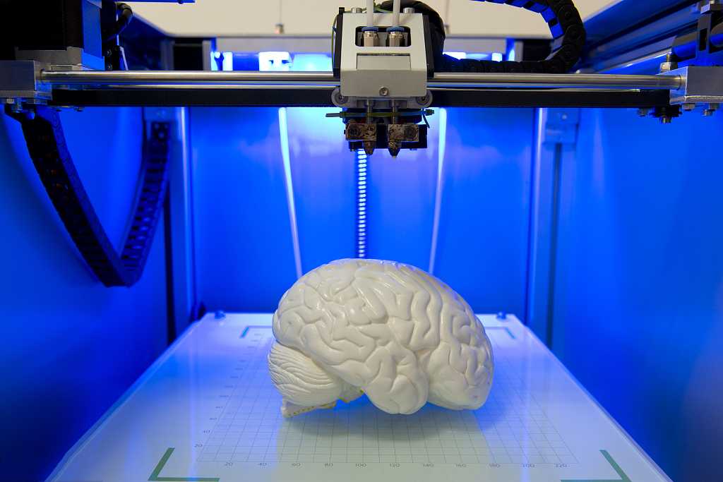
Many times, companies use 3D data gained from scanning products or facilities to help themselves design similar products or facilities. Additionally, one of the most impressive new applications of 3D laser scanning is 3D printing.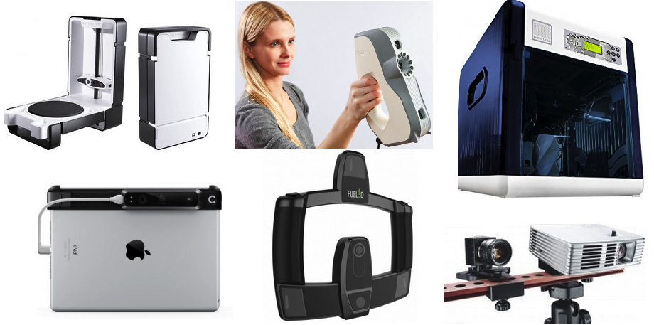 With 3D printing, objects or models of buildings can be scanned and printed out in a variety of sizes.
2. Reverse Engineering
If you have an object with dimensions you don't know, you can use 3D laser scanning to get the most accurate measurements. The data from the scan can then produce a 3D model of the object or space in multiple formats. This sort of reverse engineering functionality means that companies can figure out how to reconstruct an object even without its design documents.
3. Planning
One of the most beneficial applications of 3D laser scanning across several industries is the ability to plan future actions and prototypes better. Say you have a facility and are looking to add a new machine or area to it. You can scan the current facility to find where new parts of the facility or machines can fit in with the current structure. The same principles can be applied to products that need to be compatible with other products from the company.
4.
 Marketing and Educational Applications
For companies that work with clients and are engaged in design work, 3D laser scans can help marketing teams bring their product to clients virtually. In the educational sphere, 3D laser models can be used as an instructional tool to show people how to construct or produce different items properly. For example, architecture students may find it valuable for an instructor to show them how a building maintains its structural integrity through the data that a scan provides.
Though 3D scanning still sometimes seems like magic, it’s made possible through highly advanced technology that has been continually improving for years. A 3D laser scanner is a non-contact, non-destructive digital technology that captures the shape of a physical object by using a line of laser light. It creates a point cloud, or a set of data points in a coordinate system, that represents the exact size and shape of a three-dimensional object.
3D scanners measure an object’s finest details, capturing free-form shapes and generating accurate point clouds for objects with complex geometries and contoured surfaces. This allows you to quickly capture precise data and deliver it quickly.
How It Works: The 3D Laser Scanning Process
3D laser scanning has gone through a revolution over the years that has provided enhanced precision, faster scanning and better results. Controlled steering of laser beams, in addition to distance measurements, makes the process possible. An internal rotary encoder in the machine controls the motion of scanning by adjusting several scanning mirrors to guide the laser beams. The process happens in several steps:
- Quality control. When it comes to ensuring that products are being properly produced, 3D laser scanning is quickly becoming a must. It has proven its value by being able to provide users with a quick update on a product's construction. For example, a company can take the data gained from a scan to catch any errors that have been made and correct them before a product is unveiled to the public.
- Rapid prototyping. A top benefit to 3D laser scanning is the ability to reduce how many prototype cycles are needed. With 3D scan data, you'll reduce the prototypes created, as you'll have the ability to get the measurements right before going to production.
 Before it's produced, the object will be constructed with the correct physical measurements, giving it the right scale and proper functionality.
 - Optimizes engineering and manufacturing. The data gathered by a 3D scan can be applied to the engineering portions of the project. For example, the 3D scan data will help you perform CAE, FEA and CFD engineering analysis on your created or modified products.
- Accurate documentation. In a variety of industries, 3D laser scanning provides companies with the ability to precisely document products that they offer. With a 3D laser scan, companies can quickly have precise measurements for all of the products that they offer.
- Meet deadlines. Though it might not be obvious, 3D scanning services can help companies keep tabs on the progress of their work. If you're a construction company, regular laser scanning will give you a detailed breakdown of how much has been accomplished on a worksite, which will then ensure that deadlines are met.
 The same principle applies to the manufacturing of objects, as laser scanning can keep tabs on the progress of whatever is being produced.
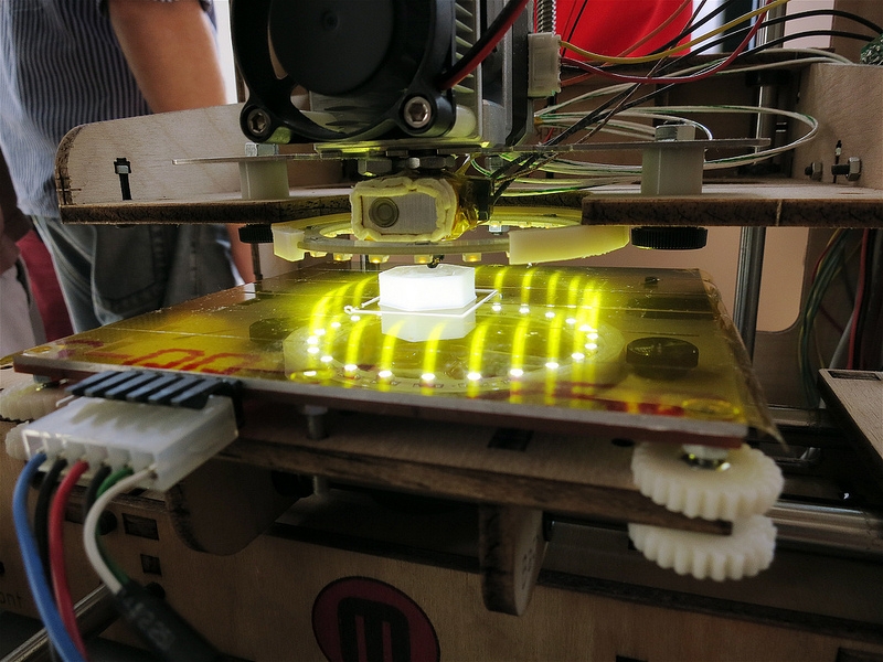
1. Scanning
The first step to the 3D laser scanning process is to pick out an object or facility that you'd like scanned. Once you select your object, you'll need to scan it. For smaller objects, you'll place them on the bed of a digitizer to begin the scanning process. For larger objects, such as buildings, you'll need to use other types of portable 3D laser scanners that can be brought out to the site.
What Are The Different Types of 3D Scanning?
To scan an object properly, you'll need to know the two main types of 3D scanning on the market today: time-of-flight and triangulation.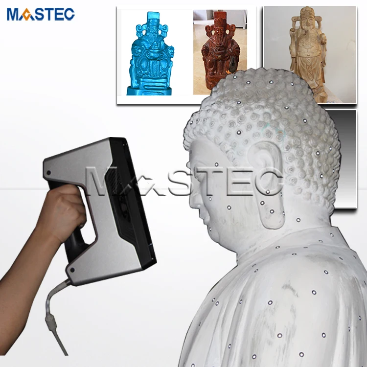
- Triangulation
Triangulation uses trigonometry to get the most accurate dimensions of the object. This method involves the use of a scanner and a camera, with the camera sitting at the top vertice of a triangle and the laser scanner sitting beneath the camera at the second vertice. The object is located at the third vertice, waiting to be scanned.
Once the scanner, camera and object are in place, the scanner scans the object. As the distance and the angle between the laser and the camera are known, the scanner can calculate the distance to the object and then begin taking the measurements of the entire object.
The scanner takes its measurements by emitting a laser line. This line lets it scan and measure the object's cross-section all at once. The laser moves up the object's surface until it captures all of its dimensions. The data gained is then fed into a computer where you can then put it to use in a variety of applications. Typically, companies use this type of scanning for short-range applications, with the objects usually being smaller.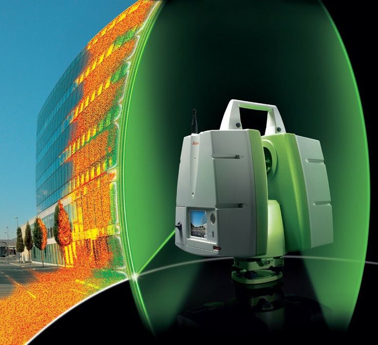
- Time-of-Flight
In contrast to triangulation, time-of-flight scanning can occur at a great distance and is often used for larger scanning jobs, such as a building or vehicle. In practice, these scanners can be considered laser range finders, as they determine the distance to the object or surface they are scanning to help them take measurements. The way they make these measurements is through a LiDAR system.
How does LiDAR work? In short, LiDAR gathers accurate data by emitting laser light and then measuring how long it takes for the light to hit the surface and bounce back to the sensors. As the speed of light is a constant that's known, the amount of time that it takes to get to the surface and bounce back tells the 3D scanner the distance between them.
Once the distance is determined, the laser will begin scanning, measuring distance one point at a time. The scanner will automatically move the laser to each point of the surface in its field of vision, with the process being extremely fast. The majority of time-of-flight scanners can measure thousands of data points per second. Due to their medium to long-range scanning capabilities, this method is often used in environmental or surveying scanning.
2. The Data
The resulting data from this process is the point cloud. Millions of points appear on a computer monitor during the laser’s movement, which captures the entire surface shape of any scanned object. The process gathers up to a million points per second with cutting-edge models like the TX8 laser scanners and others. Scanners maintain a precision within .0005 inches of the exact value.
Point cloud data files are huge. After their generation, they are registered and merged into a 3D representation of the object. Then, they’re post-processed with various software packages depending on the specific application.
3. Data Uses
Once the data has been collected and the image has been fully rendered in whatever scanning software you're using, you'll be able to select the kind of model you'd like to create through your software's 3D imaging capabilities. Sometimes you may only want a digital model, but you can also print out the model if you'd like to see a more tangible visual representation of the product.
If you're using the data you gained for inspection purposes, you can compare the designer's CAD nominal data to the object you scanned. From that comparison, you can receive a deviation report that utilizes a color map. This report will show the difference between any CAD data and scan data.
Additionally, the data can be used for reverse engineering with a CAD model. The laser scan of an object will deliver plenty of information that you can then use to reverse engineer an object. In the software, the point cloud data from an object can be plugged in to build a 3D CAD model of the object's geometry.
After the CAD model has been generated, it's easy to then to quickly reproduce an exact copy of a scanned object. Reverse engineering also allows companies to correct any imperfections in previous models. By reverse-engineering them, they can find the flaws and then keep what works while adjusting the parts that have issues in the CAD model.
Benefits of Using 3D Laser Scanning
3D laser mapping and scanning carry with them several benefits that industrial manufacturers and other businesses would be wise to utilize. To give you an idea of how 3D laser scanning can assist your company, consider the following benefits:
Technology Trends Influencing 3D Laser Scanning Capabilities
Currently, there's a debate going on in the 3D laser scanning industry about the merits of using photogrammetry or 3D laser scanning to craft 3D interactive models. Generally, it's better to use photogrammetry if you need to cover a large amount of space quickly, but for those who want a higher level of accuracy, laser scanners should be your top choice.
One main technological trend that has made 3D laser scanning faster has been the advent of drones that can quickly gather data in hard-to-reach areas. This new piece of technology closes some of the gap between photogrammetry and 3D laser scanning in terms of speed. Companies are also starting to use UAVs to eliminate LiDAR collection processes, which can cut some costs associated with LiDAR.
As reverse engineering and part inspection continue to become a major fixture of industrial manufacturing, the accuracy that 3D laser scanning provides makes it the clear choice over previous photogrammetry methods. Other new trends include more mobile LiDAR scanners, greater automation and faster processes, the growth of multimodal scans and greater AR/VR integration.
Contact Duncan-Parnell With Any Questions About 3D Scanning or Imaging
3D scanning services are vital to modern industrial manufacturing processes. 3D laser scanning technology has many applications and benefits that can affect virtually every stage of the design and manufacturing processes of products. For those interested in adding 3D scanners, 3D software or 3D scanning services, consider browsing our vast selection of 3D scanning products.
If you're just looking for more information, we have you covered as well. For those who want to know more about the 3D printing process, consider reading our blog about how to use 3D printer software and the various printing methods. Additionally, if you have other questions, feel free to contact us today!
About author
Back to Blog
What is laser 3D scanning? | Professional 3D scanning solutions
BySvetlana Golubeva
Jan.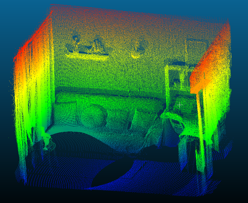 24, 2022
15 min read
5266
9
summary
In this guide, we take a deeper look into one of the most popular 3D scanning technologies – laser 3D scanning. After reading it, you’ll be familiar with what types of scanners are referred to as “laser,” how they work, where they’re most useful, and what they are used for.
Types of laser scanners by technology
Time of flight, phase shift, triangulation
Types of laser scanners by product
Handheld, tripod-mounted, desktop
Types of laser scanners by range
Short range (up to 5 m), medium range (up to 120 m), long range (up to 2 km)
Today, there are multiple ways and technologies to bring an object from the real world into the digital 3D space. You can do it with various types of 3D scanners: desktop, handheld, or tripod-mounted, industrial or consumer-grade; photo cameras and photogrammetry software; contact-based measuring systems; smartphones or tablets with built-in LiDAR sensors; mobile, terrestrial, airborne systems, and more.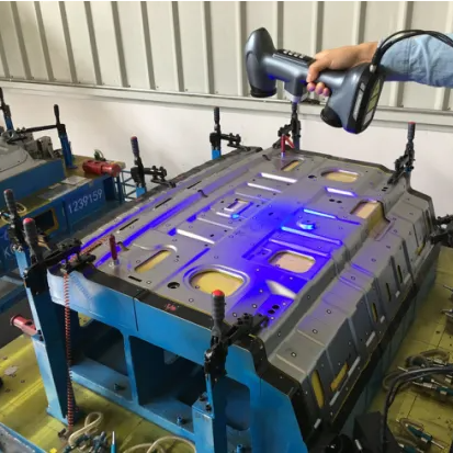
In this article, we’re going to focus on one of the most popular scanning technologies used everywhere from construction and land surveying to forensics and heritage preservation – laser 3D scanning. We’ll see what types of scanners are referred to as “laser,” how each of them work, and where and what those devices are used for.
What is a 3D laser scanner?
When people hear the term “laser 3D scanner,” they might imagine an array of scanning devices, depending on their background and area of expertise. An industrial designer, for example, might picture a portable handheld unit that can capture small to medium objects at a short range, while a construction worker – a tripod-mounted terrestrial scanner for surveying and measuring larger objects such as buildings or entire outdoor areas from the ground. A surveying and mapping technician, on the other hand, would likely picture a car or a drone with a scanning system onboard used for mapping terrain on the go.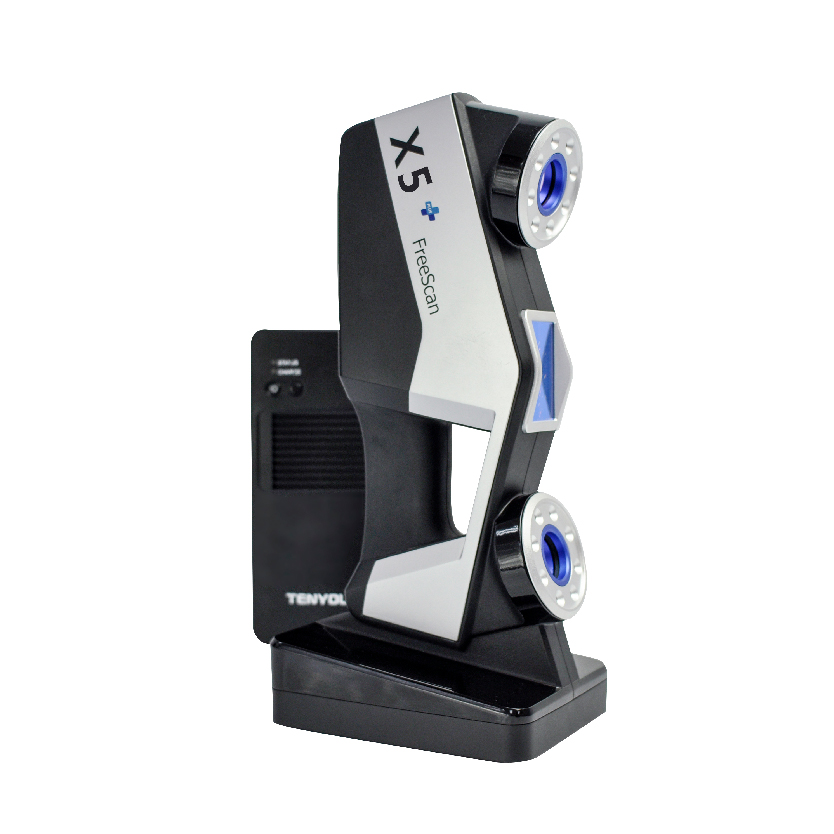 And all of them would be right, because each of the devices above can correctly be referred to as a 3D laser scanner.
So, what is laser scanning and which devices can be called laser scanners?
To simplify it, laser scanning is a process of capturing precise, three-dimensional information from a real-world object, a group of objects, or an environment, using a laser as a light source. By projecting laser light onto the object, the scanner creates point clouds – millions of precisely measured XYZ points that define the object’s position in space. Some laser scanners allow the option of downloading the model as point clouds, while others automatically convert it into a triangulated mesh, which can then be transformed into a CAD model or a full-colored 3D model if the recording of texture is supported.
A long-range laser scanner being prepared for use on an offshore vessel (Photo courtesy of ASOM)
Unlike the contact-based measuring systems that we reviewed earlier, laser 3D scanners are 100% non-contact and non-destructive active devices that can capture objects made of solid and fragile materials. They can work indoors while some can operate outdoors as well. They can be used in daylight or at night, and can be both stationary and portable. They can be used to scan at a wide range of scales and for a broad range of objects and sites – from very small to very large.
KEY POINT
Non-contact and non-destructive devices, laser scanners capture XYZ coordinates of myriads of points on an object’s surfaces to calculate its dimensions, reconstruct its shape in a 3D environment, and define its position in space – all with astounding accuracy.
Depending on the application, 3D laser scanners can come as standalone devices – portable, handheld, or stationary and tripod-mounted, for example – or as part of a more complex solution such as robotic arms, mobile or airborne laser scanning systems, and more. On the technological side, there are time of flight, phase shift, and triangulation-based laser scanners.
Let’s take a closer look at the most popular types of laser scanners and how they work.
Types of laser scanners
Time of flight
The first type of laser scanners typically used for long-range data acquisition is Time of Flight (TOF). Such 3D scanners work by the same principle as laser range finders work: a laser pulse is sent out onto an object, while a portion of the pulse is reflected from the object’s surface and returns to the scanner. The distance to the object is calculated by the time of the flight of the pulse, using this formula: Distance = (Speed of Light x Time of Flight) / 2). This distance is then used to calculate a coordinate for the tiny section of the surface hit by the laser beam.
How Time of Flight measurement principle works
Time of flight 3D scanners can capture objects over great distances of up to 1,000 meters away. However, their typical working range is 5-300 meters. While TOF systems can measure over long distances, they have the slowest data caption rates – between hundreds and thousands of points per second.
The accuracy of TOF technology is determined by the system’s ability to accurately measure the time of the returning signal. While accuracy specifications vary across different systems, the typical accuracy for a TOF scanner is 4-10 mm. More recent TOF systems also include an additional RGB caption option, either through an internal camera or an external camera set.
Phase shift
Phase shift 3D scanners emit laser light at alternating frequencies and determine the distance to an object by measuring the phase difference between the emitted and reflected signals. Unlike the time of flight scanners, phase shift scanners work at shorter ranges from 80 to 120 meters maximum, with a typical operating range of 1 to 50 meters.
How phase shift measurement principle works
Phase-based 3D scanners are often categorized as the fastest laser scanners, with some systems claiming a caption rate of up to a million points/second. They also have higher accuracy and resolution than TOF scanners. And, like TOF scanners, they include internal or external color capture options.
Key point
All laser scanners send out laser light but employ different technologies to interpret inbound signals. Time-of-flight scanners log the time emitted light takes to return once it’s bounced off the surface of an object, phase-shift scanners measure the phase difference between emitted and reflected signals, and triangulation scanners calculate the angle at which an outbound beam returns to the sensor.
Thanks to their high accuracy, phase shift scanners work best for medium-range scanning needs such as large pumps, automobiles, and industrial equipment. Both phase shift and time of flight systems can also be used in terrestrial scanning applications where larger objects or structures of a couple of meters up to multiple kilometers can be surveyed.
Terrestrial TOF and phase-based scanning systems can come as stationary, tripod-mounted equipment, which can be used as-is or mounted onto land-based or aerial vehicles for projects that require information from vast landscapes or inaccessible areas.
Triangulation
The third type of laser-based scanners operates on the principle of triangulation, where laser light is emitted and returned to a specific location on an image sensor array of an inboard camera. To calculate the distance between the object and the 3D scanner, the system uses trigonometric triangulation because the laser source, the sensor, and the target left on the object form a triangle. The distance between the laser source and the sensor is known very precisely, as is the angle between the laser and the sensor. As the laser light bounces off the scanned object, the system can measure the angle at which it is returning to the sensor, and therefore the distance from the laser source to the object’s surface.
How triangulation measurement principle works
Triangulation-based laser scanners work at much shorter ranges (less than 5 meters) than the time of flight or phase shift scanners due to the small dynamic range of the image sensors and decreased accuracy with range. Most triangulation systems also come with an internal RGB capture option.
Commonly, triangulation-based scanners are most suited for scanning smaller objects ranging in size from 1 cm up to 2-3 meters, depending on the manufacturer. As for the form factor, there are stationary, tripod-mounted triangulation scanners. However, this technology meets the most success when used in portable handheld 3D scanners.
Applications of laser scanners
Laser scanners are used in a wide variety of fields, and for a wide variety of applications: from construction and civil engineering to forensics and archeology. As the technology becomes cheaper, lighter, and smaller, more and more industries are getting into laser scanning. Some well-known applications of these devices are listed below.
Reverse engineering
Scanning the undercarriage of a car with short-range laser triangulation 3D scanner
From small mechanical components to massive industrial objects, laser scanners have become an essential technology in the toolkits of professionals involved in product design and development. Once a complicated process that could require days of disassembly, detailed manual measurements, and the painstaking process of examining each part of a product, thanks to laser scanning reverse engineering now takes anywhere from a few minutes for a CAD surface model, to a few hours for a parametric CAD model. The scanners are used to create accurate digital blueprints of parts that have been damaged or deformed, need a redesign but don’t have CAD data available for them. Portable laser scanners with embedded processors are perfect for examining small and medium-sized objects, while medium and long-range devices work best for larger items. Instant creation of CAD models frees up hours if not days of work, which R&D teams can spend on the actual product enhancement.
Quality inspection
Inspecting the pipes with a laser scanner
Another important stage of the manufacturing process and one more area revolutionized by laser scanners is quality inspection. Traditionally dominated by manual, contact-based measuring techniques, thanks to laser scanning quality inspection workflows can now be done way faster, more accurately, and with far more measurable data. This in turn results in fewer iteration loops and faster delivery of products to the customer. Unlike CMMs that can typically acquire dozens of point measurements one at a time, need to be in physical contact with the surface, and require programming for every new part to be examined, laser scanners can capture millions of measurements for various types of objects with a wide range of geometrical complexities in a fraction of the time, and completely contact-free.
Key point
Laser scanners have proved to be effective measuring tools for both industrial production and consumer-level applications: from reverse engineering to quality control, forensics, and self-driving cars.
Short-range laser triangulation scanners that come in the form of portable handheld devices provide flexibility over the types of objects to be inspected, as well as their location. They are great at capturing complex parts that would be impossible to measure by hand or with a moving touch-probe. Thanks to their lightweight design, such devices allow QA managers to be more mobile without being tied to a particular place or area.
Long-range laser scanners are perfect for examining and collecting accurate and measurable data from large objects, and can even be paired with a handheld scanning solution for capturing smaller elements in high detail. The resulting 3D model captured with a laser scanner can be processed in a scan processing software, then converted into a CAD file. At this stage, it can be compared to the original CAD model, and the parts which are in or out of tolerance can be identified.
Forensics
Capturing a crime scene with laser triangulation 3D scanner
Thanks to their capability of capturing large spaces such as room interiors, buildings, and entire sites, laser scanners are becoming the new go-to solution for the accurate documentation and investigation of crime scenes, and reconstruction of accidents. Unlike traditional evidence collection methods such as photo and video cameras, and measuring tapes, laser scanners allow investigators to capture entire crime scenes in their original state, with precise dimensions for every piece of evidence, be it a body, a footprint, or a bullet hole, and do it all in a matter of minutes.
Portable handheld laser scanners with embedded processors are perfect for capturing standalone items on the go at multiple locations within a day, and can be brought in when higher and more accurate data is needed, e.g. a closer scan of a dead body, a damaged piece of furniture, or close up scan of a footprint left by the criminal. Long-range scanners, on the other hand, are useful for capturing an entire space. By having it placed in the middle of the room where it scans fully automatically, the investigator can engage in other parts of their work, such as talking to witnesses and victims, without a need to control the scanner. The 3D data enables forensic experts to have a fuller and much more detailed picture of a crime scene and build stronger and more decisive cases to present in the courtroom.
Construction (BIM)
3D scanning a warehouse with a tripod-based long-range laser scanner
Another popular application of long and medium-range terrestrial laser scanners, particularly among architects and construction technicians, is 3D capture of buildings and entire construction sites. Such devices allow facility owners or construction project managers to quickly create accurate documentation and 3D visualization of existing buildings and their conditions. They are also used to track the progress of construction and quality inspection of newly constructed projects and compare them with an as-designed model. Laser scanners not only save the time and cost used for manual measurements, they also increase safety conditions when working in unsafe locations. Laser 3D scanners can be used throughout the whole lifecycle of the building, and provide permanent and rich 3D data that can be used for renovation or new building projects, and be accessed anytime.
Archeology
Capturing the skull of a triceratops with a handheld short-range laser scanner (Image by David Cano / 3D Printing Colorado)
Archeology is another area where laser scanners have become indispensable tools for 3D documentation of archaeological excavations, be it a single bone of an extinct animal or an entire ancient city. Portable handheld laser scanners with embedded processors come in handy in fieldwork, and allow archeologists complete autonomy in capturing their discoveries. Thanks to the built-in screen, they can see the results of what they scan in real-time, without carrying an additional laptop or tablet at the same time. Long-range terrestrial and airborne laser scanning systems are successfully applied to map topography, excavations planning, and spot archaeological sites that researchers would never be able to see with the naked eye, thus leaving them hidden.
Laser scanners allow archeologists to collect reliable and high-resolution data much quicker than they’d be able to with other methods such as total stations, GPS devices, or photogrammetry, saving them hundreds of hours of labor during an excavation. Thanks to their non-destructive, contactless nature, they can be used to capture fragile and vulnerable historical pieces in their original state. The data collected can be used for archaeological documentation and for creating virtual-reality models, restoration, preservation, and demonstration of archeological discoveries for the public.
Mobile mapping
An example of a vehicle-borne laser mapping system
One more application of long-range laser scanners is mobile mapping – the process of collecting 3D geospatial data, in other words, where objects are positioned on Earth, from a mobile vehicle either land-based (cars, trains, boats) or airborne (drones, helicopters, or planes). Mobile mapping systems are typically fitted with various navigation and remote sensing technologies such as GNSS, cameras, and LiDAR. The combination of all these technologies allows professionals to visualize, record, measure, and understand environments, whether it’s for road and rail networks management, urban planning, analyzing underwater or underground structures, improving safety in power plant infrastructure, designing digital maps – the list goes on and on.
Artec 3D laser scanners
As we approach the end of our review, it makes sense to at this point look at some real examples of different laser scanners. Here at Artec 3D, we have two types of laser scanners. One is handheld and works best for medium-sized to large objects over short distances (0.35 – 1.2 m) – Artec Leo, while the other one is a phase-shift scanner with an operating range up to 110 meters – Artec Ray.
Artec Leo
Artec Leo is perfect for capturing medium-sized to large objects with up to 0.2 mm resolution and 0.1 mm precision
Artec Leo is a portable, handheld, and versatile triangulation-based structured light laser scanner that remains in a league of its own. All thanks to the built-in computing unit, HD display, Wi-Fi, and a battery that enables scanning and reviewing results in real-time with no other gear (PC or tablet) needed. The scanner can capture up to 35 million points per second and create highly detailed point clouds with 0.1 mm precision and 0.2 mm resolution in a matter of seconds. The large field of view (838 × 488 mm for the furthest range) allows Leo to scan and process quite a variety of object sizes, from small 20-50 cm parts to larger objects or even scenes, from 50 to 200 cm and bigger. Leo utilizes Class 1 VCSEL laser as a light source, which is completely safe for eye exposure, and can be used for scanning both inanimate objects and people. Leo’s design provides complete autonomy and flexibility over the scanning process, which is why its applications go far and wide: from reverse engineering and CAD-based design to healthcare, archeology, forensics, and many more.
Artec Ray
Artec Ray can capture large objects with submillimeter accuracy from up to 110 meters away
Artec Ray is a phase-shift long-range laser scanner designed to capture large and very large objects, such as buildings, airplanes, wind turbines, and the like, with submillimeter accuracy. The scanner has an operating range of 110 meters and can capture up to 208,000 points per second by rotating 360 degrees around itself and vertically with a 270-degrees viewing angle. Unlike many long-range scanners, Ray acquires highly accurate and clean data, which makes it usable for reverse engineering and quality inspection purposes. It comes with a tripod and can work autonomously both indoors and outdoors, thanks to a built-in battery, onboard Wi-Fi, and a mobile app that enables remote control of the scanner. The data captured with Artec Ray can complement more dense and feature-rich scan data acquired with Artec’s handheld scanners.
Written by:
Svetlana Golubeva
Tech reporter
Was this article helpful?
Perhaps
scopes and overview of models / Sudo Null IT News
3D laser scanning - creating a digital model of a physical body using a laser beam. The technology is non-contact, works at close and long distances, eliminates damage to objects during scanning. The principle of operation of 3D laser scanners: a directed laser beam is reflected from the surface of an object, forming a cloud of points. Each point has its own coordinates in space. The software identifies them and creates a finished 3D digital model based on this data.
From the overview you will find out where laser scanning is used and what equipment is used to solve related problems.
Purpose of laser scanners
Source: newequipment.com
Compared to traditional measurement methods, laser scanners have an important advantage - they can digitize objects with complex surfaces and work in hard-to-reach places for humans. The main areas of application of devices are input and output quality control in production, inspection of working devices in order to prevent and eliminate defects, reverse engineering and other areas.
Construction, renovation and renovation of objects
Source: ellisdon.com
During the preparation of the building design, it is necessary to evaluate the features of the site and the cost of the forthcoming works. With the help of 3D laser scanners, a landscape model is created, on the basis of which further work is carried out. During the construction process, intermediate control of the geometry of future buildings is required: walls, corners, openings, etc. Laser scanning copes with this task more accurately and faster than conventional measuring technologies.
The basis for an exterior or interior renovation is often an accurate digital model, on the basis of which changes and additions to the current interior or exterior are planned. Laser scanners are also indispensable in this area.
Road networks and transport
Source: autodesk.com
Laser scanning is becoming an integral part of the planning and creation of urban and suburban road networks, tunnels, pedestrian sections, railways, ports. The technology is used to assess the current state of coatings, plan and estimate the cost of repairs, to obtain models of perennial structures, such as bridges. The equipment is involved in the design, manufacture, repair and tuning of cars, air transport and ships.
Public utilities
Source: 3dscanner.es
With the help of 3D laser scanners, it became possible to quickly digitize and document engineering communications. Scanning significantly saves time during maintenance and reconstruction. The devices work remotely, minimizing the risks of people when working in adverse conditions and in hard-to-reach areas.
Oilfield installations
Source: ramboll.com
Oil production complexes located in the water require constant monitoring of work processes. Objects are regularly exposed to adverse and changeable environmental influences: winds of different strengths and directions, currents, temperature changes, etc. 3D laser scanning is becoming an integral part of the inspection of oil production installations. The equipment allows you to quickly identify and fix deformations and other damage, control wear, calculate the timing of scheduled maintenance, and prevent accidents.
Forensic examination
Source: faro.com
Photographs and manual measurements in investigative processes and forensic examinations are being replaced by 3D laser scanning. The devices create three-dimensional models of scenes of incidents with accurate fixation of the location of objects and the distances between them. The data is used in the process of pre-trial and litigation.
Other applications
Source: news.microsoft.com
3D laser scanners facilitate and optimize workflows in the following areas:
- In cartography and geodesy - when creating terrain plans, maps, geographic information systems (GIS).
- In archeology - in the restoration and preservation of ancient artifacts.
- In paleontology, to create missing parts of excavated skeletons.
- In medicine, including plastic surgery and dentistry.
Overview of models and manufacturers
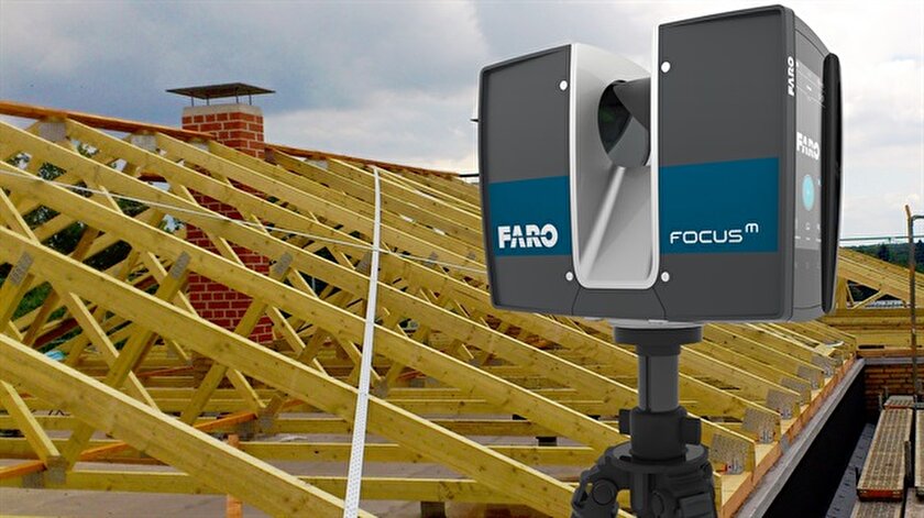
FARO Focus
Source: ifworlddesignguide. com
FARO is one of the popular manufacturers of laser scanning devices. The new Focus3D S-series instruments stand out from other scanners in lightness and compact size, as well as the ability to work in bright sunlight and keep in touch with the location using GPS.
The FOCUS 3D S 150 scanner works at a distance of up to one hundred and fifty meters, with an accuracy of up to ±2000 microns at a maximum distance. The device is used in design, architecture and construction, for digitizing equipment and other objects.
You can learn more about this model on the website.
Source: youtube.com
Focus3D S 350 scans with the same accuracy as the previous device, but the distance to the measurement object is increased to 0.35 km. The device is designed for outdoor use.
Source: kkgeosystem.blogspot.com
SHINING 3D
Source: shining3d. com
FreeScan is a line of well-known Chinese manufacturer of digital equipment SHINING 3D. These are universal laser handheld 3D scanners FreeScan X5 (X5+), FreeScan X7 (X7+) weighing up to 1 kg, with an excellent set of professional features.
Basic parameters:
Specifications
Creaform
Source: foundry-planet.com
Creaform's SCAN 3D range is characterized by high scanning quality combined with ease of use. Portable laser scanners HandySCAN 3D, MetraSCAN 3D have a clear interface, do not require special skills and complex user training.
Instrument features:
ScanTech
Handheld range
Source: cmmxyz.com
The HandHeld Prince series uses blue and red laser beams to scan large and small objects with high accuracy. Scanners can operate in bright sunlight and low light conditions. Due to its compact size, high speed and detail, the equipment is widely used in reverse engineering, quality inspection, digitization of museum, archaeological and other objects.
Key features:
Composite series
Source: twitter.com
In addition to the dual scan mode, the KSCAN20 is equipped with a photogrammetry system, thanks to which the working area of the device is 2.5 m * 3 m with an accuracy of 35 µm / m.
Blue and red lasers provide high-speed scanning of up to 650,000 measurements per second with a resolution of 0.01 mm.
Key Features:
3D Laser Scanner Applications
Reduce construction costs and time with FARO Focus
Source: autodesk.com
US construction company Gilbane invested $60,000 in a FARO Focus-S 350 laser scanner, software, and employee training. At first glance, the amount seems too large for a small-scale firm. But, after the calculations, the company's management came to the conclusion that the investment will pay off in the shortest possible time.
According to Gilbane's director of 3D design, John Tocci Jr. , after introducing the expensive new technology, the company began to use the equipment even in areas where it was not originally planned. The specialists managed to save $30,000 for one hour of Focus-S 350 and Autodesk Revit software.
Source: autodesk.com
Building a digital model of air ducts and other systems made it possible to avoid errors during the installation of physical objects, which could take several weeks. The use of FARO Focus in the assembly of plumbing, electrical and mechanical installations helped to optimize costs at all stages of work
Case “Modernization of the building of the University of Miami”
Source: elevar.com
At the time of the start of work, the architects had drawings made 85 years ago, and a little more than 4.5 thousand square meters of the old building. Using a 3D laser scanner, Gilbane digitized the training areas in one day. Modernization of load-bearing structures, as well as the main utility systems: plumbing, electrical and ventilation, was based on data obtained from scanning.
Quality Inspection with ScanTech
Source: 3d-scantech.com
The advantage of metal stamping over forging and casting is the lower weight and thickness of the resulting parts. The use of molds gives high accuracy and maximum compliance of the obtained parts with the specified characteristics, but does not completely exclude deviations and deformations. Which, in turn, can lead to difficulties in assembling finished products and reducing product quality. Therefore, constant quality inspection is a necessary part of production.
Having understood the problems of the manufacturer, ScanTech experts proposed to check the quality of stamped parts using the PRINCE laser scanner. The ability to switch blue and red laser modes allowed the device to combine the functionality of traditional portable and metrological 3D scanners. The mode of operation with an active beam of a red laser provides fast digitization of objects. In the case of increased requirements for accuracy and detail, turn on the blue laser beam mode.
The photo shows the stages of work:
1. Installing markers - takes about two minutes.
Source: 3d-scantech.com
2. Digitizing a part takes about three minutes.
Source: 3d-scantech.com
Source: 3d-scantech.com
3. Deviation detection - lasts 3 minutes.
Source: 3d-scantech.com
The digital model shows the parameters and deviations, allows you to correct errors at the design stage. The case clearly shows that the process required a minimum of time and effort.
Using FARO 3D scanners on Justin Timberlake's world tour
Source: disguise. one
Timberlake's "Man of the Woods" program features scenery brought to life on stage. First, the ScanLAB team digitized a number of corners of the forest in the US state of Oregon. Laser projectors then directed images over the auditorium and stage, painting amazing pictures of the Portland landscape on translucent canvases suspended in the air.
Source: faro.com
Two Faro Focus X 330 laser scanners, Faro Scene 6.2 software were used to prepare visual effects. In total it took 40 digital copies and 1 working day in the concert hall.
Source: www.esa.int
Considering the limited preparation time, the large surface areas for displaying the image and the corresponding need for high image resolution, it was not possible to create visual effects in a short time without using the chosen technology.
Selection guide for 3D laser scanners
In the review, we introduced you to the equipment of market leaders with an excellent reputation. All the devices described have high performance, so we recommend that you pay attention to these devices for use in various fields:
FARO Focus: Focus3D S350, Focus 3D S150.
Creaform: MetraSCAN 350 (350 Elite), MetraSCAN 750 (750 Elite), HandySCAN Black (Black Elite).
SHINING 3D: FreeScan X5 (X5+), FreeScan X7 (X7+).
ScanTech: KSCAN20, PRINCE 775, PRINCE 335.
Results
Source: 3d-scantech.com
The cases discussed clearly prove that the use of 3D laser scanning optimizes workflows in many areas. The range of tasks solved with the help of 3D laser scanners is constantly expanding.
Buy a professional 3D laser scanner in Top 3D Shop — experienced specialists will help you choose the most suitable equipment, software for your business, and offer a project to modernize production.
3D ground laser scanning
Point cloud examples
Despite the fact that the first terrestrial 3D scanners appeared in the last century, there is no reason to state that 3D laser scanning technology is widely used in geodesy. The main reasons, probably, are the still high cost of such systems and the lack of information on how to use them effectively in various applications. Nevertheless, interest in this technology and its demand in the market of geodetic equipment are growing exponentially every year.
What is a 3D laser scanner?
According to the type of information received, the device is in many ways similar to a total station. Similar to the latter, the 3D scanner uses a laser range finder to calculate the distance to an object and measure vertical and horizontal angles to obtain XYZ coordinates. The difference from a total station is that daily shooting with a ground-based 3D laser scanner is tens of millions of measurements. Obtaining a similar amount of information from a total station will take more than one hundred years ...
The initial result of the 3D laser scanner is a point cloud. In the process of shooting, three coordinates (XYZ) and a numerical indicator of the intensity of the reflected signal are recorded for each of them. It is determined by the properties of the surface on which the laser beam falls. The point cloud is colored depending on the degree of intensity and after scanning looks like a three-dimensional digital photo. Most modern models of laser scanners have a built-in video or photo camera, so that the point cloud can also be painted in real colors.
In general, the operation of the device is as follows. The laser scanner is mounted opposite the object to be filmed on a tripod. The user sets the required point cloud density (resolution) and survey area, then starts the scanning process. To obtain complete data about an object, as a rule, it is necessary to perform these operations from several stations (positions).
Then the initial data received from the scanner is processed and the measurement results are prepared in the form in which they are required by the customer. This stage is no less important than field work, and is often more time-consuming and complex. Profiles and sections, flat drawings, three-dimensional models, calculations of areas and volumes of surfaces - all this, as well as other necessary information, can be obtained as the final result of working with a scanner.
Where can laser scanning be used?
Main applications of 3D scanning:
- industrial enterprises
- building and architecture
- road shooting
- mining
- monitoring of buildings and structures
- documentation of emergencies
This list is far from complete, since every year users of laser scanners perform more and more unique projects that expand the scope of technology.
Laser Scanning from Leica Geosystems - History of Laser Scanners
The history of Leica laser scanners began in the 90s of the last century. The first model 2400, then under the Cyra brand, was released in 1998. In 2001, Cyra entered Leica Geosystems into the HDS (High-Definition Surveying) division. Now, after 14 years, Leica Geosystems introduces a line of two scanning systems on the market.
As mentioned above, 3D laser scanning is used in completely different areas, and there is no universal scanner that would effectively solve all problems.
For shooting industrial facilities where a long range is not required, but the model must be very detailed (that is, an accurate high-speed device is needed), the Leica ScanStation P30 laser scanner will be optimal: range up to 120 m, speed up to 1,000,000 points per second.
Completely different requirements are imposed on the scanner when it comes to shooting opencast mines and storages of bulk materials in order to calculate volumes. Here, centimeter accuracy of the rangefinder is enough, and the shooting range and protection from weather conditions and dust come to the fore. The ideal tool for scanning in such conditions - Leica HDS8810 with a range of up to 2,000 m and IP65 dust and water resistance. In addition, this device is the only one on the market of scanning systems that operates in the temperature range from -40 to +50 degrees. That is, the HDS8810 is a laser scanner that works in all weather conditions.
The key model of Leica Geosystems' HDS division is the Leica ScanStation P40 . The famous and most popular ScanStation line in the world, whose history began in 2006, was replenished in April 2015 with the P40 scanner. The P40 inherited the accuracy and speed from the previous model, but has become more long-range, and the data quality has become even better. In terms of the range of tasks to be solved, this device is truly a leader in its segment. It is no coincidence that despite the "youth" of this model, it has already gained wide popularity in the world.
Laser Scan Data Processing Software (Point Clouds)
It is impossible not to say a few words about the software for processing data received from the scanner. Potential customers pay undeservedly little attention to this component of the 3D laser scanning system, although data processing and obtaining the final result of the work are no less important stages of the project than field work. The range of Leica HDS software is truly the widest on the laser scanning market.
The main element of the spectrum is, of course, the Cyclone complex.