3D laser scanner surveying
3D Laser Scanning for Surveyors
3D laser scanning customer stories to inspire your business
3D laser scanning allows you to quickly capture, visualise and pre-register data in the field, which can then be processed in the office to deliver conventional 2D models and 3D digital twins, helping you to offer better and higher value services to your clients and win new business. Surveyors are measurement experts, and geared with 3D laser scanning, can document any structure or environment safer, faster and more efficiently.
Growing your business with 3D laser scanning
Nelson Boquin, founder of Nelson Surveys, based in Australia, explains how adding 3D laser scanning to its company services has resulted in more business.
Nelson Boquin, founder of Nelson Surveys, based in Australia, explains how adding 3D laser scanning to its company services has resulted in more business.
READ MORE
Five reasons to get into laser scanning and how to get started
Learn the easiest way surveyors can get started with laser scanning and hear from surveyor Don Smith the benefits of 3D laser scanning.
Learn the easiest way surveyors can get started with laser scanning and hear from surveyor Don Smith the benefits of 3D laser scanning.
READ MORE
Experience point cloud data from real projects
Explore the point cloud data in TruView from different projects and get inspired on how you can share a photorealistic digital reality environment with your clients from anywhere, anytime.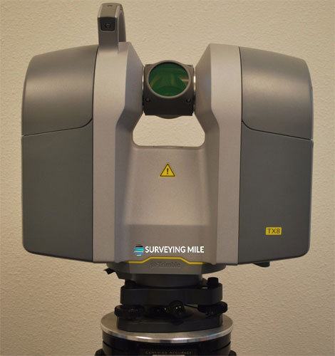
Explore the point cloud data in TruView from different projects and get inspired on how you can share a photorealistic digital reality environment with your clients from anywhere, anytime.
DISCOVER MORE
Deliver new services with 3D laser scanning
Civil infrastructure
See how surveyors can deliver the highest quality 3D data for civil infrastructure with scanning. From creating as-built representations of new civil infrastructure to measuring existing infrastructure before planning to rebuild or renovate, 3D laser scanning is the ideal reality capture technology for creating digital twins.
See how surveyors can deliver the highest quality 3D data for civil infrastructure with scanning. From creating as-built representations of new civil infrastructure to measuring existing infrastructure before planning to rebuild or renovate, 3D laser scanning is the ideal reality capture technology for creating digital twins.
READ MORE
Building construction
Discover how surveyors can play a pivotal role by using 3D laser scanning technologies to improve the plan, design, construction, management and renovation processes for buildings.
Discover how surveyors can play a pivotal role by using 3D laser scanning technologies to improve the plan, design, construction, management and renovation processes for buildings.
READ MORE
Urban planning
Explore how surveyors can provide 3D models – the base for all operations in a smart city. 3D models provide the right insights so urban planners can understand risks and make informed decisions.
Explore how surveyors can provide 3D models – the base for all operations in a smart city. 3D models provide the right insights so urban planners can understand risks and make informed decisions.
READ MORE
Power and plant
Explore how 3D models enables surveyors to capture as-built data form a safe distance and create valuable models for planning, fabrication, and clash detection for power and plant documentation.
Explore how 3D models enables surveyors to capture as-built data form a safe distance and create valuable models for planning, fabrication, and clash detection for power and plant documentation.
READ MORE
Heritage and preservation
Learn how surveyors geared with 3D laser scanning can measure with high resolution any historical monument, building or heritage site to document, study, and understand any threats.
Learn how surveyors geared with 3D laser scanning can measure with high resolution any historical monument, building or heritage site to document, study, and understand any threats.
READ MORE
Your surveying partner
Only Leica Geosystems has 200 years of experience helping surveyors. Find out how we can support you with premium quality measuring and positioning solutions and services.
Only Leica Geosystems has 200 years of experience helping surveyors. Find out how we can support you with premium quality measuring and positioning solutions and services.
Read More
Grow your business
Discover how embracing digitalisation with technologies and processes can support your business to create new opportunities, stay competitive and improve productivity.
Discover how embracing digitalisation with technologies and processes can support your business to create new opportunities, stay competitive and improve productivity.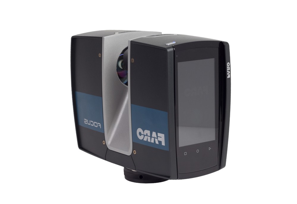
Get Inspired
Surveying solutions
Regardless of how complex your task is, a solution is available within our diverse measuring, positioning, visualising and collaborating portfolio to help you succeed and be more efficient.
Regardless of how complex your task is, a solution is available within our diverse measuring, positioning, visualising and collaborating portfolio to help you succeed and be more efficient.
DISCOVER OUR SOLUTIONS
Improve your skills
Learn the skills to be more efficient and react to business opportunities. Unlock your potential to offer better, faster and more specialised services to your clients.
Learn the skills to be more efficient and react to business opportunities. Unlock your potential to offer better, faster and more specialised services to your clients.
Start Now
A Perfect Tool for Surveyors
Print 🖨 PDF 📄 eBook 📱
Running a surveying business is highly rewarding, but it comes with multiple technology considerations. As a surveyor, you need to choose the right tools for the job, and knowing which tools are most suitable for your projects can be a big hurdle when it comes to growing your business.
In this blog, Hexagon’s Andrea Biasion explains the different benefits of the 3D laser scanners in Leica Geosystems product portfolio – which includes tools designed for simplicity, speed, accuracy, precision and effectiveness in all environmental conditions.
Firstly, what is reality capture?Reality capture is the process of digitising the physical world.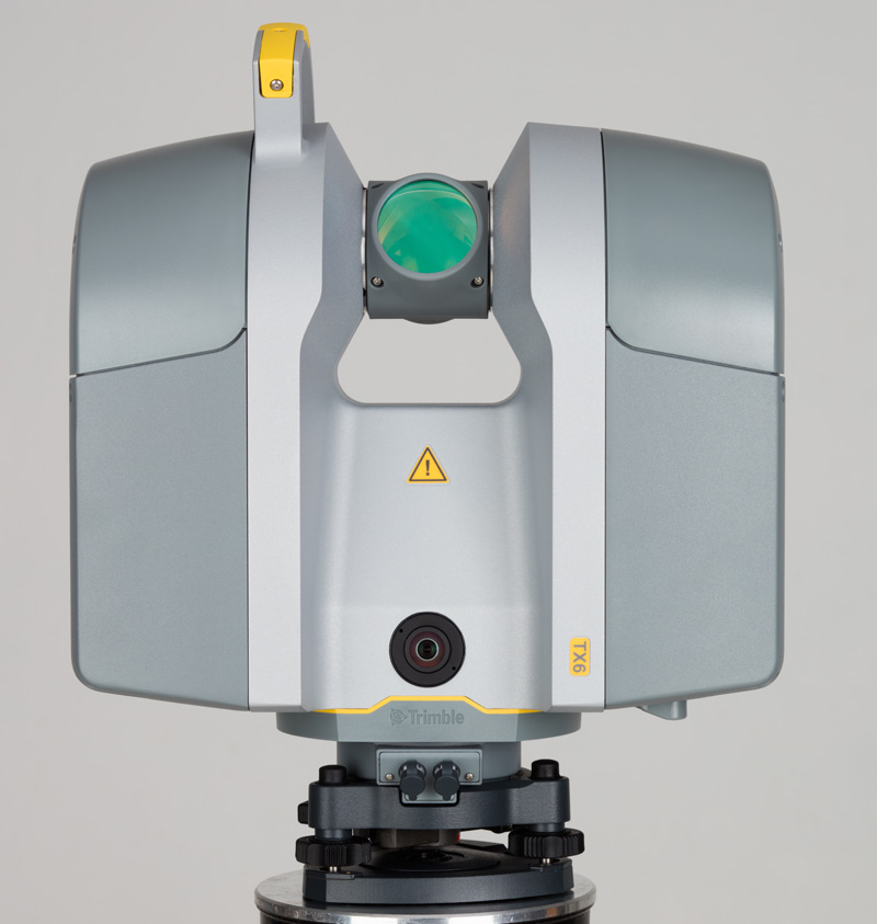 Professionals can use different measurement technologies to collect accurate 3D data for use in various software applications and workflows. The physical world can be digitised and represented in a 3D environment using 3D sensors, becoming the basis for decisions in different fields of work. Then, decisions based on the digital models can inform concrete actions in the physical world.
What are the applications of reality capture?
From traditional building construction and crime scene investigation to city mapping and volumetrics, reality capture applications are almost endless. The end-to-end workflow for reality capture is divided into four steps; capturing data, processing data, managing data and creating the end deliverables. The first – capturing data in the field – is what surveyors are most used to doing. The workflow’s other three phases are sequential and mainly performed in the office. The processing of the data is where the data is imported, registered and modelled.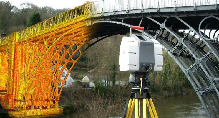 The management of the data is where the data is made available to create the final deliverables. At the end of the workflow, the data is put to work for all professionals that consume the data.
There are three flagship devices for the job; The Leica BLK360 Imaging Laser Scanner, the Leica RTC360 3D Laser Scanner and the Leica ScanStation P-Series.
To compare, the BLK360 is the smallest and lightest imaging laser scanner of its kind. It’s simple to use and captures full-colour panoramic images overlaid on a high-accuracy point cloud. The RTC360 allows users to automatically pre-register point cloud data in the field to conduct quality control checks quickly. Its streamlined process for reality capture makes it suitable for non-surveying users and allows individuals to make better-informed decisions on-site, even on complex projects. Finally, the ScanStation P-Series is a range of versatile, survey-grade 3D laser scanning solutions.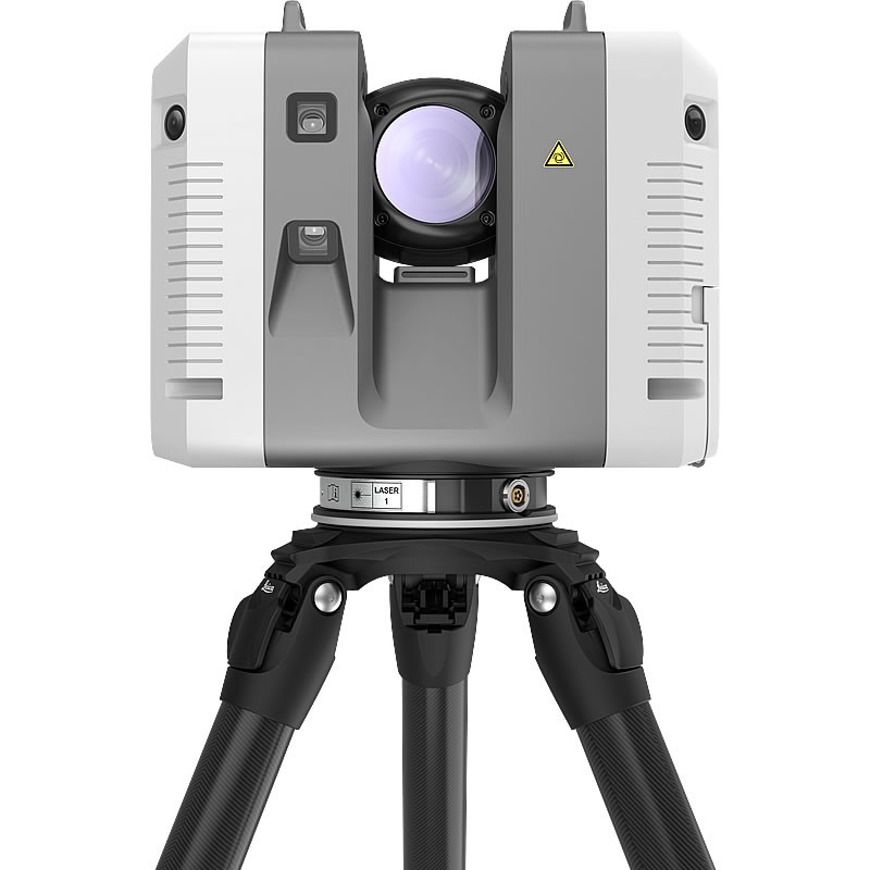 These scanners deliver speed, accuracy and range for demanding scanning projects, making them perfect for creating as-built representations and capturing the 3D geometry of civil infrastructure.
What’s the difference between these 3D laser scanners?
The environment is a significant factor in deciding which laser scanner to invest in, especially if the user will be operating under extreme temperatures. The three laser scanners have a varied temperature range – the ScanStation P-Series can operate from -20°C to +50°C, whereas the BLK360 can operate between +5°C and +40°C and the RTC360 can operate between -5°C and +40°C.
Then there are differences in speed and resolution. The RTC360 has the highest scan speed at two million points per second, followed by the ScanStation P-Series at 1 million points per second and the BLK360 at 360,000 points per second. The ScanStation P-Series offers the highest resolution. The maximum range measurable also differs between them – the BLK360 is 20-60 metres, the RTC360 is 40-130 metres, and the ScanStation P-Series is 70-1,000 metres.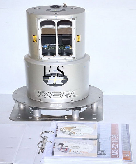
For software, all three laser scanners connect with the Leica Cyclone FIELD 360 mobile device app for data acquisition in the field. This means that each laser scanner is able to capture, register and examine scan and image data automatically. The user interface combines easy handling of complex calculations with graphical user guidance, which offers a remarkably straightforward user experience, even suitable for novice users.
How do I know which 3D laser scanner is right for my project?
Each scanner has its own unique offering, so choosing the right laser scanner comes down to the day-to-day projects your team works on. The BLK360 is perfect for relatively small-scale documentation applications where images are as important as accurate 3D data. It’s suitable for outdoor and indoor applications and works well in congested areas due to its maximum portability and simplicity. Users who have no experience using laser scanning technology can easily adopt this scanner due to its easy interface and one-button operation. What’s more, because it’s very light at only 1kg, it’s perfect for projects requiring a device that’s easy to handle.
Meanwhile, the RTC360 is a scalable solution for larger projects: think mapping something the size of an industrial plant. The laser scanner is perfect for projects where productivity and data quality are key factors, such as construction planning or public safety. It embodies a Visual Inertial System using five cameras and other sensors, allowing the scanner to track its position while moving from setup to setup. This streamlines all of the registration and processing operations, making the full end-to-end workflow faster and more optimised. Whether you operate in light or dark environments, the RTC360 can collect a full-dome HDR of pictures in less than one minute and has the highest scanning speed at up to two million points per second. It’s the perfect companion for challenging environments.
Finally, the ScanStation P-Series offers the right solution if your team requires highly reliable and accurate results to feed into a range of workflows. They are high-end laser scanners adopting surveying functionalities like target measurement, troubleshooting and inspections. These scanners are ideal if your team is operating in the harshest conditions with extreme temperature ranges; our customers use them in, for example, bridges, highways, mines, airports and dams. Due to their superior measurement range, they will be the instruments of choice when covering larger areas where data quality over a long-range is a key factor. In summary, the ScanStation P-Series are weatherproof, robust and perfect for teams that require best-in-class data quality.
To learn more, watch Andrea Biasion’s presentation from Intergeo 2021, 3D Laser Scanners: A Perfect Tool for Surveyors.
Andrea Biasion
Product Manager, Laser Scanning
Reality Capture Division
Leica RTC360 3D Laser Scanner | Leica Geosystems
- home
- Products/Solutions
- Laser scanners
- Scanners
- Leica RTC360 3D laser scanner
Use automatic on-site pre-registration of point cloud data for real-time quality control, increased productivity, and more informed decisions on the job site
Document and digitize your environment in 3D with the Leica RTC360 3D reality capture solution. Increase productivity on site and in the office with fast, accurate, portable and easy-to-use hardware and software. With the RTC360 3D Laser Scanner, a skilled technician can overcome any design challenge with accurate and reliable 3D models to unlock the full potential of any site.
- The compact, highly automated, intuitive and user-friendly RTC360 solution includes a high-performance 3D laser scanner, the Leica Cyclone FIELD 360 mobile app for edge computing, such as automatic registration of scanned data in real time, and Leica Cyclone REGISTER 360 software for office work , with which you can easily implement the resulting 3D model into your workflow.
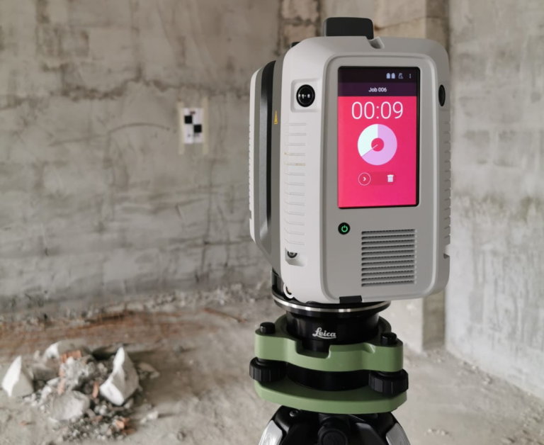
- Capture scans, including stunning HDR images, in less than two minutes.
- Automatic recording of movements between survey points to pre-register scanned data in the field without manual intervention.
- Augment the collected data with informative tags with hints for optimal planning and information about the real conditions on the site, which will help your colleagues to better understand the situation.
- Upload collected data from Cyclone FIELD 360 directly to Leica TruView Cloud to quickly share design data before import and registration.
Fast
The new Leica RTC360 laser scanner captures reality in 3D at a speed never seen before. Capturing up to 2 million points per second and using advanced HDR image capture, the scanner generates colorful 3D point clouds in less than two minutes.
 Automated, labelless data logging in the field based on VIS technology and convenient automatic data transfer from site to office further speed up field work and increase productivity.
Adaptive
Thanks to its portable design and foldable tripod, the compact and lightweight Leica RTC360 fits into a regular backpack. On the object, one click of a button is enough to scan the environment without any additional settings.
Fine
Low noise in the acquired data means better image quality – you get crisp, detailed scans that are ready for a variety of industries. Combined with the Cyclone FIELD 360 automated data logging software in the field, the Leica RTC360 delivers amazing accuracy that can be verified on site.
Pre-registration in the field
The Cyclone FIELD 360 app, part of the RTC360 solution, bridges the gap between on-site 3D data collection and on-site registration of laser scan data in the office with Cyclone REGISTER 360.
 User can automatically capture, register, and control scan and image data on site . The easy-to-learn and user-friendly graphical interface offers visual aids for complex calculations, making it easy for even beginners to master.
 Previous Next
Scanning options
The RTC360 3D Laser Scanner automatically captures movement between survey points to pre-register scanned data on the spot. Juergen Mayer spoke about the latest developments in an interview with The Reporter.
Introduction to the RTC360
The latest Leica RTC360 3D reality capture solution, unveiled at HxGN LIVE 2018, combines a high-performance laser scanner with a mobile application for capturing and pre-logging real-time scan data.
From hardware to software
Geosystems specialists optimize every link of the workflow in both software and hardware solutions to increase the efficiency and productivity of field work and data processing in the office.
Leica RTC360: 3D reality capture solution
Leica Cyclone FIELD 360 mobile-device app
Downloads
Videos
EXPERT ADVICE
Examples of using
Podcasts
Introducing the Leica RTC360 3D Laser Scanner
3D environments in a matter of minutes - an outlook on recent reality capture technology
3D reality capture - new opportunities, greater understanding
Transforming Ayacucho into a digital city
Services
myWorld Customer Portal
Active Customer Care
Customer Support Packages
Related products
Laser scanners
Leica BLK360 laser scanner
Leica ScanStation P40 / P30
Leica ScanStation P50
Software
Leica Cyclone
Leica Cyclone REGISTER
Leica Cyclone REGISTER 360
Leica CloudWorx
Leica TruView
Leica JetStream
Accessories
Accessories for 3D laser scanners 9015
contact-for-laser-scanning
As of v7.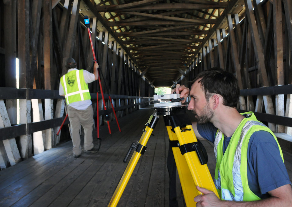 0.1, Safari exhibits a bug in which resizing your browser horizontally causes rendering errors in the justified nav that are cleared upon refreshing.
As of v7.0.1, Safari exhibits a bug in which resizing your browser horizontally causes rendering errors in the justified nav that are cleared upon refreshing.
CONTACT US
The High-Definition Surveyor - Blog
Learn how Leica Geosystems laser scanning solutions are helping professional to shape the future of our world.
Learn how Leica Geosystems laser scanning solutions are helping professional to shape the future of our world.
Read More
Scanning power
Quality is a tradition, built deep within our DNA. We have a commitment to excellence and exceptional attention to detail.
Scanning power
Quality is a tradition, built deep within our DNA. We have a commitment to excellence and exceptional attention to detail.
WATCH NOW
Educational articles and analytics
What is 3D Reality Capture and how is it applied in your industry?
What is 3D Reality Capture and how is it applied in your industry?
learn more
Comparison table of laser scanners
Which laser scanner is right for you?
Which laser scanner is right for you?
download now
Reality Capture Newsletter
Click here to subscribe to our regular newsletter and stay up-to-date on all the latest reality capture news.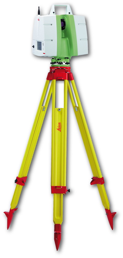
Click here to subscribe to our regular newsletter and stay up-to-date on all the latest reality capture news.
Subscribe
Online learning
Leica Geosystems has developed an online learning platform to further educate customers on how to maximize the functionality of their instruments.
Leica Geosystems has developed an online learning platform to further educate customers on how to maximize the functionality of their instruments.
3D Ground Laser Scan
Point cloud examples
Despite the fact that the first terrestrial 3D scanners appeared in the last century, there is no reason to state that 3D laser scanning technology is widely used in geodesy.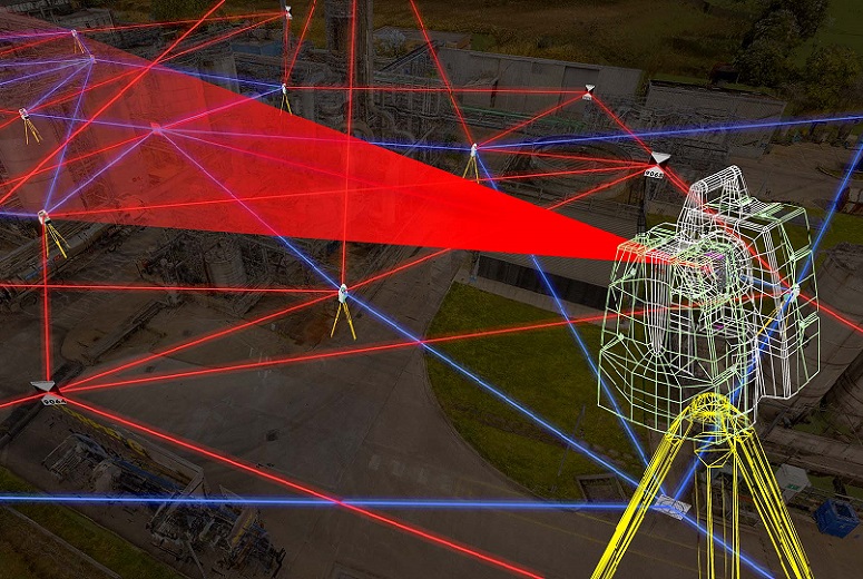 The main reasons, probably, are the still high cost of such systems and the lack of information on how to use them effectively in various applications. Nevertheless, interest in this technology and its demand in the market of geodetic equipment are growing exponentially every year.
What is a 3D laser scanner?
According to the type of information received, the device is in many ways similar to a total station. Similar to the latter, the 3D scanner uses a laser range finder to calculate the distance to an object and measure vertical and horizontal angles to obtain XYZ coordinates. The difference from a total station is that daily shooting with a ground-based 3D laser scanner is tens of millions of measurements. Obtaining a similar amount of information from a total station will take more than one hundred years ...
The initial result of the 3D laser scanner is a point cloud. In the process of shooting, three coordinates (XYZ) and a numerical indicator of the intensity of the reflected signal are recorded for each of them.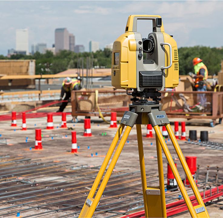 It is determined by the properties of the surface on which the laser beam falls. The point cloud is colored depending on the degree of intensity and after scanning looks like a three-dimensional digital photo. Most modern models of laser scanners have a built-in video or photo camera, so that the point cloud can also be painted in real colors.
In general, the operation of the device is as follows. The laser scanner is mounted opposite the object to be filmed on a tripod. The user sets the required point cloud density (resolution) and survey area, then starts the scanning process. To obtain complete data about an object, as a rule, it is necessary to perform these operations from several stations (positions).
Then the initial data received from the scanner is processed and the measurement results are prepared in the form in which they are required by the customer. This stage is no less important than field work, and is often more time-consuming and complex. Profiles and sections, flat drawings, three-dimensional models, calculations of areas and volumes of surfaces - all this, as well as other necessary information, can be obtained as the final result of working with a scanner.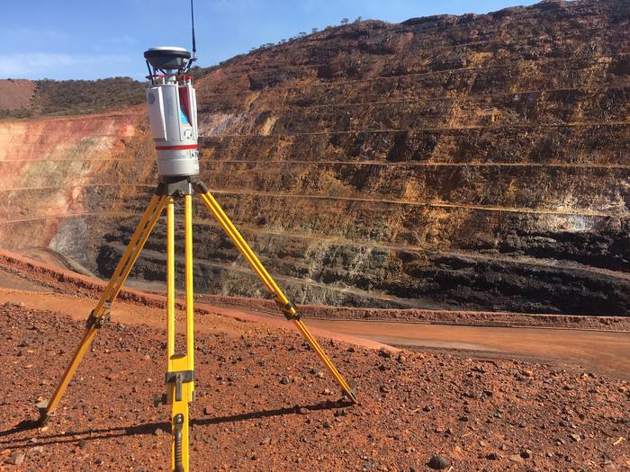
Where can laser scanning be used?
Main applications of 3D scanning:
- industrial enterprises
- building and architecture
- road shooting
- mining
- monitoring of buildings and structures
- documentation of emergencies
This list is far from complete, since every year users of laser scanners perform more and more unique projects that expand the scope of technology.
Laser Scanning from Leica Geosystems - History of Laser Scanners
The history of Leica laser scanners began in the 90s of the last century. The first model 2400, then under the Cyra brand, was released in 1998. In 2001, Cyra entered Leica Geosystems into the HDS (High-Definition Surveying) division. Now, after 14 years, Leica Geosystems introduces a line of two scanning systems on the market.
As mentioned above, 3D laser scanning is used in completely different areas, and there is no universal scanner that would effectively solve all problems.
For shooting industrial facilities where a long range is not required, but the model must be very detailed (that is, an accurate high-speed device is needed), the Leica ScanStation P30 laser scanner will be optimal: range up to 120 m, speed up to 1,000,000 points per second.
Completely different requirements are imposed on the scanner when it comes to shooting opencast mines and storages of bulk materials in order to calculate volumes. Here, centimeter accuracy of the rangefinder is enough, and the shooting range and protection from weather conditions and dust come to the fore. The ideal tool for scanning in such conditions - Leica HDS8810 with a range of up to 2,000 m and IP65 dust and water resistance. In addition, this device is the only one on the market of scanning systems that operates in the temperature range from -40 to +50 degrees. That is, the HDS8810 is a laser scanner that works in all weather conditions.
The key model of Leica Geosystems' HDS division is the Leica ScanStation P40 . The famous and most popular ScanStation line in the world, whose history began in 2006, was replenished in April 2015 with the P40 scanner. The P40 inherited the accuracy and speed from the previous model, but has become more long-range, and the data quality has become even better. In terms of the range of tasks to be solved, this device is truly a leader in its segment. It is no coincidence that despite the "youth" of this model, it has already gained wide popularity in the world.
Laser Scan Data Processing Software (Point Clouds)
It is impossible not to say a few words about the software for processing data received from the scanner. Potential customers pay undeservedly little attention to this component of the 3D laser scanning system, although data processing and obtaining the final result of the work are no less important stages of the project than field work. The range of Leica HDS software is truly the widest on the laser scanning market.
The main element of the spectrum is, of course, the Cyclone complex.