3D building scanners
Building Construction 3D Laser Scanning
- Home
- Industries
- Pure Surveying
- Grow your business
- 3D laser scanning
- Building construction
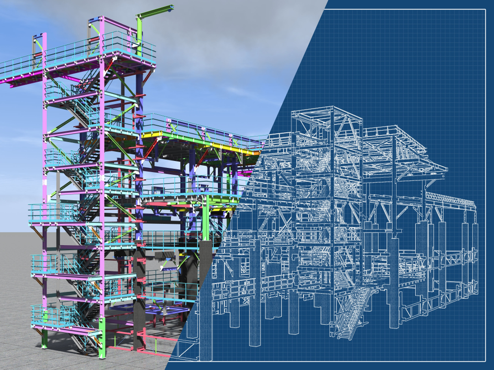
Leverage BIM to improve the planning, construction and renovation of buildings
Using intelligent 3D models that are accurate and accessible, BIM has improved the way professionals in the architecture, engineering and construction (AEC) industries collaborate, reducing re-work and helping to eliminate wasteful processes.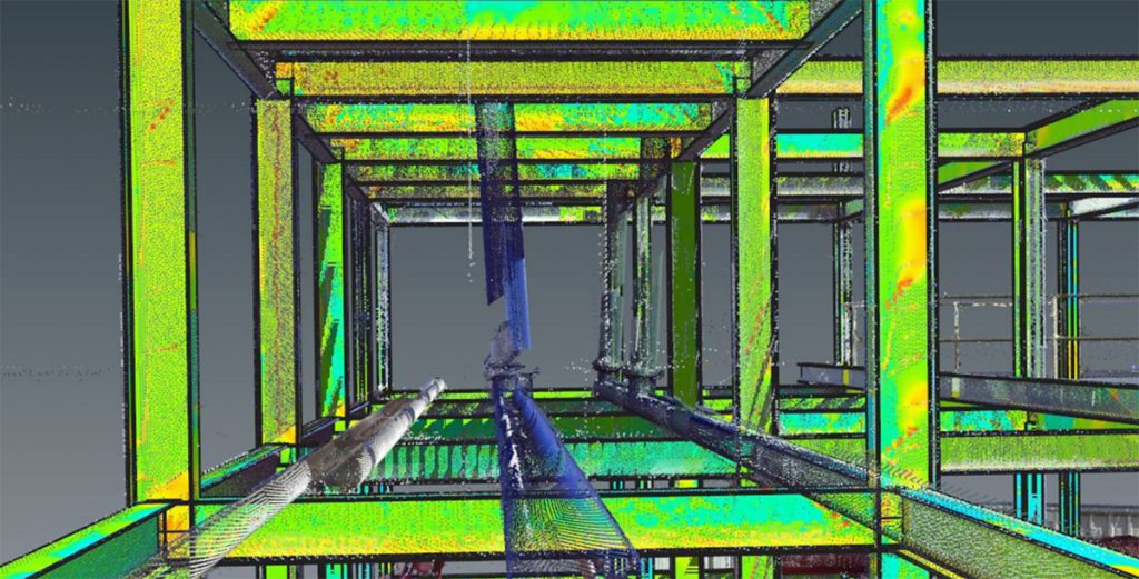
3D laser scanning solutions allows surveyors to provide as-built surveys, which prevent expensive rework by identifying any mistakes early in the design to construction phase. In addition, surveyors can play a pivotal role by using scanning technologies to improve the plan, design, construction, management and renovation processes for buildings.
Best 3D laser scanning solutions for building construction
Reality Capture software
A complete workflow
Leica Geosystems provides surveyors with the tools they need to capture, process, manage, collaborate, consume and deliver point cloud data.
Process your captured 3D scan data in the industry-leading 3D point cloud processing software Leica Cyclone.
Easily integrate point cloud data into the CAD platform of your choice with Leica CloudWorx to get the most out of BIM.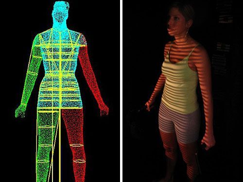
Collaborate and share easy access to point cloud data for anyone in your project ecosystem with Leica TruView.
Explore a building construction point cloud in TruView.
LEARN MORE
ScanStation P40
Get the highest accuracy
From creating as-built representations of buildings to measure, maintain or renovate, deliver highest quality 3D data for building construction and creating digital twins.
Supporting surveying workflows like traversing and resection with the ability to apply scale-factors, the P40 supports surveyors to get the highest accuracy.
Key specifications:
- 3D accuracy: 3.2mm at 50m and 5.9mm at 100m
- Scan speed: 1 mio pts/sec
- Temp range: -20°C to +50°C
- Range: Long (70-270m)
- Field registration: Surveying procedures
LEARN MORE
RTC360
Fast and agile
Move quickly in and around buildings to document prior to renovation or to record an as-built digital twin.
Supported by a Visual Inertial System (VIS) the RTC360 scanner tracks its movement without the need to use targets to stitch adjacent scans together.
Key specifications:
- 3D accuracy: 6.4mm at 50m and 12.5mm at 100m
- Scan speed: 2 mio pts/sec
- Temp range: -5°C to +40°C
- Range: Medium (40-130m)
- Field registration: VIS based
LEARN MORE
BLK360
Pure simplicity
Ideal for small areas, with the simple push of a button, a room is captured in 3D in seconds.
With Cyclone FIELD 360 app, BLK360 scans are easily aligned and checked for completeness before being transferred to the office for further processing.
Key specifications:
- 3D accuracy: 6mm at 10m and 8mm at 20m
- Scan speed: 360’000 pts/sec
- Temp range: +5°C to +40°C
- Range: Short (20-60m)
- Field registration: SW based
LEARN MORE
How Hollis captures, processes, manages and delivers reality capture data
Read how Tim Beach has incorporated laser scanning into existing survey workflows at Hollis. Using a complete 3D laser scanning workflow, Hollis produces deliverables of floor plans, sections, and elevations.
Read how Tim Beach has incorporated laser scanning into existing survey workflows at Hollis. Using a complete 3D laser scanning workflow, Hollis produces deliverables of floor plans, sections, and elevations.
READ MORE
Speeding up BIM-reconstruction of historical building with laser scanning
Read how Trimetari Consulting obtained as-built documentation with point cloud data, creating 3D models that allowed the reconstruction of a historical building with laser scanning and BIM modelling in Russia.
Read how Trimetari Consulting obtained as-built documentation with point cloud data, creating 3D models that allowed the reconstruction of a historical building with laser scanning and BIM modelling in Russia.
READ MORE
Using laser scanning technology for retail redevelopment
Equipped with the RTC360 and P40, RM Surveys was contacted by an architect firm about creating a survey-grade architectural and structural Revit BIM model for the redevelopment a shopping centre in Perth, Australia.
Equipped with the RTC360 and P40, RM Surveys was contacted by an architect firm about creating a survey-grade architectural and structural Revit BIM model for the redevelopment a shopping centre in Perth, Australia.
READ MORE
Rent a laser scanner from Leica Geosystems and see for yourself why laser scanning is the right fit for your business.
CONTACT US
Your surveying partner
Only Leica Geosystems has 200 years of experience helping surveyors.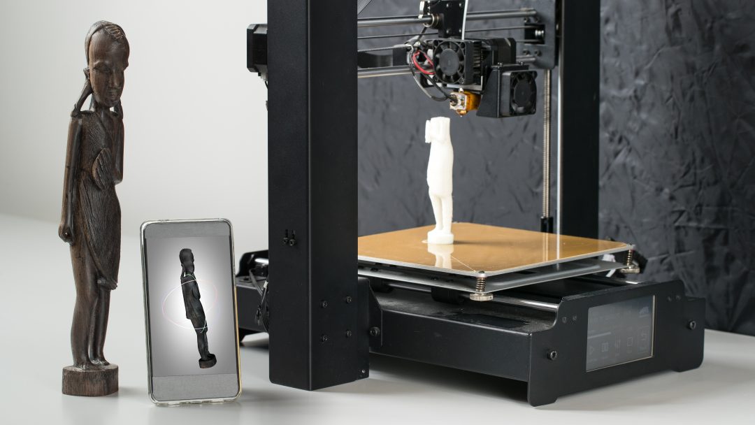 Find out how we can support you with premium quality measuring and positioning solutions and services.
Only Leica Geosystems has 200 years of experience helping surveyors. Find out how we can support you with premium quality measuring and positioning solutions and services.
Read More
Grow your business
Discover how embracing digitalisation with technologies and processes can support your business to create new opportunities, stay competitive and improve productivity.
Discover how embracing digitalisation with technologies and processes can support your business to create new opportunities, stay competitive and improve productivity.
Get Inspired
Surveying solutions
Regardless of how complex your task is, a solution is available within our diverse measuring, positioning, visualising and collaborating portfolio to help you succeed and be more efficient.
Regardless of how complex your task is, a solution is available within our diverse measuring, positioning, visualising and collaborating portfolio to help you succeed and be more efficient.
DISCOVER OUR SOLUTIONS
Improve your skills
Learn the skills to be more efficient and react to business opportunities. Unlock your potential to offer better, faster and more specialised services to your clients.
Learn the skills to be more efficient and react to business opportunities. Unlock your potential to offer better, faster and more specialised services to your clients.
Start Now
3D Scanning for Architecture, Engineering & Construction
Sie können Ihre Dokumentation und 3D-Scans vom Bestand optimieren, sowie eine einfache Zusammenarbeit genießen und das egal, ob Sie im Bereich Architektur, Ingenieurwesen oder Bauwesen tätig sind. Außerdem können Sie mithilfe von Matterport Kosten reduzieren und das wohl wertvollste Gut sparen - Ihre Zeit. Mehr zu den Lösungen für Architektur, Ingenieur- und Bauwesen finden Sie hier.
89%
bestätigen, dass Realitätserfasssung die Zukunft für Architektur, Ingenieur- und Bauwesen ist
82%
bestätigen, dass das Vorhandensein eines Rundgangs in 3D besser als andere Alternativen für die Kommunikation des Status des Standortes sind
Matterport kostenlos testen Buchen Sie eine Capture-Techniker
Matterport BIM-Datei
Erstellen Sie BIM-Dateien von Ihrem Bereich – schneller, einfacher und kostengünstiger denn je.
Mehr erfahren
Nutzen auch Sie den Matterport-Vorteil
Unsere umfassende 3D-Datenplattform ist die leistungsfähigste, genaueste und schnellste Lösung für die Dokumentation eines Gebäudes oder einer Immobilie. Sie können alles - von kleinen bis großen Räumlichkeiten, sowohl innen als auch außen - mit der größtmöglichen Detailtreue mit einer kompatiblen Kamera erfassen.
3D-Scannen, dass sich in Ihre Arbeitsabläufe integriert
Unsere Plattform fügt alle Ihre Daten automatisch zusammen und ermöglicht Ihnen den einfachen Export dieser in andere Plattformen, wodurch erhebliche Mengen an manueller Arbeit sowie Zeit eingespart werden.
Erstellen Sie 3D-Rundgänge und führen Sie Besucher sofort virtuell durch die Baustelle.
- Kommunizieren Sie wichtige Meilensteine schnell und effektiv, indem Sie Reisezeiten beseitigen, sowie durch das Teilen des Modells und Anmerkungen in diesem, um Zustimmungen zu erhalten.
- Führen Sie ortsunabhängig Inspektionen durch, vermessen Sie in Abwesenheit und reduzieren Sie Vor-Ort-Besichtigungen durch die Vorab-Erfassung aller Daten.
Erfahren Sie, wie Swinerton mit Matterport die Reisezeit der Kunden um 100 Prozent reduziert und potenzielle Projektverzögerungen von vier Wochen vermieden hat.
Wie 3D-Scan zu BIM Kosten für Design und Bau reduzieren kann
Die Implementierung Matterports in Ihren Prozess für die Erstellung von Bestandsmodellen (BIM) kann bei der Reduzierung von Kosten für virtuelles Design und Bau helfen und sie unterstützen, um mehr Aufträge zu gewinnen.
- Exportieren Sie Ihre Punktwolke, und teilen sowie rendern Sie diese einfach in Revit® und anderen BIM-Tools.
- Generieren Sie OBJ-Dateien und Punktwolken für Bestands- und Baudokumentation.
- Scannen Sie enge Bereiche 10 bis 15 Mal schneller als mit einem typischen LIDAR-Scanner.
- Überlagern Sie Ihre Punktwolke mit Ihrem BIM-Modell, um ein Evaluierungsverfahren durchzuführen.

- Vermessen Sie schwer zugänglichen Stellen wie Rohre, Traversen und Deckenbalken.
Finden Sie heraus, wie wir Perkins&Will geholfen haben, effizient und remote zu arbeiten.
Erhalten Sie die von Ihnen benötigte Genauigkeit aus einer einzigen Quelle
Matterport liefert unglaubliche Genauigkeit und bietet einfache Vermessungsmöglichkeiten in der Plattform.
- Mit einer Pro2-Kamera von Matterport steht Ihnen eine Genauigkeitsabweichung von nur 1% bei der Erfassung von Scans zur Verfügung, während diese bei der Leica BLK360 G1 nur 0,1% beträgt.
- Ersetzen Sie Tausende von Fotos, indem Sie alle Bilder und Daten gleichzeitig erfassen. Sparen Sie darüber hinaus Zeit, indem Sie den Bedarf an Dokumentation, Sortierung und Beschriftung von Fotos abschaffen.
- Erhalten Sie Deckenspiegel und schematische Grundrisse.

- Beseitigen Sie Passermarken oder manuelle Ausrichtung.
Erfahren Sie, wie die University of Wolverhampton Online-Campustouren für Studieninteressierte erstellt und den Wiederaufbau von Gebäuden verbessert hat.
Gebäudedatenmodellierung (Building Information Modeling, BIM)
Matterport BIM-Dateien ermöglichen schnelle, einfache und präzise 3D-Baupläne für jeden beliebigen Bereich. Architekten, Designer und Bauingenieure können jetzt den aktuellen Zustand jedes Gebäudes und dessen Inhalt in CAD- und Planungssoftware schneller, einfacher und kostengünstiger als je zuvor erfassen.
- Starten Sie Ihre Arbeitsabläufe, indem Sie den Ist-Zustand mit Matterport erfassen und das BIM-Datei-Add-on bestellen.
- BIM-Datei enthält eine .RVT- und zwei .DWG-CAD-Dateien
- Keine manuelle Erfassung des Ist-Zustandes mehr mit Matterport + BIM
- Optional enthält die BIM-Ausgabe umfassende Architektur-, Möbel- und MEP-Elemente
- Das Autodesk-Revit-Plugin ist für den schnellen Import des digitalen MP-Zwillings und der zugehörigen Datendateien verfügbar
- Die Dateien enthalten quantifizierbare Abmessungen und Mengen
Mehr erfahren
Erhalten Sie zusätzliche Details mit E57-Dateien
Schöpfen Sie das volle Potential Ihrer Leica BLK360 G1 oder Pro-Serie Kamera mit E57-Punktwolken aus.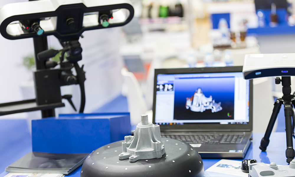 E57-Dateien liefern mehr als das Zehnfache der Details des traditionellen MatterPak XYZ-Formats. Sie sind herstellerunabhängig und werden von den meisten 3D-Konstruktionsprogrammen weitgehend übernommen. Sie ermöglichen die Integration von Punktwolken mit höherer Dichte in Ihre Dokumentations- und Modellierungs-Workflows.
- Automatisierte Punktwolkenregistrierung in der Cloud ohne die Notwendigkeit von Umfragetools für nur 89 USD (75€)
- Fügen Sie mit Leica BLK aufgenommene Outdoor-Aufnahmen zu Ihrem Matterport 3D-Workflow hinzu
- Koordinieren Sie Projekte von überall aus und laden Sie E57-Dateien in Ihre bestehenden cloudbasierten Anwendungen hoch
Mehr erfahren
Gestalten Sie die Art und Weise neu, wie Sie Ihre Immobilien vermarkten und verwalten, mit der digitalen Zwillingsplattform von Matterport.
Verbessern Sie die Interaktionen der Betrachter, indem Sie eine Geschichte rund um Ihren Raum kreieren.
Puppenhausan-
sichten
Google Street
View
Geführte
Geführte
Tags
Arbeiten Sie mit Ihrem Team, Ihren Anbietern oder Kunden zusammen, planen und teilen Sie Ihre Inhalte noch einfacher.
Messmodus
Ansichten
Notizen
Wählen Sie Add-ons aus, die für Branchenexperten entwickelt wurden.
Schematische
Grundrisse
BIM
E57
Greifen Sie auf unternehmensgerechte Sicherheit und erweiterte Verwaltungsfunktionen für Teams jeder Größe zu.
Sicherheit für
Unternehmen
Verwaltung und
Berechtigungen
Einbettung privater
Modelle
Alle Funktionen anzeigen
Sehen Sie sich an, wie die 3D-Technologie von Matterport Architektur, Ingenieur- und Bauwesen ändert
Matterport kostenlos testen
Erfahren Sie mehr darüber, wie Sie mit dem 3D-Scannen loslegen können
Der Einstieg mit Matterport ist einfach und schnell.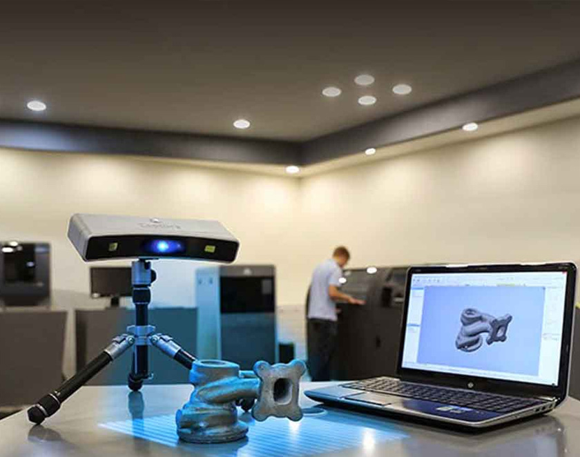 Wenn Sie eine 360°-Kamera haben, können Sie kostenlos einsteigen. Registrieren Sie sich unten für ein kostenloses Konto und beginnen Sie jetzt mit dem Scannen!
Sie wünschen sich genauere Scanergebnisse in 3D? Die Pro2-Kamera von Matterport erfasst große Objekte genau und leicht.
Erfahren Sie mehr über kompatible Kameras
MATTERPORT KOSTENLOS TESTEN
Wir übernehmen die Erfassung für Sie.
Capture Services ist bereit, Ihre Immobilie in einen detaillierten digitalen Zwilling zu verwandeln, sodass Sie jederzeit und von überall auf Ihren Raum zugreifen, ihn verwalten und bewerben können.
- 24-48 Stunden Bearbeitungszeit
- Perfekt für kleine und große Räume
- Erschwingliche Preise in über 700 Städten auf der ganzen Welt
Weitere Informationen
Sie werden in guter Gesellschaft sein
-
Monica Sosa
Projektmanager, Senior Associate CorganBei Corgan haben wir die Matterport Pro2-Kamera während eines Projekts in LAX verwendet.
 Die Technologie ermöglichte es uns, vorhandene Bedingungen effizient zu scannen, wichtige Meilensteine zu erfassen, virtuelle Schlaglisten zu erstellen, den Fortschritt zu dokumentieren und 3D-Modelle mit Eigentümern und Facility Managern zu teilen.
 -
Melissa Parry
BIM-Spezialist HH AngusDie ersten 30,5 Stunden, die wir in das Scannen der MEP-Einrichtungen des Toronto Western Hospital investiert haben, waren für einen effizienten Modellierungsworkflow von entscheidender Bedeutung.
 Durch die Erfassung guter, zuverlässiger Scandaten wurde sichergestellt, dass die verbleibenden 300 Stunden der Modellierung von MEP-Systemen in Autodesk Revit nahtlos verliefen.
 -
David Kuoppamaki
Inhaber KUOP DesignsIch werde kein mehrstöckiges Gebäude ohne eine Matterport-Kamera bauen.
-
Farbod Mehr
Technologieberater Arup"Wir haben begonnen, Matterport zu nutzen, um unseren Ingenieuren und Designern eine effektivere Möglichkeit zu bieten, mit Kunden, Auftragnehmern und anderen in Kontakt zu treten", sagte Mehr.
 "Nach dem Scannen des Bereichs kommentieren und teilen wir Punch-Listen aus der Matterport Cloud, sodass 10 bis 15 Personen nicht mehr an Standortumfragen teilnehmen müssen."
Der Matterport-Unterschied für Architektur, Ingenieur- und Bauwesen
Burns & McDonnell hilft dem Kunden, jahrelange Verzögerungen bei der Energieverteilung zu vermeiden
HH Angus spart Zeit und Geld mit Matterport BIM-Dateien
Corgan realisiert Bau-ROI mit Matterport 3D Digital Twin von LAX
3D construction scanners
You are here
Home
Have you ever wondered how massive landmarks or buildings are made to scale? Learn more about 3D construction scanners in this detailed guide.
Why would you do this?
Although the lasers used for 3D scanning are not very dangerous, safety goggles are recommended. (Source: ukconstructionmedia.co.uk)
Models of large structures such as buildings are sometimes required for various reasons such as restoration, documentation or archaeological research. There are two ways to get a building model: measure every dimension you need, or simply 3D scan the entire object.
In most cases, it is easier to scan a building than it is to measure every window, doorway, and facade. So, in this guide, we're going to break down the process of 3D scanning a building.
Scan types
The drone can perform both LIDAR scanning and photogrammetry. (Source: Darko Izgarevich / All3DP)
The two most common types of 3D scanning methods are LIDAR and photogrammetry:
- LIDAR : Commonly used in architecture and construction, the LIDAR scanner consists of a powerful laser moving horizontally and a mirror rotating around a vertical axis.
 Thus, the laser covers a huge area, scanning thousands of points every second. Laser scanning also requires a high-end computer that can store and process large amounts of data.
 - Photogrammetry: a technique that produces 3D models from multiple images of an object of interest. The software we will be using later, 3D Zephyr, is an example of photogrammetry software.
Is it possible to any building?
Even bridges can be scanned in 3D. (Source: bimplus.co.uk)
With correct transmission, there are no restrictions for these building scan methods. Some lasers are capable of scanning an area up to 350 m (about 1150 feet) in a single pass. These laser systems can even be mounted on a drone to scan high rooftops or towers.
On the other hand, photogrammetry depends mainly on the number of shots taken and the quality of the photos. However, it is best to avoid sunny days when using photogrammetry as the presence of shadows can easily confuse the software. Drones can help in this case by taking photos of hard-to-reach places.
Applications
3D scanning of buildings can be extremely useful for construction projects. (Source: navvis.com)
As mentioned earlier, 3D scanning is widely used in architecture and construction. This can help restoration projects by collecting a lot of data about an existing building, and designers can better visualize their projects using real building data as a basis.
Another interesting use of 3D scanning is in archaeology. Scanning archaeological sites can be useful for planning excavations or studying a structure that is too fragile or dangerous for personal study.
Step 1: Capture and import
Model of a building generated in 3D Zephyr. (Source: treddi.com)
Photogrammetry is more suitable for hobbyists than LIDAR because it does not require technical training to use.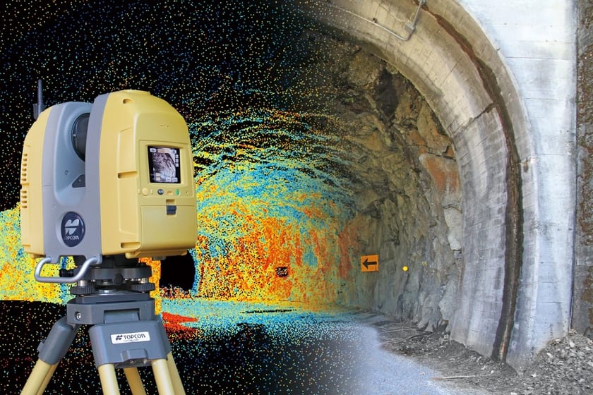 Hence, we will use it for our detailed example.
In this walkthrough, we will be using 3D Zephyr, a photogrammetry tool that allows you to create 3D models from 2D photographs. The free version allows you to import up to 50 images, which is more than enough for some projects.
Wait for the right weather - a cloudy day is best to avoid shadows. However, if you plan to scan only one side of the building, you may not encounter this problem.
- Take a photo of the building. Try to make sure that the entire building is in every frame, and that they all overlap in features that capture.
- You will probably need a drone to photograph the high parts of the building. 3D Zephyr has a great feature that allows you to extract key photos from a single video.
- Once you have all the photos and videos, you can finally open the photogrammetry software. First click "Workflow" in the top left corner and then "New Project".
- If you want to spend some time modeling, you can check the Image Masking box.
 Otherwise, you can skip this step.
 - Next, we need to import the footage. If your video is long, it may generate too many images, so try changing the Similarity Auto Reset Threshold setting. Note that a higher value will result in fewer images from a single video.
Step 2: Data Management
3D Zephyr allows you to capture multiple key images from a single video. (Source: Darko Izgarevich / All3DP)
- After importing the images into 3D Zephyr, the next step is to adjust the settings for generating the 3D model. In the Category section, select Urban (assuming you are scanning a building or urban structure) and leave the presets as default. If Zephyr rejects some photos, use the "Deep" preset.
- Click "Run" and wait. Keep in mind that this process may take some time.
- From the workflow menu, select Dense Point Cloud Generation. Leave the default options as they are and click Run.

- Repeat the creation of a dense point cloud until you are satisfied with the result.
- Next, from the Workflow menu, select Mesh Extraction. If there are two or more different point clouds, choose the one you like.
- Before finally extracting the model, you can experiment with the tools to clean up the model, such as scaling, rotating, and moving. To learn more about the tools available in 3D Zephyr, check out some of the basic software tutorials.
- When our textured mesh is ready to be exported, simply select Export Textured Mesh from the Export menu. Choose the correct format for your needs and destination folder, then export your final model.
This approach to 3D building scanning may not be the most practical, efficient or professional, but it will give you a taste of the real project!
Source
Tags:
3D building scanners, 3D scanning lasers, building 3D scanning process, LIDAR scanning, Photogrammetry, 3D Zephyr, 3D scanning in archeology, 3D models
Other materials:
- 3D printing of copper products
- The place where BMW prototypes are born
- How 3D bioprinting works in space and why
- PD-14 engine.
 Technology of direct laser growth of large-sized aircraft products
 - Engineers tested the design of the Leonardo da Vinci bridge using 3D printing.
Attention!
We accept news, articles or press releases
with links and images. [email protected]
scopes and overview of models / Sudo Null IT News
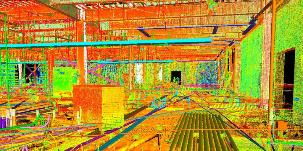
3D laser scanning - creating a digital model of a physical body using a laser beam. The technology is non-contact, works at close and long distances, eliminates damage to objects during scanning. The principle of operation of 3D laser scanners: a directed laser beam is reflected from the surface of an object, forming a cloud of points. Each point has its own coordinates in space. The software identifies them and creates a finished 3D digital model based on this data.
From the overview you will find out where laser scanning is used and what equipment is used to solve related problems.
Purpose of laser scanners
Source: newequipment.com
In comparison with traditional methods of measurement, laser scanners have an important advantage - they can digitize objects with complex surfaces and work in hard-to-reach places for humans. The main areas of application of devices are input and output quality control in production, inspection of working devices in order to prevent and eliminate defects, reverse engineering and other areas.
Construction, renovation and renovation of objects
Source: ellisdon.com
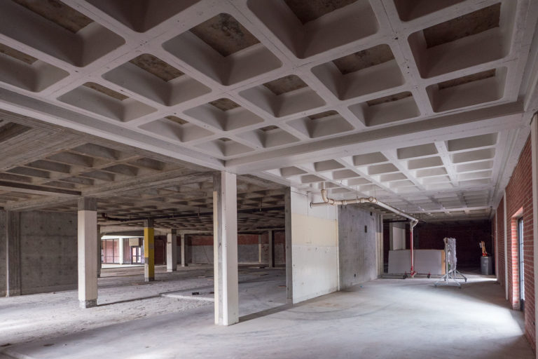
During the preparation of the building project, it is necessary to assess the features of the site and the cost of the forthcoming works. With the help of 3D laser scanners, a landscape model is created, on the basis of which further work is carried out. During the construction process, intermediate control of the geometry of future buildings is required: walls, corners, openings, etc.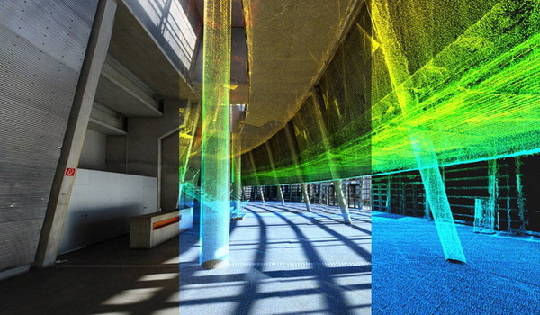 Laser scanning copes with this task more accurately and faster than conventional measuring technologies.
The basis for an exterior or interior renovation is often an accurate digital model, on the basis of which changes and additions to the current interior or exterior are planned. Laser scanners are also indispensable in this area.
Road networks and transport
Source: autodesk.com
Laser scanning is becoming an integral part of the planning and creation of urban and suburban road networks, tunnels, pedestrian sections, railways, ports. The technology is used to assess the current state of pavements, plan and estimate the cost of repairs, to obtain models of perennial structures, such as bridges. The equipment is involved in the design, manufacture, repair and tuning of cars, air transport and ships.
Public utilities
Source: 3dscanner.es
With the help of 3D laser scanners, it became possible to quickly digitize and document engineering communications.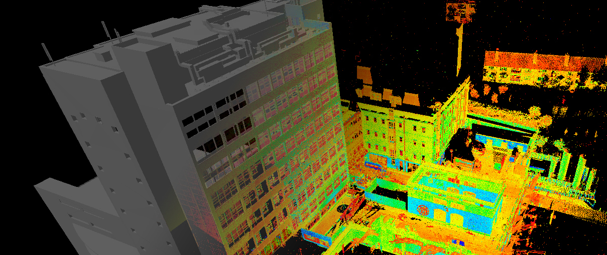 Scanning significantly saves time during maintenance and reconstruction. The devices work remotely, minimizing the risks of people when working in adverse conditions and in hard-to-reach areas.
Oilfield installations
Source: ramboll.com
Oil production complexes located in the water require constant monitoring of work processes. Objects are regularly exposed to adverse and changeable environmental influences: winds of different strengths and directions, currents, temperature changes, etc. 3D laser scanning is becoming an integral part of the inspection of oil production installations. The equipment allows you to quickly identify and fix deformations and other damage, control wear, calculate the timing of scheduled maintenance, and prevent accidents.
Forensic
Source: faro.com
Photographs and manual measurements in investigative processes and forensic examinations are being replaced by 3D laser scanning.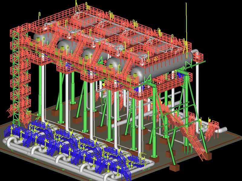 The devices create three-dimensional models of scenes of incidents with accurate fixation of the location of objects and the distances between them. The data is used in the process of pre-trial and litigation.
Other applications
Source: news.microsoft.com
3D laser scanners facilitate and streamline workflows in the following areas:
- In cartography and geodesy - when creating terrain plans, maps, geographic information systems (GIS).
- In archeology, when restoring and preserving ancient artifacts.
- In paleontology, to create missing parts of excavated skeletons.
- In medicine, including plastic surgery and dentistry.
Overview of models and manufacturers
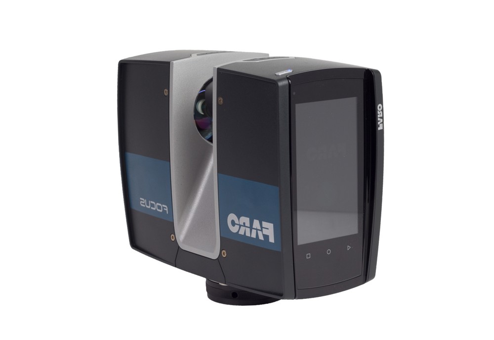
FARO Focus
Source: ifworlddesignguide.com
FARO is one of the popular manufacturers of laser scanning devices. The new Focus3D S-series instruments stand out from other scanners in lightness and compact size, as well as the ability to work in bright sunlight and keep in touch with the location using GPS.
The FOCUS 3D S 150 scanner works at a distance of up to one hundred and fifty meters, with an accuracy of up to ±2000 microns at a maximum distance. The device is used in design, architecture and construction, for digitizing equipment and other objects.
You can learn more about this model on the website.
Source: youtube.com
Focus3D S 350 scans with the same accuracy as the previous device, but the distance to the measurement object is increased to 0.35 km. The device is designed for outdoor use.
Source: kkgeosystem.blogspot.com
SHINING 3D
Source: shining3d.com
FreeScan is a line of well-known Chinese manufacturer of digital equipment SHINING 3D. These are universal laser handheld 3D scanners FreeScan X5 (X5+), FreeScan X7 (X7+) weighing up to 1 kg, with an excellent set of professional features.
Basic parameters:
Specifications
Creaform
Source: foundry-planet.com
Creaform's SCAN 3D range is characterized by high scanning quality combined with ease of use. Portable laser scanners HandySCAN 3D, MetraSCAN 3D have a clear interface, do not require special skills and complex user training.
Instrument features:
ScanTech
Handheld range
Source: cmmxyz.com
The HandHeld Prince series of devices uses blue and red laser beams to scan large and small objects with high accuracy. Scanners can operate in bright sunlight and low light conditions. Due to its compact size, high speed and detail, the equipment is widely used in reverse engineering, quality inspection, digitization of museum, archaeological and other objects.
Main Features:
Composite Series
Source: twitter. com
com
In addition to the dual scan mode, the KSCAN20 is equipped with a photogrammetry system, thanks to which the working area of the device is 2.5 m * 3 m with an accuracy of 35 µm / m.
Blue and red lasers provide high-speed scanning of up to 650,000 measurements per second with a resolution of 0.01 mm.
Key Features:
3D Laser Scanner Applications
Reducing financial and time costs in construction with the help of FARO Focus
Source: autodesk.com
US construction company Gilbane invested $60,000 in the purchase of a FARO Focus-S 350 laser scanner, software and employee training. At first glance, the amount seems too large for a small-scale firm. But, after the calculations, the company's management came to the conclusion that the investment will pay off in the shortest possible time.
According to Gilbane's director of 3D design, John Tocci Jr., after introducing the expensive new technology, the company began to use the equipment even in areas where it was not originally planned. The specialists managed to save $30,000 for one hour of Focus-S 350 and Autodesk Revit software.
Source: autodesk.com
Building a digital model of air ducts and other systems made it possible to avoid errors during the installation of physical objects, which could take several weeks. The use of FARO Focus in the assembly of plumbing, electrical and mechanical installations helped to optimize costs at all stages of work
Case “Modernization of the building of the University of Miami”
Source: elevar.com
At the time of the start of work, the architects had drawings made 85 years ago, and a little more than 4.5 thousand square meters of the old building. Using a 3D laser scanner, Gilbane digitized the training areas in one day. Modernization of load-bearing structures, as well as the main utility systems: plumbing, electrical and ventilation, was based on data obtained from scanning.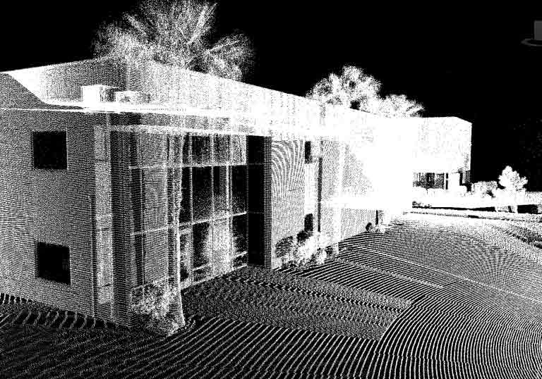
Quality Inspection with ScanTech
Source: 3d-scantech.com
The advantage of metal stamping over forging and casting is that the resulting parts are lighter and thinner. The use of molds gives high accuracy and maximum compliance of the obtained parts with the specified characteristics, but does not completely exclude deviations and deformations. Which, in turn, can lead to difficulties in assembling finished products and reducing product quality. Therefore, constant quality inspection is a necessary part of production.
Understanding the manufacturer's tasks, ScanTech suggested checking the quality of stamped parts using the PRINCE laser scanner. The ability to switch blue and red laser modes allowed the device to combine the functionality of traditional portable and metrological 3D scanners. The mode of operation with an active beam of a red laser provides fast digitization of objects. In the case of increased requirements for accuracy and detail, turn on the blue laser beam mode.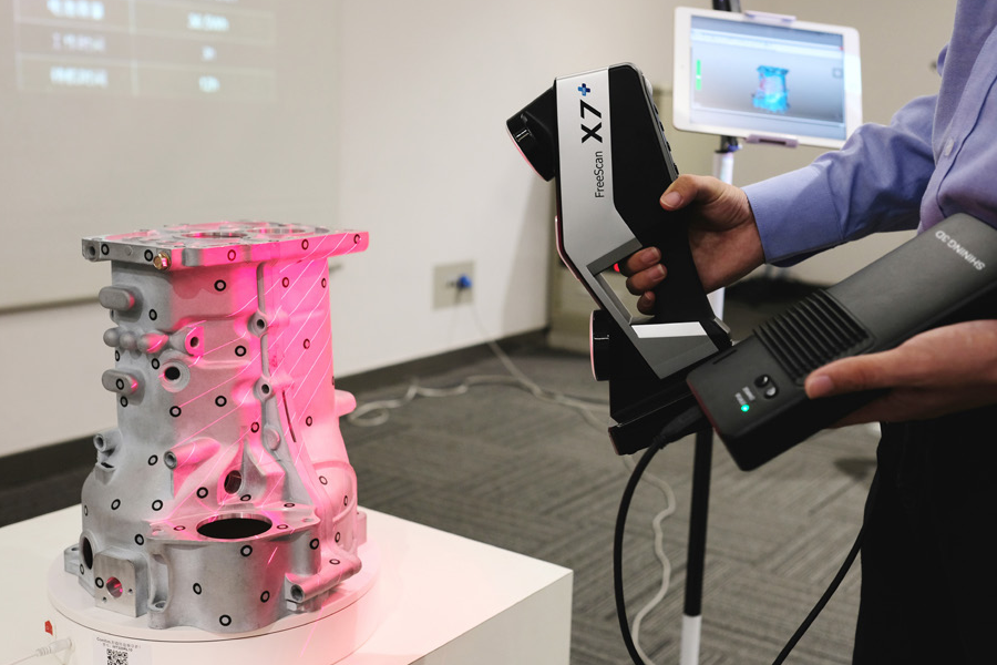
The photo shows the stages of work:
1. Installing markers - takes about two minutes.
Source: 3d-scantech.com
2. Digitizing a part takes about three minutes.
Source: 3d-scantech.com
Source: 3d-scantech.com
3. Deviation detection — lasts 3 minutes.
Source: 3d-scantech.com
The digital model demonstrates the parameters and deviations, allows you to correct errors at the design stage. The case clearly shows that the process required a minimum of time and effort.
Using FARO 3D Scanners on Justin Timberlake's World Tour
Source: disguise.one
Timberlake's "Man of the Woods" program features scenery brought to life on stage. First, the ScanLAB team digitized a number of corners of the forest in the US state of Oregon. Laser projectors then directed images over the auditorium and stage, painting amazing pictures of the Portland landscape on translucent canvases suspended in the air.
Source: faro.com
Two Faro Focus X 330 laser scanners, Faro Scene 6.2 software were used to prepare visual effects. In total it took 40 digital copies and 1 working day in the concert hall.
Source: www.esa.int
Considering the limited preparation time, the large surface areas for displaying the image and the corresponding need for high image resolution, it was not possible to create visual effects in a short time without using the chosen technology.
Selection guide for 3D laser scanners
In the review, we introduced you to the equipment of market leaders with an excellent reputation. All the described devices have high performance, so we recommend to pay attention to these devices for use in various fields:
FARO Focus: Focus3D S350, Focus 3D S150.