Metal detector 3d ground scanner
Groundtech Discovery SM Smart 3D Ground Scanning Detector | Shop | Features | Reviews
- 5 Different Scanning Features.
- Embedded System Technology.
- 3D Graphics.
- Perfect UMD - 2 Technology.
- Multi-Language Support.
- Personal Customization.
Your Eyes Under the Ground: Discovery
High-tech, smart ground scanning detector.
A new generation ground scanning detector that allows you to identify anomalies under the ground and carry out 3-D analyses.
5 Different Scanning Features
For an entertaining journey of discovery.
Automatic and Manual Ground Scanning, Real-Time Scanning, Dynamic Scanning and Pinpoint Scanning as standard scanning features.
*SMR model also features automatic and manual resistivity scanning.
Embedded System Technology
Get the results using a single device with detailed 3-D graphics.
On the home screen of the Discovery, you may view the 3-D scanning results and carry out detailed analyses without the need for a different device (e.g. tablets, computers).
This is a First.
Success Lies in the Details
View the information on the depth, location, and size with 3-D graphics and numerical data.
Different options such as 3-D analyses, details, depth information allow you to carry out detailed and perfect analyses on the measurements. Analyze the scanning results in a detailed manner with 3-D graphics and numerical data.
Multi-language support
Easy to use with multi-language options.
It is easy to use with the language options: English, German, Spanish, Italian, French, Turkish, Russian, Chinese, Arabic, and Persian.
Personal Customization!
Customizable menu options make your scanning process fun and easy.
Install your device for the first time and make it special to you.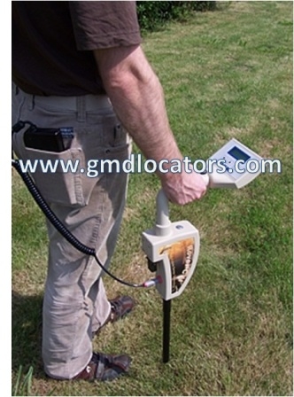 Free to customize menu themes, language options, units of measurement, location information, time zone, and more.
3D Graphics
Get the results quickly with understandable graphics.
You may view the scanning results in the form of 3-D colored graphics. Metals, spaces, structures, and differences are identified with a color range different from one another.
How deep would you like to go?*
Solve the mystery of every buried object with a high sensitivity of detection.
You can carry out scanning up to a 25-meter depth depending on the soil structure and the size of objects. Get results far beyond those achievable by standard detectors. * Variable depending on the soil structure and the size of buried objects as well as the scanning function.
Perfect UMD–2 Technology by Groundtech
Get successful scanning results with the UMD-2 technology and a faster processor.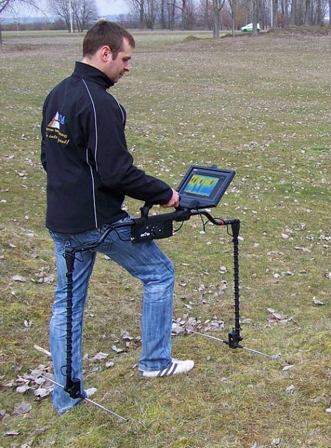
High-sensitivity UMD-2 sensor technology allows you to carry out more sensitive and deeper scanning. UMD-2 technology that minimizes the margin of error allows you to get the perfect scanning results.
Save Thousands of Scanning Results
You will no longer lose your older data thanks to the option to save scanning results.
Create a List of Favorites
Add to favorites your successful and interesting scanning results.
Successful scanning results thanks to many features
First installation and customization, restoration to factory settings, and more await you in Discovery.
Discovery SM Detector - Package Contents:
- Discovery system box with telescopic sensor
- Hard Transport Case
- AC Charger
- Car Charger
- USB Cable
- Universal plug adapter
- Carrying bag for system box
- Sunshade
- Headphone
- User manual
- 2 Year Warranty Certificate
| SKU | DISCOVERY-SM_KIT |
|---|---|
| Leasable with Katapult | Yes |
| Approximate Weight The approximate weight of the detector when fully assembled. | 2.5 Pounds |
| Battery Requirements The type and amount of batteries used to operate the detector. | Lithium-Ion |
| Brand The company that produces the detector. | Groundtech |
| Built-In Flashlight An on-board flashlight. | Yes |
| Country The country where the detector is made | Turkey (USA Service Center) |
| Circuitry Type The type of circuitry the detector uses. Typically, you will see VLF (Very Low Frequency) detectors, and PI (Pulse Induction) detectors. | UMD-2 Sensor Technology |
| Warranty The amount of time the manufacturer will cover any broken parts or malfunctioning electronics. | 2 Years |
No questions yet.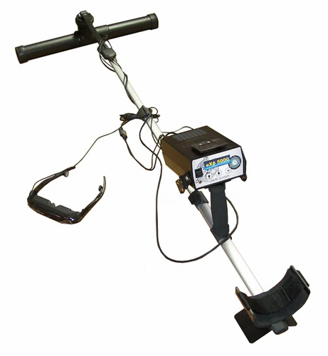 Be the first to ask the question!
DRS 3D Stealth Ground Scanner Pro | Detect and Image Buried Objects
Using Deep Scanning Gradiometer technology, DRS Electronics of Germany has introduced the next major advance in Camouflage treasure hunting. See with your own eyes a full color, 3-D analysis of what lies below. The DRS 3D Stealth Ground Scanner Pro utilizes 8 separate sensors to pierce deeply into the earth. The sensors are concealed in the vest pockets. The Ground Scanner Pro will find the Metal, Water, Earth or Cavities that lie below all while automatically eliminating iron. The extreme depth of the Gradiometer signal locates targets as deep as 15 meters.
See the DRS 3D Stealth Ground Scanner Pro in Action
Locate Hidden Cavities, Voids, Tunnels and Precious Metals in Three Simple Steps!
- First use the 3D Scanning Mode to see a detailed visual analysis of the targets that lie below.
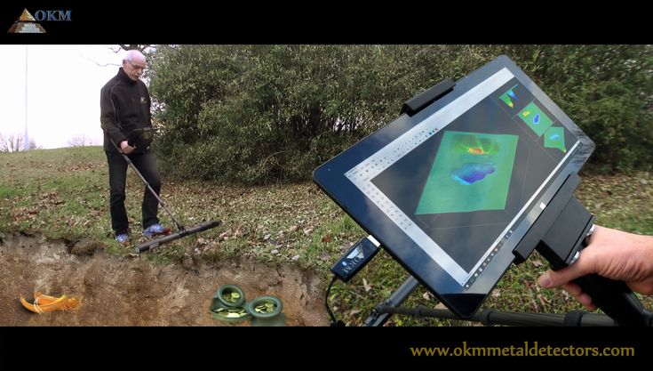 See clearly in 8 vivid colors metals, mineral deposits, stone formations, empty voids, full voids and water.
 - Finally use the Depth Evaluation Mode to determine the depth of your target.
Latest Deep Scanning Gradiometer Technology
See Color Underground Analysis of Metals and Geological Layers Below Before You Dig!
Using Deep Scanning Gradiometer technology, DRS Electronics of Germany has introduced the next major advance in treasure hunting. See with your own eyes a full color analysis of what lies below. The DRS 3D Stealth Ground Scanner Pro utilizes 8 separate sensors to pierce deeply into the earth.
The DRS 3D Stealth Ground Scanner Pro divides targets into four distinct categories: Metal, Water, Earth and Cavities.
Extreme Depth Locates Targets as Deep as 15 Meters
The DRS 3D Ground Scanner Pro discriminates between iron and precious metals! The layers of the ground are further divided into the different layers of soil, geological structures, gaps caused by human or nature, caves, vaults, tunnels, shelters and underground water formations.
Advanced Eight Sensor Design
Unlike traditional metal detectors or imaging detection devices which contain large bulky search coils, the DRS 3D Stealth Ground Scanner Pro is lightweight and minimal in design. Simply slip on the supplied vest and insert the Eight super geophysical sensors SGS-70 into the specially designed pockets. Finally connect the sensors to the supplied tablet computer and simply turn the power on; you are ready to begin searching!
The 8 powerful super geophysical sensors SGS-70 utilize deep scanning Gradiometer technology to extract the signals from the earth for analysis.
Search and Treasure Hunt in Comfort
The DRS Ground Scanner Pro utilizes a compact, concealed design. The long lasting battery allows you to hunt for hours without being noticed by anyone. This ingenious camouflage design allows you to blend into any environment. Simply slip the vest on under your jacket, power up the tablet and begin your search!
Scan Feature Draws 3-Dimensional Target View
Once you have located a target, just hit the “Begin Scan” button to analyze your signal.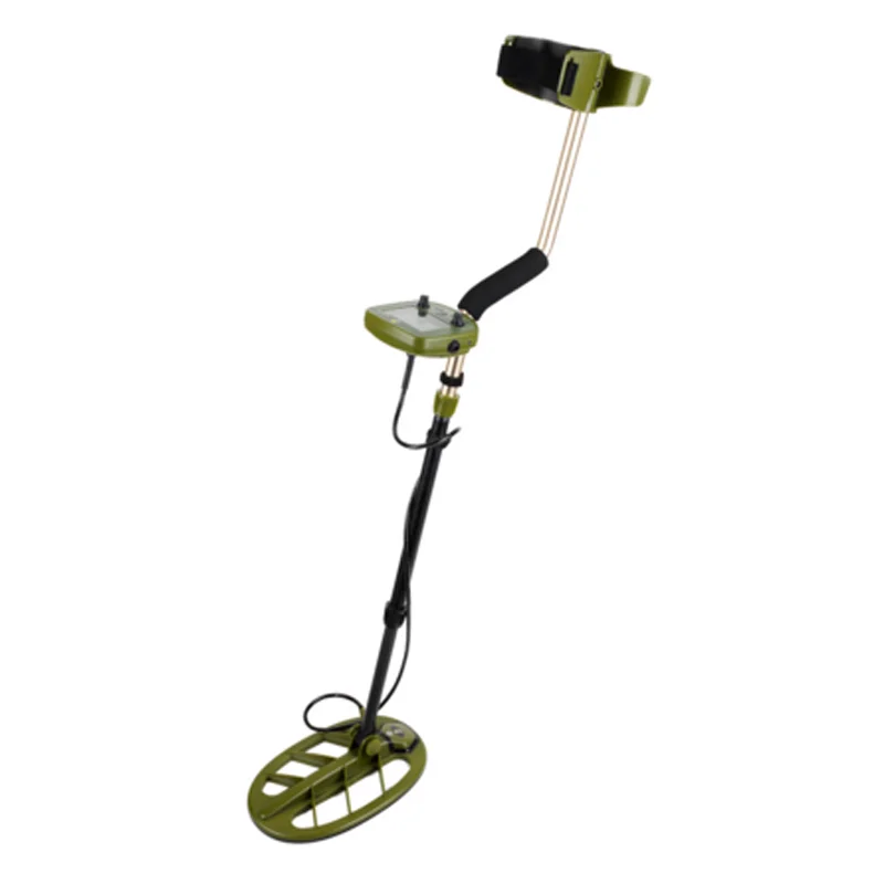 Thanks to the unique eight sensor design, the DRS 3-D Ground Scanner Pro is able to draw the targets in three dimensions. The system processes the data retrieved from the deep scanning Gradiometer signal and draws a signal map of the area being scanned on the display screen.
See both new and old Metal, Underground Structures such as Abysses, Caves, Vaults and Tunnels in brilliant 3D color.
Leave No Treasure Behind!
By searching your site in a precise grid like pattern, you can most effectively cover the ground. Your path should keep to an area of 30 centimeters in width. The data gathered by the sensors is converted to graphics in real time on the display. See the analysis on the display and in color as you proceed through your site.
Understand What Is Below
See with your own eyes the Metal, Water, Earth or Cavities that lie below. A 3-D graphic is presented in color that shows the detail of the layers below. The system will display on your tablet or smartphone the Metals, Caves, Vaults, Tunnels and Underground Water below.
Works on Tablet Computer
The Ground Scanner Pro software comes pre-installed on the included tablet computer. Intuitive menus and an easy to understand on-screen guide provide instant target analysis right in the field! No special proprietary hardware is required, just use the included tablet. Power up and you are ready to begin your search!
See real-time treasure hunting results in 3D Color. The included DRS software will bring your treasure to life.
Precisely control the DRS 3D Stealth Ground Scanner Pro with this Wireless blue tooth joystick remote.
Discriminates Between Iron and Precious Metals with Precision
The Ground Scanner automatically eliminates iron. The device is sensitive to all precious metals including Gold, Silver, Copper and more. The device does not distinguish between the type of precious metal. Now you can find precious metal treasures without digging for iron trash targets.
Easy to Understand Visual Color Codes
As you view the analysis of the ground, you will see that all items beneath the earth are displayed in color. This simple to understand color coding system makes identifying what lies below intuitive. All precious metals are shown in Red.
DRS 3D Stealth Ground Scanner Pro Includes Everything Listed Below:
- Installed 3D Stealth Ground Scanner Pro Software
- Windows Tablet PC
- Tablet PC Charger
- Tablet Case
- Lithium Ion Battery
- Lithium Ion Battery Charger
- Sensor Carrying Vest
- Required Cables
- DRS Software Suports 8 Languages: English, German, Arabic, Turkish, Persian, French, Italian, and Russian.
- Detailed Instructions
- DRS Bluetooth Control Joystick
- 2 Year Warranty
See an Overview of All DRS Technologies
Detector Technology
Gradiometer
This technology can determine if an object in the ground is metal, mineral or a cave or cavity.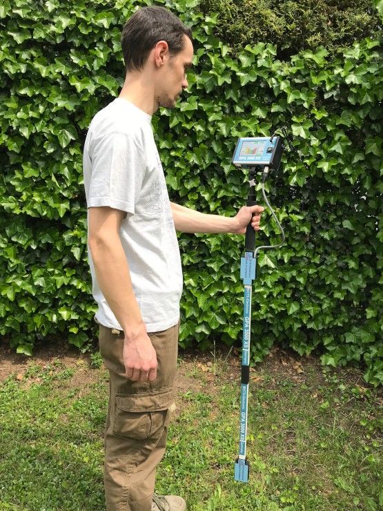 The two magnetic sensors in the Gradiometer probe analyze the signals in the earth in real-time. The first sensor simply measures the positive (+) signals while the other measures the negative (-) signals. When metal is detected, the positive value increases while the negative value decreases. When caves or cavities are detected, the positive value decreases while the negative value increases. When minerals are detected, the negative value does not change as the positive value increases. Results are shown visually in an easy to understand 3D image analysis on the display.
| SKU | DRS-3D-SCANNER-PRO_kit |
|---|---|
| Leasable with Katapult | Yes |
| Approximate Weight The approximate weight of the detector when fully assembled. | 5 |
| Battery Requirements The type and amount of batteries used to operate the detector. | Rechargeable Battery Pack |
| Battery Indicator An indicator to show the user how much battery life is left. | Yes |
| Brand The company that produces the detector. | DRS Electronics |
| Built-In Flashlight An on-board flashlight. | No |
| Country The country where the detector is made | Germany |
| Ground Balance A feature available on many detectors that allows the device to filter out signals from minerals in the ground, while accepting signals from actual targets. | Auto Ground Balance |
| Holster Included Holsters are typically included with Pin Pointers | Yes |
| Operating Mode Operating modes would include, but are not limited to, discriminate mode and all-metal mode | Deep Scanning Radar Technology |
| Circuitry Type The type of circuitry the detector uses. | Gradiometer |
| Search Coil Shape | Multiple |
| Sensitivity Adjustment This adjustment affects how sensitive the detector is to targets, and ultimately how deep they will be able to be detected. | Yes |
| Visual Identification A visual target ID that allows the user to determine the composition of the target being detected before digging. Typically, a visual target ID is a numerical display based off the conductivity of the target being detected. | Tablet PC |
| Warranty The amount of time the manufacturer will cover any broken parts or malfunctioning electronics. | 2 Years |
| Water Resistance The degree to which the detector is resistant to water. | Water Resistant |
Deep metal detector Nocta Macro
Please enable JavaScript in your browser!
-
Delivery
-
Payment
-
Installment/Credit
-
Guarantee
-
Return
-
Stock
-
Contacts
-
About Us
-
Login Registration
- metal detectors
- Nokta Makro metal detectors
Pre-order
from 24577 RUR/month
The metal detector can find and identify all types of metal, such as gold, silver, steel, copper and iron. With this instrument, you will see cavities such as ditches, rooms, bunkers, caves, tunnels, pipes, etc.
Warranty: 2 years.
Manufactured in: Turkey
3D Earth Scan
This detector can safely be called the most advanced device for detecting non-ferrous metals and underground voids. Stable operation in difficult ground, real-time 3D visual identification, exceptional depth of detection and an intuitive interface - this device is suitable for both search professionals and beginners.
You can identify metals and voids on scan images. You will also get more information about the types of metals.
You can find out if an object contains valuable precious metal or non-valuable (iron) metal.
But in many cases you will be able to read the actual type of metal on the display, such as "gold" or "iron".
Jeohunter 3D even eliminates fine ferrous metals completely from the localization process.
With LED illumination, you can search quickly and efficiently in places where standard coils cannot be used (eg walls or vertical slopes).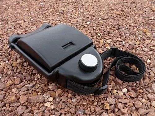
In addition to the light warning, this detector has an advanced audio identification system (two tones) that allows the user to work equally efficiently in any conditions.
Jeohunter 3D Dual System - works with 3 different search coils - it's almost like having three different detectors: which have been underground for a very long time and have already oxidized, which eventually led to the creation of a magnetic field around them (search depth up to 12 meters) The Makro Jeohunter 3D Dual System metal detector can be bought by installments or on credit, get a discount when paying online for an order in an online store. Your purchase will be convenient and fast! All equipment presented in the store is certified, with a guarantee. 30 days to return or exchange goods. Specifications Makro Jeohunter 3D Dual System
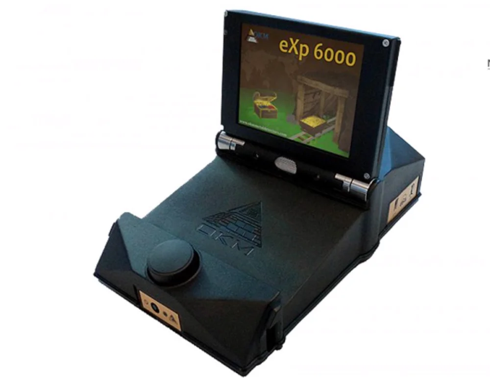 ..13 kHz
 Complete set

Brand Nokta Makro Series Jeohunter 3D Dual System Type Deep
Similar products
Pre-order
61058.40 rub
from 10176 rub/month
Deep metal detector Fisher Gemini 3
Nemphis soil scanner in Tiraspol (Metal detectors, metal detectors)
Price: Specify the price
for 1 unit.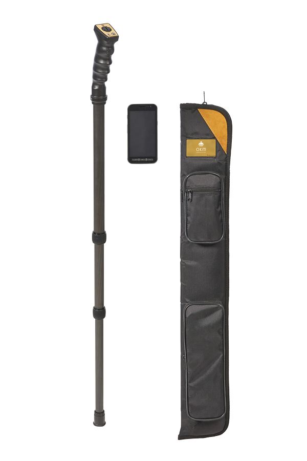
The Poiskgrunt online store company (Tiraspol) is a registered supplier on the BizOrg.su website. You can purchase the Nemphis Soil Scanner product with delivery in one region of Moldova, calculations are made in ₽. If you have any problems when ordering a product, please let us know via the feedback form.
Product description
NEMFIS DEPTH SCANNER. Multi-purpose electromagnetic 3D scanner.
Detailed product description
The method of electromagnetic induction frequency sounding, implemented in the NEMFIS scanner equipment, is designed to study the spatial distribution of resistivity from objects located at a depth of up to 10 m. search for burials of various objects - metals, plastics, voids, ceramic products, etc. with the allocation of contours of distributions of electrical conductivity. Thus, the use of the deep scanner "NEMFIS" allows you to solve the following tasks:
- archeology and treasure hunting;
- engineering geophysical surveys;
- reconnaissance of construction sites;
- analysis of the state of public utility pipeline systems;
- soil science;
- environmental assessment of contamination;
- qualitative assessment of soil water saturation;
- search for sources of salt and fresh water;
- localization and monitoring of underground structures and communications;
- detection and localization of burial sites of industrial waste of any chemical composition;
- search for the source of leakage and assessment of the volume of leakage from the main pipelines of gas products.
Depth scanner delivery set includes:
- Generator part,
- Measuring probe,
- Joystick control with indicator and cable,
- NEMFIS - PC connection cable,
- PDA-based primary processing and visualization unit,
- Wireless GPS receiver,
- Notebook with pre-installed software for detailed data manipulation for 2D, quasi-3D and 3D visualization,
- Software CD,
- Charger,
- Technical description, instruction manual and passport,
- Carrying strap for the device,
- Case for storing and transporting the device,
- Packing box (in case of sending to the customer's warehouse).
12 month hardware warranty.
Key features of NEMFIS:
Tri-coil probe.
Frequency range: 2.5-222 kHz (14 frequencies).
Measurement time: 0.3-2 s (depending on the number of selected frequencies).
Weight: 7 kg.
Assembled dimensions: 275x30x10 cm.
Battery life: 12 hours.
The NEMFIS search complex uses the following operating principle: the measured signal has a sinusoidal shape and is represented by two components as a complex number.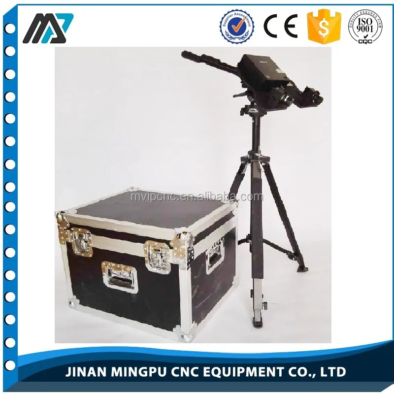 The signal is extracted using the synchronous detection method. This method makes it possible to carry out phase selection, and is optimal for achieving the highest sensitivity in measuring two signal components - the imaginary one, which is in phase with the maximum current in the generator loop, and the real one, which is ahead of the imaginary by 90 degrees.
The electromagnetic field is emitted by a magnetic dipole. The sinusoidal shape of the current in the generator loop is formed in a resonant series LC oscillatory circuit. The phase of the current in the circuit is controlled by the microcontroller through the pump circuit. The current measurement is performed by the same phase detector that converts the signal from the receiving coils. The measured components of the sinusoidal signal from the inductive current sensor are recorded in the instrument's memory as a seven-digit decimal number. Subsequently, the data is processed programmatically to build maps and sections, depending on the selected scanning mode (line, site, GPS fix).
Multi-purpose depth scanner "NEMFIS" was developed in the laboratory of electromagnetic fields of the Institute of Geophysics of the Siberian Branch of the Russian Academy of Sciences (SB RAS). Designed for operational research of soils at depths up to 10 m to solve the problems of archeology and treasure hunting, construction, utilities, soil science, ecology, etc.
NEMFIS equipment implements the method of electromagnetic induction frequency sounding and is a three-coil probe. The generator loop emits an electromagnetic field at 14 frequencies in the range of 2.5-222 kHz. The moments of the pick-up coils are chosen so that the primary field is compensated in air and, thus, during the measurement, the differential EMF induced by the eddy currents flowing in the medium is recorded.
The search complex consists of a probe enclosed in a durable fiberglass case, a portable computer with special ISystem software. The total length of the probe in working condition is 2.75 m, in the transport position 1.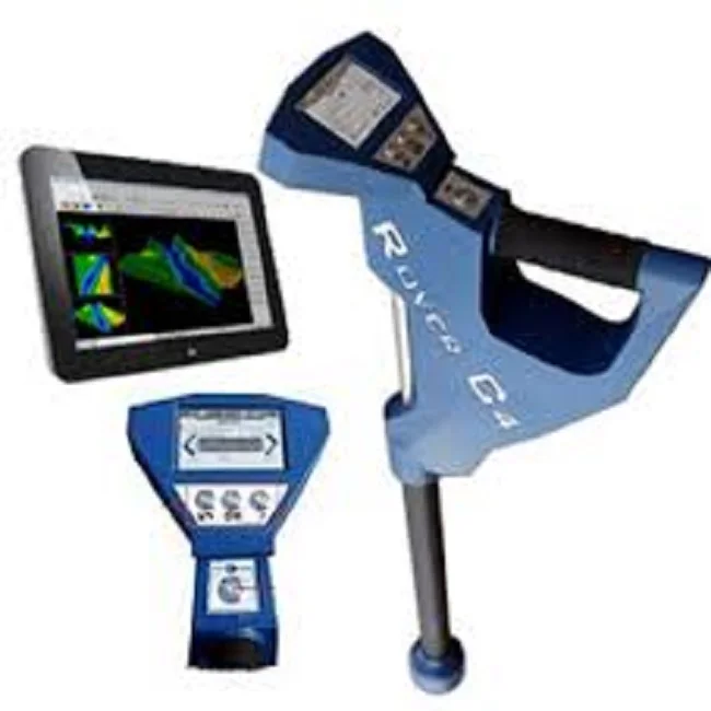 4 m. Weight 8 kg. The probe moves on an outstretched arm or in a special plastic trolley, so due to its dimensions, the scanner can be used almost everywhere where it is impossible to move with the overall sensors of deep metal detectors and ground penetrating radars. The device is controlled using the keyboard and LCD monitor. The internal memory of the scanner is designed to store data measured on 4000 pickets (10 hours of continuous operation). Working with data includes their transfer from the device memory to a computer, processing and visualization in the form of maps and / or sections, thus it is possible for the operator to obtain a two-dimensional, quasi-three-dimensional and three-dimensional distribution of underground electrical conductivity inhomogeneities. The NEMFIS depth scanner operates without galvanic contact with the medium and is resistant to electromagnetic interference. The average time of one measurement is up to 2 s (when operating at one or two frequencies - real-time measurement).
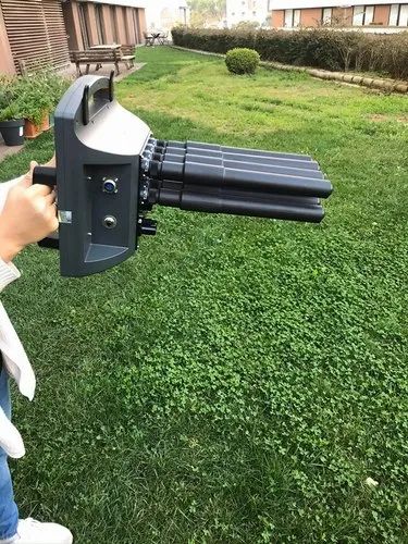
The problem of searching and identifying archaeological objects, especially those not expressed in the relief of the day surface, is quite acute. As the inventory of archaeological sites shows, a large number of objects are completely or partially destroyed due to plowing with powerful machinery and other human economic activities. As a rule, in such conditions, the boundaries of settlement complexes can be established only very conditionally by the plume of material lifted from the destroyed layer; In addition, the search for archaeological sites where the cultural layer is overlain by thick alluvial, aeolian, and other deposits is always difficult.
The described difficulties in some cases can be overcome using the method of electromagnetic induction frequency probing, which is implemented in the NEMFIS scanner. This method, with appropriate implementation and processing of the field material, makes it possible to judge the distribution of electrical conductivity. Archaeological monuments are characterized by a contrast in the electrical conductivity of various soil fractions, the remains of human activity, changes in the upper soil layer due to technogenic interference, etc. Therefore, the use of the NEMFIS deep 3D scanner for solving archeological problems is extremely effective.
Comparison with the most popular Western instruments showed that the method of electromagnetic scanning with "NEMFIS" is an order of magnitude faster than the method of resistance (electrical prospecting), much more informative than electromagnetic mapping at a single frequency and incomparably more noise-resistant than existing multi-frequency electromagnetic instruments. The section built according to NEMFIS data is much easier to interpret than GPR data.
1 year instrument warranty.
Similar products to Nemphis Soil Scanner
You can place an order for the "Nemfis Soil Scanner" in the company "Poiskgrunt Online Store" through our BizOrg platform. The offer is currently in the "available" status.
Poiskgrunt online store pluses
-
special service and price offer for users of the BizOrg trading platform;
-
timely fulfillment of their obligations;
-
various payment methods.
Leave a request right now!
Frequently Asked Questions
- How to place an order? Be sure to indicate that you found the company on the BizOrg marketplace.
- Where can I find more detailed information about Poiskgrunt Online Store? To obtain detailed information about the company, go to the link-name of the company in the upper right corner of the page. Next, go to the desired tab with a description.
- The offer is indicated with errors, the phone number is not responding, etc. If you have problems working with Poiskgrunt Online Store, please report the company ID (168079) and product/service ID (3584205) to our technical support service.
Service information
-
"Nemfis Soil Scanner" belongs to the category: "Metal detectors, metal detectors".
-
The offer was created on 09/02/2013, last updated on 19.11.2013.
-
For all the time the offer was viewed 674 times.

Learn more


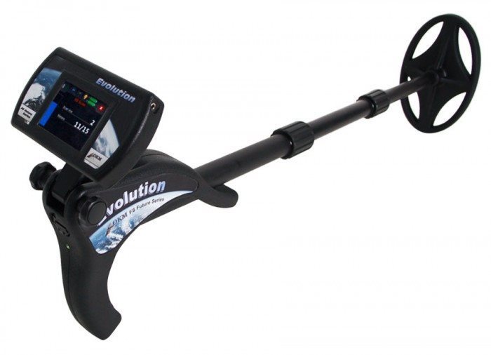
 Typically, you will see VLF (Very Low Frequency) detectors, and PI (Pulse Induction) detectors.
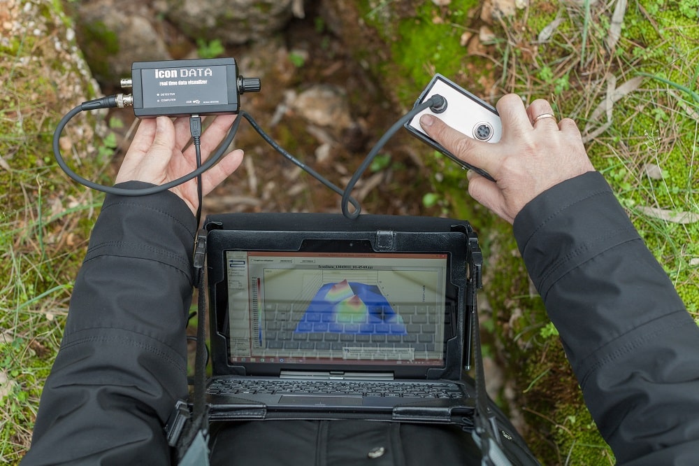 Weatherproof implies that the detector is resistant to splashing and rain. Waterproof implies the detector is fully submerisble. (All models will offer waterproof search coils.)