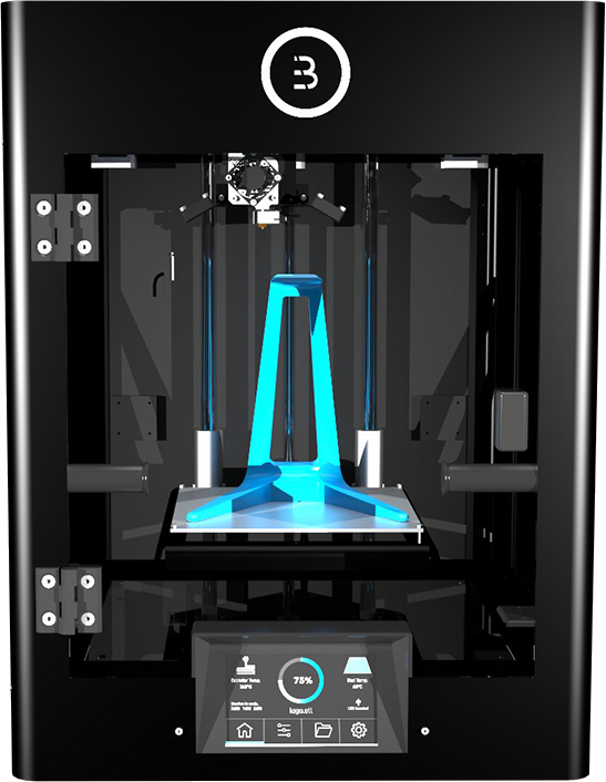
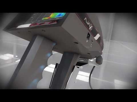
3D underground scanner
DRS 3D Stealth Ground Scanner Pro | Detect and Image Buried Objects
Using Deep Scanning Gradiometer technology, DRS Electronics of Germany has introduced the next major advance in Camouflage treasure hunting. See with your own eyes a full color, 3-D analysis of what lies below. The DRS 3D Stealth Ground Scanner Pro utilizes 8 separate sensors to pierce deeply into the earth. The sensors are concealed in the vest pockets. The Ground Scanner Pro will find the Metal, Water, Earth or Cavities that lie below all while automatically eliminating iron. The extreme depth of the Gradiometer signal locates targets as deep as 15 meters.
See the DRS 3D Stealth Ground Scanner Pro in Action
Locate Hidden Cavities, Voids, Tunnels and Precious Metals in Three Simple Steps!
- First use the 3D Scanning Mode to see a detailed visual analysis of the targets that lie below.
See clearly in 8 vivid colors metals, mineral deposits, stone formations, empty voids, full voids and water.
- Finally use the Depth Evaluation Mode to determine the depth of your target.
Latest Deep Scanning Gradiometer Technology
See Color Underground Analysis of Metals and Geological Layers Below Before You Dig!
Using Deep Scanning Gradiometer technology, DRS Electronics of Germany has introduced the next major advance in treasure hunting. See with your own eyes a full color analysis of what lies below. The DRS 3D Stealth Ground Scanner Pro utilizes 8 separate sensors to pierce deeply into the earth.
The DRS 3D Stealth Ground Scanner Pro divides targets into four distinct categories: Metal, Water, Earth and Cavities.
Extreme Depth Locates Targets as Deep as 15 Meters
The DRS 3D Ground Scanner Pro discriminates between iron and precious metals! The layers of the ground are further divided into the different layers of soil, geological structures, gaps caused by human or nature, caves, vaults, tunnels, shelters and underground water formations.
Advanced Eight Sensor Design
Unlike traditional metal detectors or imaging detection devices which contain large bulky search coils, the DRS 3D Stealth Ground Scanner Pro is lightweight and minimal in design. Simply slip on the supplied vest and insert the Eight super geophysical sensors SGS-70 into the specially designed pockets. Finally connect the sensors to the supplied tablet computer and simply turn the power on; you are ready to begin searching!
The 8 powerful super geophysical sensors SGS-70 utilize deep scanning Gradiometer technology to extract the signals from the earth for analysis.
Search and Treasure Hunt in Comfort
The DRS Ground Scanner Pro utilizes a compact, concealed design. The long lasting battery allows you to hunt for hours without being noticed by anyone. This ingenious camouflage design allows you to blend into any environment. Simply slip the vest on under your jacket, power up the tablet and begin your search!
Scan Feature Draws 3-Dimensional Target View
Once you have located a target, just hit the “Begin Scan” button to analyze your signal. Thanks to the unique eight sensor design, the DRS 3-D Ground Scanner Pro is able to draw the targets in three dimensions. The system processes the data retrieved from the deep scanning Gradiometer signal and draws a signal map of the area being scanned on the display screen.
See both new and old Metal, Underground Structures such as Abysses, Caves, Vaults and Tunnels in brilliant 3D color.
Leave No Treasure Behind!
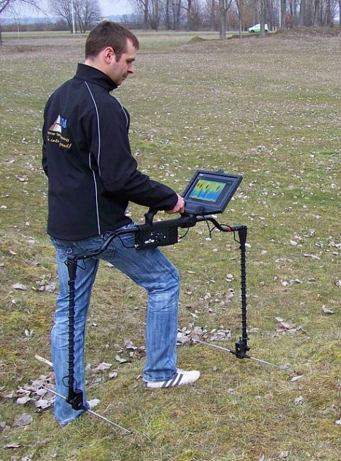
By searching your site in a precise grid like pattern, you can most effectively cover the ground. Your path should keep to an area of 30 centimeters in width. The data gathered by the sensors is converted to graphics in real time on the display. See the analysis on the display and in color as you proceed through your site.
Understand What Is Below
See with your own eyes the Metal, Water, Earth or Cavities that lie below. A 3-D graphic is presented in color that shows the detail of the layers below. The system will display on your tablet or smartphone the Metals, Caves, Vaults, Tunnels and Underground Water below.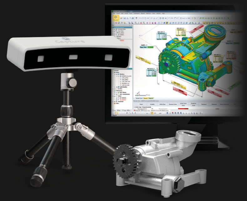
Works on Tablet Computer
The Ground Scanner Pro software comes pre-installed on the included tablet computer. Intuitive menus and an easy to understand on-screen guide provide instant target analysis right in the field! No special proprietary hardware is required, just use the included tablet. Power up and you are ready to begin your search!
See real-time treasure hunting results in 3D Color. The included DRS software will bring your treasure to life.
Precisely control the DRS 3D Stealth Ground Scanner Pro with this Wireless blue tooth joystick remote.
Discriminates Between Iron and Precious Metals with Precision
The Ground Scanner automatically eliminates iron. The device is sensitive to all precious metals including Gold, Silver, Copper and more. The device does not distinguish between the type of precious metal. Now you can find precious metal treasures without digging for iron trash targets.
Easy to Understand Visual Color Codes
As you view the analysis of the ground, you will see that all items beneath the earth are displayed in color. This simple to understand color coding system makes identifying what lies below intuitive. All precious metals are shown in Red.
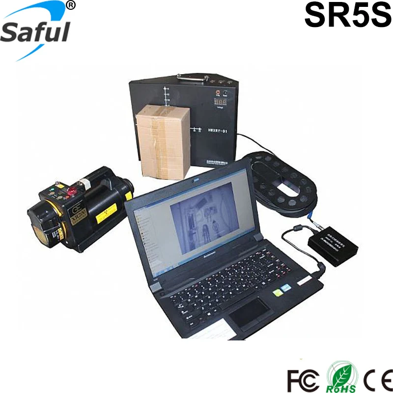
DRS 3D Stealth Ground Scanner Pro Includes Everything Listed Below:
- Installed 3D Stealth Ground Scanner Pro Software
- Windows Tablet PC
- Tablet PC Charger
- Tablet Case
- Lithium Ion Battery
- Lithium Ion Battery Charger
- Sensor Carrying Vest
- Required Cables
- DRS Software Suports 8 Languages: English, German, Arabic, Turkish, Persian, French, Italian, and Russian.
- Detailed Instructions
- DRS Bluetooth Control Joystick
- 2 Year Warranty
See an Overview of All DRS Technologies
Detector Technology
Gradiometer
This technology can determine if an object in the ground is metal, mineral or a cave or cavity. The two magnetic sensors in the Gradiometer probe analyze the signals in the earth in real-time. The first sensor simply measures the positive (+) signals while the other measures the negative (-) signals. When metal is detected, the positive value increases while the negative value decreases. When caves or cavities are detected, the positive value decreases while the negative value increases. When minerals are detected, the negative value does not change as the positive value increases. Results are shown visually in an easy to understand 3D image analysis on the display.
| SKU | DRS-3D-SCANNER-PRO_kit |
|---|---|
| Leasable with Katapult | Yes |
| Approximate Weight The approximate weight of the detector when fully assembled. | 5 |
| Battery Requirements The type and amount of batteries used to operate the detector. | Rechargeable Battery Pack |
| Battery Indicator An indicator to show the user how much battery life is left. | Yes |
| Brand The company that produces the detector. | DRS Electronics |
| Built-In Flashlight An on-board flashlight. | No |
| Country The country where the detector is made | Germany |
| Ground Balance A feature available on many detectors that allows the device to filter out signals from minerals in the ground, while accepting signals from actual targets. | Auto Ground Balance |
| Holster Included Holsters are typically included with Pin Pointers | Yes |
| Operating Mode Operating modes would include, but are not limited to, discriminate mode and all-metal mode | Deep Scanning Radar Technology |
| Circuitry Type The type of circuitry the detector uses. | Gradiometer |
| Search Coil Shape | Multiple |
| Sensitivity Adjustment This adjustment affects how sensitive the detector is to targets, and ultimately how deep they will be able to be detected. | Yes |
| Visual Identification A visual target ID that allows the user to determine the composition of the target being detected before digging. Typically, a visual target ID is a numerical display based off the conductivity of the target being detected. | Tablet PC |
| Warranty The amount of time the manufacturer will cover any broken parts or malfunctioning electronics. | 2 Years |
| Water Resistance The degree to which the detector is resistant to water. | Water Resistant |
 Typically, you will see VLF (Very Low Frequency) detectors, and PI (Pulse Induction) detectors.
 Weatherproof implies that the detector is resistant to splashing and rain. Waterproof implies the detector is fully submerisble. (All models will offer waterproof search coils.)
Phoenix metal detector 2022 is a 3D ground scanner
Description
Details
Phoenix metal detector 2021 is a 3D ground scanner with a completely new ground scanning technology that ensures faster and more accurate results in finding and detection of ancient treasures and burials at very great depths.
Device Features
· Powerful 3D Ground Scanner with unique and new ground scan technology
· Multi-purpose metal detector for treasure hunting, archaeological excavation and underground cavities detection like tunnels and chambers.
· 3 search systems: [3D Ground Scan – Live Stream – Pin Pointer], suitable for different treasure hunting applications and metal detection purposes.
· New unique 3D ground scanning technology via Multi Ground Scanner (M. G.S) probe, with larger scan surface that offer more coverage and faster scan process, but with reliable accurate results.
· Powerful Live Stream system via Vertical High Signal Transceiver or shortly V.S.T probe that offer live scan of ground area with visual representation based on target type on both screen and tablet
· Pin Pointer system for easy visual pin pointing of detected target using V.S.T.
· 3D visual presentation for targets in 3D Ground Scan system on the Android tablet with different colors that point to a different target types like metal, normal ground and cavities like tunnels.
· 2D visual presentation of scan process on device screen for all search systems
· Multi Visual Analyzer app for any Android tablet or smart phone, which offer a visual result presentation and powerful visual tools to analyze and get complete information about detected targets like target type, location and depth.
· LEDs Bars a set of LEDs located on two sides of conical end of V. S.T that change its color based on detected target type.
· Practical modern design suitable for long-time operation and ground scan
· Large size colored LCD screen provides a comfortable viewing experience for the results, and easy to change the scan settings.
· Powerful multi-lingual visual software program offers best user experience through visual controls, icons and graphics for easy settings adjusting and results display.
· Operated via an external rechargeable lithium-ion batteries guarantee a long-time operation
Additional information
System Box (Main Unit)
Multi Ground Scanner (M.G.S.60)
Vertical High Signal Transceiver: (V.S.T)
M.G.S Connector Armrest & Shafts
Lithium-Ion Battery
Headphones
Accessories Box (Screws – Nuts – Battery Charger – Cables…)
Android Tablet (Optional)
1 – 3D Ground Scan System [GROUND SCAN]
3D ground scan system is the most powerful system for detection in Phoenix device, it is developed with a new technology incorporated in the scanner probe called Multi Ground Scanner or M. G.S in short.
M.G.S with its unique design and large surface with multiple sensors, enable coverage and scanning of larger area in less time but with more accurate results.
3D ground scan system displays the scanning data obtained from M.G.S as 2D visualization on device screen or as 3D graphics presentation on bundled Android Tablet via Multi Visual Analyzer app as we will explain later.
After selecting the system from the main menu, the device program allowing the user to choose how to display the scan results. There are two options:
1 – Device
This option if selected enable the user to complete 3D ground scan process using device LCD screen as the results will display directly on screen, before that the user must adjust the ground scan settings that include following options:
- Mode
This option defines the method for conducting the ground scan, meaning how the measurements will be recorded at each scan point.
Here there are two modes:
- Manual: in manual mode the recording of scan measurement performed manually by the user using red button in main unit of the device.

- Automatic: in this mode, the device is responsible for taking measuring points automatically
- Path
It expresses the shape of the user’s movement path when conducting a ground scan, there are two types:
- One Direction: In this case, the scan points are recorded in each scan line in one direction. In other words, the direction of measurements recording is in a specific direction in each scan line, for example, starting from the south towards the north, and so on for each line, meaning that the start points of the scan lines are on the same side.
- Zig Zag: here the direction of measurements recording in two consecutive scan lines are in opposite direction, meaning that the start points of two consecutive scan lines are on the opposite’s sides.
- Size
It is a dimensions of virtual scanning grid made up of cells, related to the number of scan lines and points in each scan line.
It includes the following two values:
- Width: it is width or number of columns in grid, it same as scan line count.
- Height: it is height or number of rows in the grid, it equal to number of scan points
- Start Point
It is the starting point for ground scan within the pre-defined area, and one of the following two options can be chosen:
- Left: in this case the scan process starts from bottom – left corner of scan area
- Right: the ground scan will begin from bottom – right corner of area
After setting the previously explained ground scan settings, Scan tab displays a table summarizing the selected settings with a button to start scanning, and the user can press the OK button to actually start the scanning process and record the results.
During the scan process the measurement in every scan point will be presented visually on screen as 2D grid consisting of rows and columns of cells and every scan point presented as cell with 4 sub-cells in specific colors based on type of target that M.G.S hover it in this point.
The table below show the type of target for each color:
| Green | Light Blue | Blue | Yellow | Red |
| Normal Ground | Small Cavity | Cavity | metal objects | gold |
On the left side of screen near the grid, there are many values presented:
– Current X: it presents the current scan line number or current column number in grid.
– Current Y: it presents the current scan point, or current row number in grid.
– Value: a numeric value related to measurement in current scan point.
2 – Tablet
If user selected this option on device screen, first he must make a wireless connection between device and tablet, he must continue the 3D ground scan on the bundled Android tablet.
In this case the user chooses same ground scan settings as explained previously, but inside the Multi Visual Analyzer app and the ground scan data visualized as 3D graphics inside the app.
Multi Visual Analyzer app can be installed on any Android tablet or smartphone, it has a simple graphical interface available in 12 languages, it used to adjust settings of ground scan and scan data transmitted in real time from M.G.S to be presented as 3D graphics with different colors that refer to various target’s types such as metal, cavity or gold like in previous table.
Multi Visual Analyzer app include a set of tools to display the data from different viewports and tools to know the location and depth of specific target visually, and filters to filter results based on specific target types.
2 – Live Stream System [LIVE STREAM]
Live Stream scan system is powerful ground scan mode with live real-time scan of the ground and direct visualization of measurement on display screen or optionally on tablet via Multi Visual Analyzer.
The scanning process in this system carried out by a Vertical High Signal Transceiver (V.S.T) probe, a new probe with unique technology to perform deep live scan to detect different types of targets including ferrous metal, non-ferrous metal and cavities like tunnels or caves.
V.S.T installed in front of Phoenix main unit, and must be vertical, it must always be perpendicular to the ground during the scanning process.
At the end of the probe, there is a four-sided cone with two sides containing a set of luminous LEDs, whose colors change during the scanning process according to the target type.
For example: When a user moves V.S.T probe over a golden object lie a golden coin the LEDs will light up in red color, it will light up in blue when V.S.T passes over a cavity.
After selecting the Live Stream system from the main menu, the screen displays a screen to calibrate the V.S.T probe first, then move directly to live-stream screen that display a continuous stream of colors changing during scan made by V.S.T based on target type in similar way as explained for LEDs, on the right of screen a numerical value of target displayed, user here can change speed of stream.
Example: color is Red when capturing a precious metal signal and green for normal ground.
User can also display live-stream visualization on tablet via Multi Visual Analyzer, in this case he must connect the device and tablet via Bluetooth, and selecting Live Stream inside the app.
Multi Visual Analyzer app will display a changed-color stream of received scan data from V.S.T, here also the colors related to the target type in the same way.
3 – Pin Pointer System [PINPOINTER]
The Pen Pointer system is a system usually used after excavation in order to accurately locate a potential target.
The scan process is carried out here via a V.S.T probe also, and in a similar way to the live stream system, where the probe must be perpendicular to the ground as well.
Pen Pointer used to determine the presence of a metal target or cavity with the precise determination of the location in which the buried metal or cavity is located via audio feedback or visualization on screen as 2D bar graph.
In the result screen there are many settings that user can adjust:
- Sensitivity
The sensitivity value is related to adjusting the sensitivity of the captured signal through V.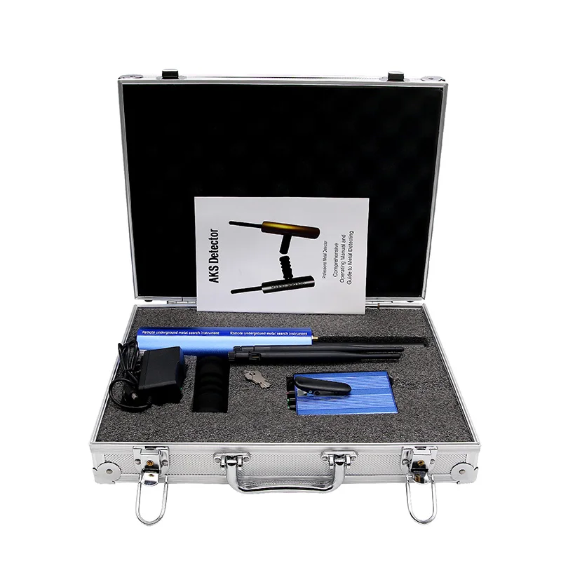 S.T probe , according to this value, the visual representation of the signals and the tone of the audio output changes.
- Calibration
User can use this option to calibrate the sensor sensitivity at any time according to the ground type and the ground state.
- Reset
This option reset the calibration process to its default value.
The visual representation of received signals on device screen is a 2D bar graph.
In case of signals of metallic target such as bronze statue for example, the bar graph will be consisting of bars facing upward, of different length, with graded colors from green to red in the middle at the maximum values, and then graded towards green on sides.
If received signals are for cavities – such as a tunnel – it will be made of bars facing downwards, of different length, ranging from green to dark blue in the middle at the maximum values, and then graded towards green at lower values.
Modern Software Program
The user interface of Phoenix software program designed visually according to latest developments in user interface design and user experience (UX) guidelines.
The software program offers the user a rich visual experience and easy way to adjust ground scan settings and seeing the results visually on screen with set of tools.
Search Systems Screen
It allows the user to choose the search system by selecting the search system icon from the list via the buttons on the control panel.
User can choose between 3 available search systems and press OK button to start using selected system.
Language Select Screen
In order to provide a Phoenix 3D Ground Scanner for all prospectors around the world, the device’s software program available in many international languages, including the most spoken and used languages in the world.
The user interface language can be easily changed within the device’s settings and user can choose from 12 international languages to cover most countries of the world.
Supported languages includes:
1- German 2- English 3- French 4- Spanish 5- Russian 6- Italian 7- Arabic 8- Hebrew 9- Persian 10- Turkish 11- Urdu 12- Chinese
Date & time Settings
One of the useful features for the user of the Phoenix, is the ability to set the date and time to match the real date and time, and the device keeps these values even if it is turned off.
The device displays a digital clock that includes the current time and appears continuously at the top right of the screen to enable the user to know the time when he searching in the fields, especially with the knowledge that when searching, the user should not carry metal objects such as a wristwatch or a mobile phone because they affect the capture of magnetic signals .
The importance of the possibility of the date and time subject is also evident when saving the search files or the values of the ground scanning process, as they are automatically saved with a name that includes the date of the day and the time at which the file was saved, and this guarantees the user the ability to return and analyze the search process that was conducted in a specific place on a specific date.
Screen Settings
In this screen user can control some useful settings related to the device’s screen, namely:
- Energy Saving Mode
In the case of activating it, the value of the time that the device needs to turn off the screen can be set (in the event that no button is pressed for a while), and this ensures that the battery power is saved for a longer use.
- Screen Brightness
The screen brightness value can be controlled within a specific value to suit the user’s conditions in terms of time during the day or night and weather conditions like in foggy or rainy days.
This option can be useful to save battery power when it is set to low values.
Audio Settings
The device features various audio alerts depending on the search system used.
Within the device’s settings, you can adjust the volume of the sound and various alerts:
- General sound: It controls the general volume of the device sound (speaker sound volume).
- Keypad sound: to adjust the sound volume of control panel buttons
- Scan sound: adjust the sound volume of sound issued when conducting the ground scan via the scanning tools
Power
Use this option to save power and energy of battery during device usage.
By using this option, the battery life time will be extent 50% at least ant it depends on the type of searching system and type of connected sensor
Scan Files
When performing scans, the user can save the current values of the scanning operation to files stored in the device’s memory.
The user can, through a simple interface, review all previously saved files and open them to view the stored results, or a previously stored file can be deleted to save space in memory for future searches.
Reset
Here the user can set the following options
- Reset Settings: reset general settings without deleting previously saved scan files.
- Factory Settings: reset to the factory values (the values when purchasing the device from the factory) while deleting the saved files
- Clear Memory: clean memory to free up the device’s memory of all saved files.
Device information
This screen displays the device information, which are:
- Device Version
- Software version
- Device Model
- Serial Number
- Manufacturer Country
- QR code: the user can read it to obtain useful information about the device, including the manufacturer website
Security settings
- Pin Lock: activate or deactivate the screen lock
- Set Pin: here user can set a pin number (a number that without entering it correctly any person can’t access and enter the device software program)
Leica RTC360 3D Laser Scanner | Leica Geosystems
- home
- Products/Solutions
- Laser scanners
- Scanners
- Leica RTC360 3D laser scanner
Use automatic on-site pre-registration of point cloud data for real-time quality control, increased productivity, and more informed decisions on the job site
Document and digitize your environment in 3D with the Leica RTC360 3D reality capture solution. Increase productivity on site and in the office with fast, accurate, portable and easy-to-use hardware and software. With the RTC360 3D Laser Scanner, a skilled technician can overcome any design challenge with accurate and reliable 3D models to unlock the full potential of any site.
- The compact, highly automated, intuitive and user-friendly RTC360 solution includes a high-performance 3D laser scanner, the Leica Cyclone FIELD 360 mobile app for edge computing, such as automatic registration of scanned data in real time, and Leica Cyclone REGISTER 360 software for office work , with which you can easily implement the resulting 3D model into your workflow.
- Capture scans, including stunning HDR images, in less than two minutes.
- Automatic recording of movements between survey points to pre-register scanned data in the field without manual intervention.
- Augment the collected data with informative tags with hints for optimal planning and information about the real conditions on the site, which will help your colleagues to better understand the situation.
- Upload collected data from Cyclone FIELD 360 directly to Leica TruView Cloud to quickly share design data before import and registration.
Fast
The new Leica RTC360 laser scanner captures reality in 3D at a speed never seen before. Capturing up to 2 million points per second and using advanced HDR image capture, the scanner generates colorful 3D point clouds in less than two minutes.
 Automated, labelless data logging in the field based on VIS technology and convenient automatic data transfer from site to office further speed up field work and increase productivity.
Adaptive
Thanks to its portable design and foldable tripod, the compact and lightweight Leica RTC360 fits into a regular backpack. On the object, one click of a button is enough to scan the environment without any additional settings.
Fine
Low noise in the acquired data means better image quality – you get crisp, detailed scans that are ready for a variety of industries. Combined with the Cyclone FIELD 360 automated data logging software in the field, the Leica RTC360 delivers amazing accuracy that can be verified on site.
Pre-registration in the field
The Cyclone FIELD 360 app, part of the RTC360 solution, bridges the gap between on-site 3D data collection and on-site registration of laser scan data in the office with Cyclone REGISTER 360.
 User can automatically capture, register, and control scan and image data on site . The easy-to-learn and user-friendly graphical interface offers visual aids for complex calculations, making it easy for even beginners to master.
 Previous Next
Scanning options
The RTC360 3D Laser Scanner automatically captures movement between survey points to pre-register scanned data on the spot. Juergen Mayer spoke about the latest developments in an interview with The Reporter.
Introduction to the RTC360
The latest Leica RTC360 3D reality capture solution, unveiled at HxGN LIVE 2018, combines a high-performance laser scanner with a mobile application for capturing and pre-logging real-time scan data.
From hardware to software
Geosystems specialists optimize every link of the workflow in both software and hardware solutions to increase the efficiency and productivity of field work and data processing in the office.
Leica RTC360: 3D reality capture solution
Leica Cyclone FIELD 360 mobile-device app
Downloads
Videos
EXPERT ADVICE
Examples of using
Podcasts
Introducing the Leica RTC360 3D Laser Scanner
3D environments in a matter of minutes - an outlook on recent reality capture technology
3D reality capture - new opportunities, greater understanding
Transforming Ayacucho into a digital city
Services
myWorld Customer Portal
Active Customer Care
Customer Support Packages
Related Products
Laser scanners
Leica BLK360 laser scanner
Leica ScanStation P40 / P30
Leica ScanStation P50
Software
Leica Cyclone
Leica Cyclone REGISTER
Leica Cyclone REGISTER 360
Leica CloudWorx
Leica TruView
Leica JetStream
Accessories
Accessories for 3D laser scanners 9015
contact-for-laser-scanning
As of v7. 0.1, Safari exhibits a bug in which resizing your browser horizontally causes rendering errors in the justified nav that are cleared upon refreshing.
As of v7.0.1, Safari exhibits a bug in which resizing your browser horizontally causes rendering errors in the justified nav that are cleared upon refreshing.
CONTACT US
The High-Definition Surveyor - Blog
Learn how Leica Geosystems laser scanning solutions are helping professional to shape the future of our world.
Learn how Leica Geosystems laser scanning solutions are helping professional to shape the future of our world.
Read More
Scanning power
Quality is a tradition, built deep within our DNA. We have a commitment to excellence and exceptional attention to detail.
Scanning power
Quality is a tradition, built deep within our DNA. We have a commitment to excellence and exceptional attention to detail.
WATCH NOW
Educational articles and analytics
What is 3D Reality Capture and how is it applied in your industry?
What is 3D Reality Capture and how is it applied in your industry?
learn more
Comparison table of laser scanners
Which laser scanner is right for you?
Which laser scanner is right for you?
download now
Reality Capture Newsletter
Click here to subscribe to our regular newsletter and stay up-to-date on all the latest reality capture news.
Click here to subscribe to our regular newsletter and stay up-to-date on all the latest reality capture news.
Subscribe
Online learning
Leica Geosystems has developed an online learning platform to further educate customers on how to maximize the functionality of their instruments.
Leica Geosystems has developed an online learning platform to further educate customers on how to maximize the functionality of their instruments.
Surveying with portable laser scanners. Scanning of underground workings, clearing spaces, warehouses and embankments
Mine surveying with laser scanners. Underground workings, treatment areas, storages and embankments
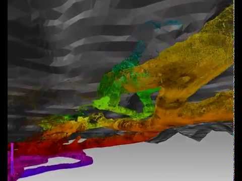
A modern trend and need is the use of modern laser scanners for complex and dangerous work in the mining industry. At the moment, mobile 3D scanners are used to build digital models of mines, calculate production volumes / chambers, determine storage volumes and track changes. Our works on the use of laser scanners in mining are presented:
Yotube Alfascaner LLC
Undeniable advantages of using portable laser scanners:
- Lightweight scanner and fast scanning. Mine surveying takes place during a bypass of a mine working, a warehouse with a scanning sensor in hand. The sensor is installed on a milestone up to 6 meters long. The range of the scanner is 100 meters. The process of taking measurements is displayed on the control device. Anyone can shoot on the go and create a digital model. Such efficiency of data acquisition makes it possible to timely and accurately determine the geometric parameters of mines and warehouses with the least risks. High detailing of survey objects allows obtaining accurate data, on the basis of which it is possible to quickly build a mine frame in programs or create a digital model, make calculations;
- Scanning does not require additional survey justification.
 Coordinate referencing occurs by control points (tacheometric), which are fixed during the scanning process;
 - Accurate results are obtained in the most difficult conditions: dust, moisture, complete darkness, remoteness.
- A big advantage of the systems is the ability to upload point clouds to the enterprise GGIS for further use and processing.
One of the leaders in the production of portable 3D laser scanning systems and software for their use on the ground, underground and in the air is the American company Greenvalley International, which has an assembly plant in Shenzhen. Its LiBackpack 50 backpack solution is the fastest and most accurate for mining applications. LiBackpack mobile scanning solutions are widely used in mine surveying in the context of digitalization in the mining industry at mines with an underground mining method to obtain up-to-date information about the state of mine workings, treatment chambers, warehouses and other mine facilities and further adapt the results for use in the MGIS. Our tests of portable 3D laser systems showed the highest accuracy with the least noise, the absence of parallel lines and artifacts. The company is a developer of mathematical SLAM algorithms and proprietary software, which makes it possible to achieve the longest scanning trajectory of more than 2000 meters, unlike similar systems.
LiBackpack portable laser scanner consists of lidar, control device, backpack, accessories and software. There are portable scanners with a built-in GNSS module for scanning large ground objects and a panoramic camera for detailing small objects and viewing any moment of shooting with a turn of 360 about .
Industrial design is important. To use the scanner in a mine environment, the high security of the scanner, the use of industrial LEMO connectors, special materials, a built-in fast-charging and capacious intelligent battery are required to ensure the operation of the system and automatic stitching on the go.
A digital model of an object is built using a cloud of points in specialized programs with the possibility of calculating geometric parameters: volumes, lengths, sections, etc.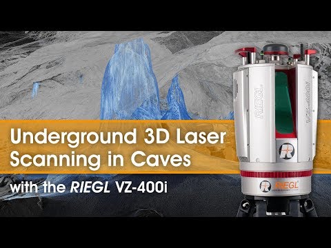
The point cloud is loaded into the enterprise's GIS for further processing and use. Additional processing of laser scanning results in various software, Credo Mainframe, Surpac, etc. is possible. When conducting industrial tests, this method for determining output showed high accuracy compared to traditional methods. The undeniable advantage is the ease and speed of obtaining data. It takes 15 minutes to capture and bind an object to the local coordinate system with a length of 150 meters. Less than 1 hour for processing and receiving volumes. Large built-in memory over 500 GB.
A portable laser scanning system is a tool for obtaining operational and reliable metric information about complex objects and is the fundamental basis of the digital twin. After all, you can effectively manage what you can accurately measure. Leading mining companies in Russia, as well as the Russian Ministry of Emergency Situations, are already using LiBackpack.
Application of LiBackpack 50 in an underground excavation
- Rapid determination of excavation volumes
- Sectioning of tunnels
- Preparation of digital models of underground facilities for planning the location of equipment, sensors, etc.
Learn more