Trimble 3d laser scanner
Trimble X12 | Trimble Geospatial
Where to Buy
Where to Buy
Trimble X12 Overview Video
Trimble X12 Overview Video
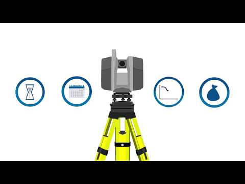
3D laser scanning has evolved.
The Trimble® X12 scanning system unites the best of both worlds with industry-leading hardware and Trimble’s powerful, ultra-efficient Trimble Perspective software for guaranteed peak performance.
No more complicated workflows. No complex registration process. No compromises in accuracy, speed, range, or imaging.
- High-end Laser Scanning
- Laser Scanning Software
Accessible
Reduces complexities normally associated with high end scanning with unparalleled ease of use.
Productive
Improves business efficiencies by offering the best scanner and software available to collect superior scan data and imagery faster than ever.
Dependable
Top notch performance and technological advancements gives the confidence that you are getting the job done right.
Trimble Perspective
With the intuitive powerful Trimble Perspective™ software achieve unparalleled performance with precise data capture.
Trimble RealWorks
Trimble RealWorks provides a complete solution to efficiently register, analyze, model and create deliverables using data from virtually any source.
Trimble Business Center
Work with scan data using the TBC Scanning Module and use automated tools for classification, feature extraction and CAD deliverables.
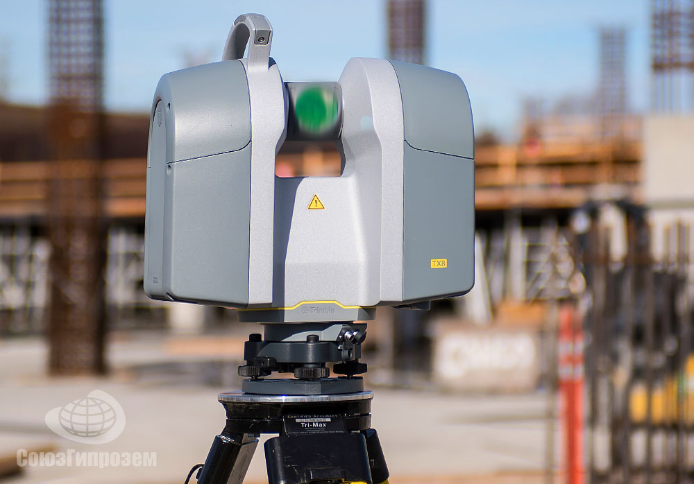
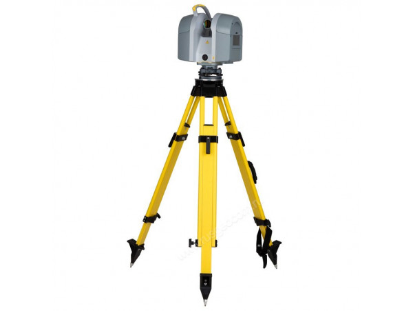
Trimble X12 3D Laser Scanner
Trimble X12 3D Laser Scanner
Trimble X12 3D Laser Scanner
Trimble X12 3D Laser Scanner
Trimble X12 3D Laser Scanner
Enhance your perspective.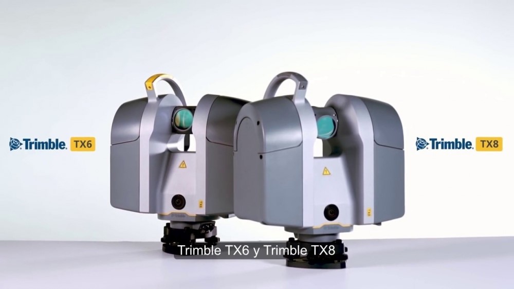 With the Trimble X12 scanning system unparalleled ease of use, increased efficiency, exceptional quality of point clouds and imagery, are now more accessible than ever.
High resolution, accurate point cloud data
- Scan up to an astonishing 2.18 million points per second with a range of 365 meters.
- Range noise of 0.2 mm and density of 0.6 mm at 10 meters.
Sharp, clean image acquisition
- Experience breathtaking colorization of your point cloud data with parallax free images.
- Smart light, LED spotlights of 700 lumen improve image acquisition in poor light conditions and even completely dark environments.
Quick, flexible point cloud capture
- Full dome scans as fast as 23 seconds, complemented with the ability to quickly and efficiently scan areas of interest at high quality settings.
- A minimum scan range of 0.
 3 meters, allowing you to capture more detail in tight spaces.
Unparalleled Ease of Use
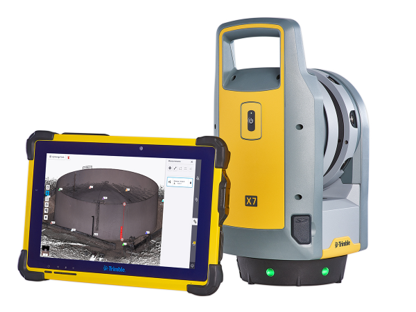
- Automatic in-field registration, refinement, reports and exports with Trimble Perspective on the T10x tablet.
- Comprehensive and user friendly OnBoard interface.
Trimble X12 Applications
- Topographic/General Surveys
- Civil Infrastructure
- Industrial Survey
- Forensics
- Cultural Heritage
- Digital Twin
- Tank—Calibration & Inspection
- Shipbuilding Surveys
The Trimble X12 quickly captures features for land title surveys, buildings, roads, intersections, site improvements, encroaching elements and complex structures:
- Document and highlight features or items of interest using annotations.

- Assign labels to each scan to create logical scan groups and annotations with pictures while scanning the next station.
- Use auto-classification tools to extract data corresponding to the ground, buildings, powerlines, signs, vegetations, and more.
- Create as-builts of road corridors, intersections, roadway surfaces, lane striping, flow lines, manholes, right of ways, overhead power lines, and other features.
With the Trimble X12, you can create as-built documentation for drawings or models for bridges, tunnels, dams and other civil infrastructure with a range that allows for operation from a safe distance, while the area scan feature provides high-resolution data on areas of interest. Also use it to:
- Incorporate scan information in clearance calculations, modeling, inspections, renovations, and expansion work.
- Leverage high-speed data capture and quickly capture area scans to reduce downtime for critical infrastructure projects.
- Benefit from unmatched HDR image quality for visual inspection and sharing of information.
- Register in the field to verify scan data is complete before importing to Trimble Business Center or Trimble RealWorks® at the office.
The Trimble X12 enables users to create accurate as-builts of complex industrial facilities for modeling and revamp designs. Also use it to:
- Take high-resolution area scans for more detail on points of interest and safely capture inaccessible areas from a distance.
- View details of existing conditions for critical decisions.
- Enhance in-field documentation with annotations and pictures of tie-in locations inside Trimble Perspective.
- Georeference scans to plant coordinate systems using Trimble RealWorks target- based registration and survey control for export-to-plant design software to do piping layouts, check fabrication spools, and detect interferences with CAD models.
For forensics applications, use the Trimble X12’s high-speed scanning and imaging to capture information at crime scenes and vehicular accidents and minimize road closures, even in extreme weather conditions.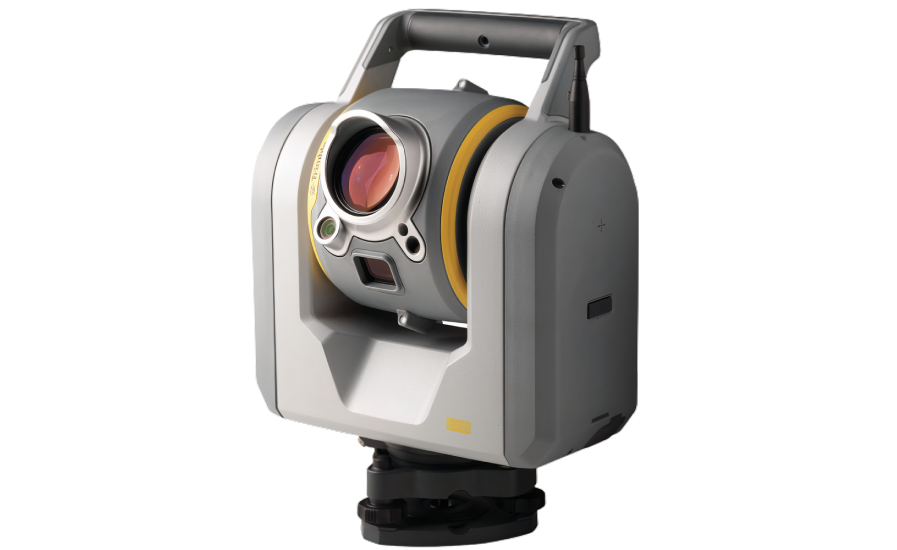 Also use it to:
- Add annotations with pictures to points of interest and take measurements in the field.
- Generate unmatched high-resolution image quality, even at night, with the LED spotlights.
- Register in the field to verify complete data capture before leaving the scene.
- Export data to Trimble Forensics Reveal software for creation of 2D/3D diagrams and animations for investigation and reconstruction.
The Trimble X12 helps you plan restoration efforts or simply capture history. Historic preservation projects require great detail to inspect or monitor surface deterioration as well as high-resolution imagery for documentation, analysis and restoration. Also use it to:
- Retain important details with high-resolution area scans on points of interest and safely capture inaccessible areas from a distance.
- Digitally preserve fragile artifacts for re-creation.
- Document and share the site with high-resolution panoramas and clear color imagery.

- Add annotations in the field with images to highlight critical areas of interest back in the office.
- Check data quality before leaving the site to eliminate costly and time-consuming field revisit.
The Trimble X12 makes it possible to safely and effectively create as-built models for scan- to-BIM and renovations and provides clarity for adaptive reuse, building extensions and inspection of facades and elevations. Also use it to:
- Optimize commercial building design accessibility.
- Produce perfectly colorized point clouds using parallax free images and clearly view the project off-site.
- Register in the field to eliminate the risk of return visits, especially where access permits are difficult to obtain.
- Transfer data to Trimble Business Center, Trimble RealWorks or other CAD software for final analysis and design.
Use the Trimble X12 to scan underground mines and quarries for deformation monitoring and stockpile volume calculations.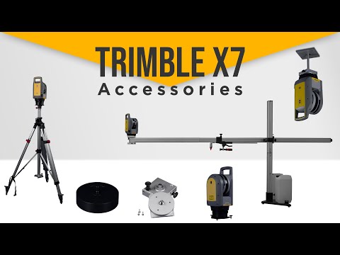 Also use it to:
- Reduce downtime with high-speed scanning backed by an IP54 rating with a two-year warranty for reliable operation in extreme conditions.
- Efficiently capture precise details of storage tanks and surrounding containment areas to document verticality, roundness, and integrity.
- Easily capture and verify data in the field before importing into Trimble RealWorks Storage Tank module.
- Calculate tank volume filling tables and secondary containment volumes, perform deformation analysis for tank repairs, and create reports meeting API 653 standards.
Whether your ship is at port or in drydock, the Trimble X12 is the ideal scanner to create as-builts for new construction, renovation, and optimization. Also use it to:
- Effectively operate in the confined spaces of ships with the best minimum scan range in the industry of 0.3 meters.
- Capture data of the hull, on deck or in holds with long range, high resolution scans.

- Quickly scan ballast tanks in preparation for water treatment systems for retrofit to comply with IMO mandates.
- Obtain the level of detail needed by the naval architect before the ship leaves port.
Resources
Trimble X12 Overview Video
Trimble X12 Overview Video
Datasheet
Application Overview
User Guide
Quick Start Guide
Comparison Guide
Regulatory Document
Devices, Software, and Accessories
Trimble X12 Works With...
Trimble T10x
Rugged tablet
More InfoTrimble Perspective
Trimble Perspective software, 3D scanning simplified
More InfoNEW Subscription Plans
Trimble RealWorks
Point cloud processing and compelling deliverables
More InfoConstruction Laser Scanning Resources
Construction Laser Scanning Resources Skip to main content-
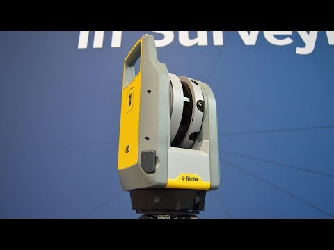
Van Bower Construction Services Ensures Accurate Restoration of Historic Site with Trimble X7 3D Laser Scanner
Trimble X7 laser scanner is put to use on an extensive restoration and mass timber addition to a historic Beatty Street building in downtown Vancouver
Read Article
-
ScanSite realises its 3D vision of the future with the Trimble X7
We join Lee Chandler and Scansite as they set out on their 3D journey with the Trimble X7
Read Article
-
Scanner X7 Documentation Technique
Découvrez plus d'informations sur le scanner laser 3D Trimble X7.

Read Flipbook
-
Fiche technique RTS 773
Découvrez plus sur le Trimble RTS 773.
Read Flipbook
-
Fiche technique RTS 673
Découvrez plus sur le Trimble RTS 673.
Read Flipbook
-
See
Request a Demo
Trimble's Scanning Technology
In Action -
3D Scanning Made Simple
3D laser scanning is a powerful tool your whole team can use to streamline construction workflows, increase accuracy and decrease rework – Ultimately translating to saved time and money.
Read Flipbook
-
Don’t Invest in a 3D Laser Scanner Until You Read This
Discover how the right software helps you get more mileage out of your scans and maximize the value of your 3D data and BIM models.
Read Article
-
Teaching a New Dog Old Tricks
Discover how Spot is transforming the construction site in the January issue of The Construction Index.
Read Article
-
View the Scanning Tools Specifications
View Now -
ECC Group creates a 21st century workflow with Trimble Cloud Engine
ECC Group tackle the global pandemic head-on with a unique digital construction workflow
Read Article
-
AEC Magazine: Spot in construction
Covid-19 has not stopped Boston Dynamics from working with AEC hardware and software developers like Trimble, together with advanced users like Foster + Partners.
Read Article
- 0:53
Scan's Best Friend
The Trimble Autonomous Robotic Scanning Solution brings together the Boston Dynamics’ Spot Robot, fully integrated with the Trimble X7 3D laser scanner and Trimble FieldLink software. This integrated
Watch Video
-
How to Choose a 3D Laser Scanner for Your Specific Construction Needs
An intuitive and self-calibrating 3D laser scanning solution lets you put the power of scanning directly into the hands of those who need it the most.
 Discover the must-have features of a 3D scanner.
Read Flipbook
- 2:48
See Spot at Work with Hensel Phelps
Construction sites can now benefit from the integration of X7 laser technology with the Spot robot platform. Laser scanning, site documentation and progress monitoring leverage are easily and safely t
Watch Video
-
Trimble RTS673 - Datasheet
Discover more about the Trimble RTS673 in this datasheet.
Read Flipbook
-
Trimble RTS773 - Datasheet
Read Flipbook
-
Datasheet - Trimble X7 3D Laser Scanner
Discover more about the Trimble X7 3D Laser Scanner in this datasheet.
Read Flipbook
- 30:53
Webinar: CloudEngine
Watch this 30-minute webinar and demo to learn more about this new point cloud editor
Watch Video
-
Mortenson/Scull Case Study - Scanning
The Project: The Monument, a new 250,000 square-foot indoor arena in Rapid City, South Dakota using the Trimble X7 3D Laser Scanner and Trimble FieldLink
Read Flipbook
-
Warner Mechanical Case Study - 3D Laser Scanning
See how the speed and accuracy of the Trimble X7 is helping Warner Mechanical save time and labor resources.
 What previously took 2-3 days using a tape measure and paper is now easily done in one day.
Read Flipbook
-
Trimble and Boston Dynamics Announce Strategic Alliance to Extend the Use of Autonomous Robots in Construction
Trimble (NASDAQ: TRMB) and Boston Dynamics announced today a strategic alliance to integrate a variety of construction data collection technologies with Boston Dynamics' Spot® robot platform.
Read Article
-
Loading More...
JSC PRIN Laser 3D scanner Trimble GX
16.04.2009
Laser scanner is a geodetic tool that automatically performs point measurements in a given sector and at a given interval. Unlike traditional electronic total stations, the Trimble GX scanner has "astronomical" performance up to 5000 measurements per second and millimeter-level accuracy. This instrument is ideal for a wide range of applications where the use of an electronic total station is not economical or feasible. Trimble GX is indispensable for facade surveys, detailed surveys of interiors of industrial facilities, open and closed mine workings, tunnels... Unlike other traditional geodetic instruments, the scanner provides detailed coordinate information about the entire measured object.
The Trimble GX requires minimal operator skills to prepare and make field measurements. Management and control over the instrument during measurements is carried out using a regular laptop, as well as Trimble TSC2 or Recon controllers.
The Trimble GX scanner is available in two versions, Standard and Professional. The professional scanner differs from the standard one in the ability to use the Trimble TSC2 controller to control shooting and save measurements to internal memory, as well as support for the autofocus function of the laser beam and SureScan technology.
SureScan technology automatically adapts scan settings to the geometry of the scanned object to maintain a constant, user-defined distance between points in 3D space. This unique feature allows you to set the same density of points when shooting objects such as roads and tunnels throughout their length. Thus, it is possible to avoid obtaining too many points at small distances and too few at large ones. SureScan technology increases the efficiency of field operations, resulting in faster and easier data processing.
The Trimble GX scanner uses Trimble VISION technology to capture and store digital images. With their help, you can easily identify objects and set points for shooting. The images are then transferred along with the scanned data to the processing software. This decision makes the demonstration of the project more visual, and in addition, increases the number of options for presenting the final result.
The Trimble GX scanner, Trimble TSC2 controller and powerful RealWorks Survey office software allow you to quickly create the necessary documentation and visualize the results.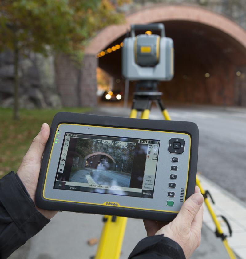 With Trimble RealWorks Survey, you can process scan data containing millions of points and export the final result to modern CAD packages (CAD).
Like the article?
Rate:
Total ratings: 0
Good
Interesting
Super
Complex
BEAUTION
Discuss:
similar publications 9000 9000 9000 9000
- # ALPHA
- #Apache
- # CGO
- CHC
- #GNSS
- # LandStar7
- # LandStar8
- #Machine Control
- #PP
- # Prince
- # PrinNet
- #RTK
- # Spectra Precision
- #Topcon
- # Trimble
- # Promotion
- # Unmanned aerial photography
- # Video
- # GIS
- # Road construction
- # Inertial system
- # History
- # Creed
- # Machine control
- # Wallpaper
- # Software
- # Projects
- # Real experience
- # Resellers
- # ACS
- # Service center
- # Base station network
- # Scan
- # Events
- # Technical support
- # Management of construction equipment
- # Training center
- # PRIN Ecosystem
We are open for communication
PRIN JSC 3D laser scanner Trimble FX
- Home
- Descriptions
- Trimble FX 3D Laser Scanner
-
Prince
-
Knowledge for the pros
-
Knowledge for beginners
-
Lifehack
-
News and updates
-
Reviews
-
Help in choosing
-
Working with software
-
Tests and reviews
-
Technical support and service
04/16/2009
Designed specifically for shooting industrial scenes.