3D laser scanner drone
LIDAR Scanner Drones - Precise Aerial Laser Scanning
eVTOL Drone with LIDAR sensor for
Precise and Cost-effective Laser Scanning
Forestry
Construction
Mining
Linear Inspections
Accuracy and speed are unrivaled using FIXAR 007 solution for LiDAR laser scanning. Complete aerial laser scanning of any terrain and receive precise data on the true surface of the Earth, even in remote, inaccessible, or densely forested areas.
Precision Data
Create precise and accurate data sets using FIXAR 007 autonomous drones complete with LiDAR technology. Scan terrain, infrastructure, or other areas using laser scanning to obtain a detailed and true 3D point cloud with reference to GPS coordinates.
User-Friendly
FIXAR 007 Laser Scanning drone is easy-to-use. Each FIXAR 007 fixed-wing VTOL drone is equipped with xGroundControl Software that can be installed on a laptop and used with Windows or macOS operating systems. Proprietary software is integrated with all FIXAR 007 UAV LiDAR units to make operation easy and intuitive for all users from novice to expert.
Wide Application
Laser scanning using autonomous drones is not just for specialty sectors. It has wide applicability across all industries including forestry, precision agriculture, monitoring of power lines, mining and aggregates, construction, archeology, and others.
FIXAR 007 for Laser Scanning
With a reliable and robust design, high cargo capacity of 2 kg/ 4.4 lbs, and a large range of up to 30 km/ 18.6 mi (configured with LiDAR sensors) the VTOL UAV FIXAR 007 is ideal for efficient drone laser scanning.
Use your FIXAR 007 combined with LiDAR to capture and control information immediately. Use the data to inform decisions and create accurate 3D models and maps of any geographical terrain.
Learn More
The FIXAR 007 with LIDAR Sensor
Increased Safety
Reduce the risk in unstable environments such as nuclear and chemical fields. Safely survey and take accurate measurements from a distance.
Accurate Data Even in Sensitive Areas
Get data that’s accurate down to the finest detail. Scan sensitive areas without disturbing the environment using non-invasive technologies to obtain data.
Quality Data
Reduce errors, and the need for do-overs that result from collecting inaccurate data. Save money and time with increased accuracy.
Cost-Effective
Drone laser scanning can reduce overall project schedule times and costs. Accuracy minimizes waste and saves money and time.
Plug and Play Payload Modules Based on Real Job Tasks
YellowScan Mapper+OEM
The YellowScan Mapper+OEM is equipped
Livox AVIA laser scanner together with
high-performance GNSS-aided
inertial navigation system into
a lightweight, standalone and
easy-to-use lidar system.
3 cm XYZ accuracy
Weight – 0.86 kg
Origin: France
TOPODRONE LiDAR AVIA
LIDAR based on Livox Avia sensor
High-precision IMU with 0,08/0,03
degrees accuracy and L1/L2 GNSS receiver
3-5 cm XYZ accuracy
Weight – 0.8 kg
Origin: Switzerland
TOPODRONE LiDAR ULTRA
LIDAR based on Velodyne Ultra sensor
High-precision IMU with 0,08/0,03
degrees accuracy and L1/L2 GNSS receiver
3-5 cm XYZ accuracy
Weight – 1.1 kg
Origin: Switzerland
Plug and Play Payload Modules Based on Real Job Tasks
YellowScan Mapper+OEM
The YellowScan Mapper+OEM is equipped
Livox AVIA laser scanner together with
high-performance GNSS-aided
inertial navigation system into
a lightweight, standalone and
easy-to-use lidar system.
3 cm XYZ accuracy
Weight – 0.86 kg
Origin: France
TOPODRONE LiDAR AVIA
LIDAR based on Livox Avia sensor
High-precision IMU with 0,08/0,03
degrees accuracy and L1/L2 GNSS receiver
3-5 cm XYZ accuracy
Weight – 0.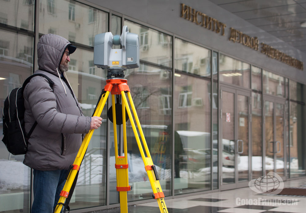 8 kg
8 kg
Origin: Switzerland
TOPODRONE LiDAR ULTRA
LIDAR based on Velodyne Ultra sensor
High-precision IMU with 0,08/0,03
degrees accuracy and L1/L2 GNSS receiver
3-5 cm XYZ accuracy
Weight – 1.1 kg
Origin: Switzerland
Laser Scanning: Expanding Surveying Capabilities
Laser scanning using FIXAR’s 007 autonomous drones provides unparalleled detailed and accurate data. Using this system will increase the quality, safety, and sustainability of your organization.
Are you ready to start using FIXAR 007 Laser Scanning in your organization?
Compatible with Most Popular Post-processing Software
High Quality Outputs from Every Single Mission
Case Studies
Explore Other Solutions
We pair our drones with our proprietary software operating systems and controls to deliver all-in-one elegant UAV solutions, revolutionizing how technology is being used in various industries worldwide, including agriculture, oil & gas, construction & civil engineering, mining, surveying, photogrammetry, cartography and more.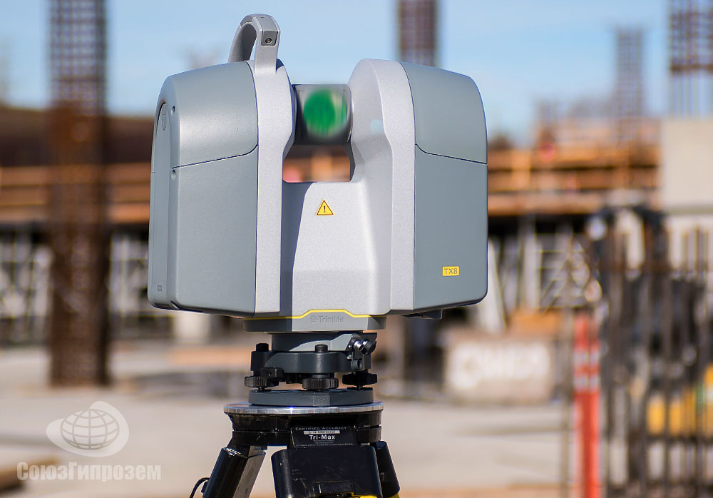
Drone Services Used for 3D Laser Scanning
TruePoint has FAA licensed pilots to aid in aerial video, building surveys, property surveys, and photogrammetry services. TruePoint utilizes DJI brand drones equipped with HD video and HD photo cameras.
We offer safe, accurate and cost-effective data collection, ensuring positional accuracy in vast, dangerous or hard to reach areas. We have extensive experience with and knowledge of drones. We work closely with our clients to harness the power of these unmanned aircraft systems for their specific needs and applications.
Applications for Drone Services
- Urban Planning and Land Management – digital surface and terrain models
- Construction – as-built surveys reduce the need to physically access job sites
- Engineering – from measuring cut and fill volumes, to inspecting crucial infrastructure
- Mining and Quarries – collecting accurate data boosts productivity through improved inventory management and planning
- BIM – data can be used to generate highly detailed and accurate 3D models
- Energy and Infrastructure –inspect linear assets such as pipelines, powerlines, rail routes and waterways
Custom Deliverables for Drone Services
TruePoint can combine highly accurate point cloud data from our laser scanners to the drone photogrammetry to create dimensionally accurate aerial photographs. We can provide the following deliverables to clients:
- Point Clouds
- 3D Models
- 2D Orthoimages
- 2D CAD Drawings
- Flythrough Videos
Nationwide Drone Services
TruePoint provides commercial drone services nationwide. We have worked in many different industries completing successful projects throughout the United States.
With the rapid rise of the drone industry, the amount of businesses entering the marketplace and offering aerial drone services has increased exponentially. Much more goes into operating a professional, high-quality, safety-conscious drone than simply purchasing and flying one. We take great pride in offering aerial drone services for our clients.
TruePoint Company Highlights
TruePoint is a highly experienced team of 3D laser scanning professionals who deliver exceptional service with a fast response, technical expertise and long-term client commitment. You can trust our team to provide the best experience in laser scanning by walking you through the entire process from pre-planning to final deliverables. TruePoint’s team has expertise from many “real world” disciplines, including engineering, architecture, information technology, and construction. Having this combination of knowledge is integral to providing you with the best laser scanning service and deliverables that save your team time and money on your next project.
- 3D laser scanning, modeling and aerial photogrammetry is our sole business, not just one aspect of it; we are dedicated to providing our clients timely and accurate responses and results.
- We offer nationwide service and have worked in many different industries.
- Our consultative approach ensures you get the right information so you can use it to make informed decisions now and for future projects.
- Our team of in-house CAD technicians all have "real world" experience in their respective disciplines and work with point clouds and photogrammetry every day to create deliverables that are practical and useful.
- We can build models to any level of detail.

- We perform hundreds of successful projects every year and are happy to provide references.
Learn More About Drone Services
To learn more about TruePoint drone services, contact us today at 419-843-7226 or [email protected].
What you need to know about the first DJI Zenmuse L1 Scanner
DJI The Zenmuse L1 is a sensor designed to meet the growing demand from DJI drone users in construction, architecture, engineering and surveying. Powerful yet affordable drone scanner.
Although laser scanning technology (LiDAR) has been around for more than half a century, the explosive effect of this technology has only been felt by specialists in various industries in the last decade. In geodesy, laser scanning is recognized as the most important technology for creating accurate three-dimensional models. nine0006
In low light conditions or in areas with dense vegetation, aerial photogrammetry methods cannot determine the true surface of the Earth.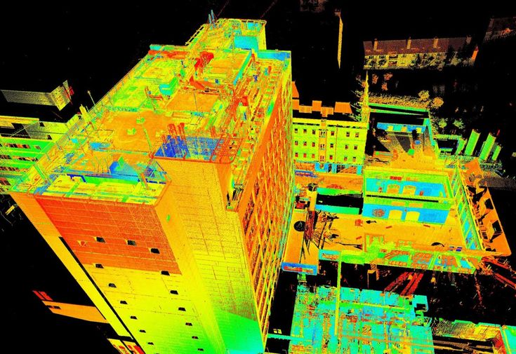 Even under such conditions, a laser scanner mounted on a drone can create accurate models of complex structures and surfaces in the form of a three-dimensional point cloud.
Compared to aerial photogrammetry, the adoption of laser scanning technology for industrial drones has been very slow. The main reason is the lack of lightweight, but highly functional and inexpensive airborne scanners or the complexity of post-processing and classification of ultra-dense data. Despite all the difficulties, airborne laser scanning technology has won its place under the sun. nine0006
Technology advances and everything is changing before our eyes. Launching in early 2021, the first DJI Zenmuse L1 drone scanner will be a major breakthrough in democratizing laser scanning technology through its efficiency, accuracy and cost-effectiveness.
1. Integrated inertial navigation system for superior accuracy
The inertial measurement system (INS) measures the triaxial acceleration and angular velocity of the drone in real time, thereby calculating the speed, position and angles of the sensor.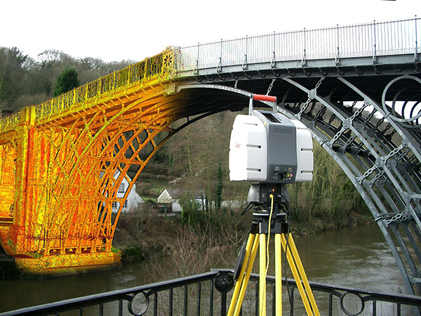 A high-precision ANN is critical to capturing quality scan data because without it, your point cloud would be nothing more than an arbitrary collection of points. nine0006
Zenmuse L1 uses an industrial grade ANN. In typical usage scenarios, the Zenmuse L1 provides an INS accuracy of 0.025° (roll/pitch) / 0.08° (heading). For greater reliability and accuracy, a video sensor for more accurate positioning and a dual-frequency GNSS receiver were included in the solution. This allows the Zenmuse L1 to achieve a 5 cm geodetic class relative accuracy and 10 cm absolute accuracy when flying at an altitude of 50 m.
2. 3-axis stabilized gimbal to close data gap
While most other drone scanners on the market require you to purchase stabilization solutions separately, the Zenmuse L1 comes with a 3-axis stabilized gimbal as a complete solution. This means that any unintended rotational movement of your drone (pitch, roll, or yaw) is dynamically stabilized within ±0.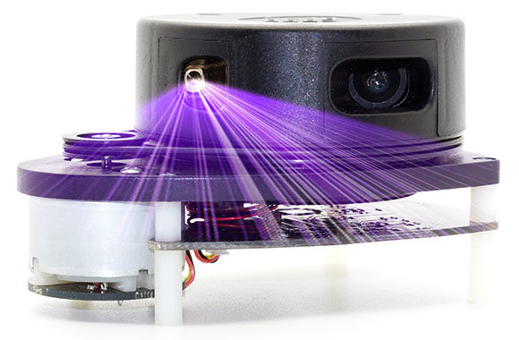 01°, ensuring even dot distribution even at very high scan speeds. Thus, the risk of data gaps is significantly reduced, which reduces the costs associated with re-flying. nine0006
Since the gimbal is integrated with DJI's flight control system, you get fully automatic rig control, increased data collection efficiency, and perfectly matched images for accurate geo-referenced aerial survey flights.
3.1" 20 MP CMOS Sensor for High Resolution Photogrammetry
As customer requirements become ever more demanding, it's impractical to force surveyors to choose between scanned data and RGB images, and it's unwise to spend twice as much time and money getting true-color point cloud models. That's why DJI's new all-in-one and cost-effective drone scanner solution, the Zenmuse L1, integrates a 1" 20MP CMOS sensor on board to perform essential functions such as taking photos and recording videos, as well as providing real-time color information. time for each point in the 3D cloud. This allows the Zenmuse L1 to capture true-colored point clouds and create 3D models. nine0006
The 1-inch 20MP CMOS sensor features a distortion-free mechanical shutter. This is the same sensor used in the most popular DJI Phantom 4 RTK mapping drone. And, like the DJI Phantom 4 RTK RTK, the Zenmuse L1 delivers images with about 2.74 cm of detail (pixel size) at 100 meters - that's if you choose to use it for photogrammetry.
4. Supports registration of up to 3 pulse reflections to penetrate dense foliage
With a scanning range of up to 450 meters, the Livox LiDAR Zenmuse L1 module provides an effective speed of up to 240,000 points per second. But the Zenmuse L1 can capture up to 3 echoes per laser pulse, which means the throughput can reach 480,000 points per second with two or three reflections.
This capability allows users of Zenmuse L1 LiDAR drones to easily create sets of spatial data on the height of dense forest and “clean up” the digital elevation model from distortion due to vegetation. The use of multiple reflections also makes it easier to classify the point cloud, highlighting different types of objects in the point cloud, such as overhead wires or various objects on a construction site. nine0006
5. Non-repetitive scan mode for full coverage
Zenmuse L1 The is the only airborne scanner that supports both linear scanning and non-repetitive scanning, a unique technology developed by Livox. In this mode, as the survey time increases, the scanned area within the field of view (FOV) increases, and the point cloud becomes denser. Following this technique increases the likelihood of detecting objects and other details within the field of view. And the longer the drone's LiDAR sensor scans an area, the higher the resolution of the data becomes (compared to conventional line scanning). nine0006
The non-repeating scan mode allows the DJI Zenmuse L1 to provide full coverage of an area of interest in a very short time and allows the sensor to collect data in any direction rather than along a specific plane.
6. IP44 certified for reliable performance
The Zenmuse L1 is IP44 rated, allowing it to fly in a wide range of adverse weather conditions including snow, smoke and fog. In addition, the LiDAR L1 module is an active sensor that uses its own radiation to work. Thanks to this, it can scan the area and receive point clouds at night or in low light conditions. nine0006
7. Complete mapping solution
Combining the Zenmuse L1 scanner with DJI's flagship Matrice 300 RTK industrial drone platform and DJI Terra post-processing software gives you an integrated, complete solution for accurate 3D data acquisition. At a flight altitude of 100 m and a speed of 10 m/s, a single flight with the DJI Matrice 300 RTK and Zenmuse L1 can cover an area of about 2 square meters. km. nine0006
To view a point cloud, simply use the Point Cloud LiveView feature to make sure you capture everything you need without landing and waiting for post-processing, and save yourself from re-flying and reworking. And once you have the right data, DJI Terra is your all-in-one post-processing solution. The software seamlessly combines INS and GNSS data to calculate cloud point coordinates and visible image positions so you can easily create 3D terrain models and get detailed accuracy reports. nine0006
Air scanners - what's next?
DJI aims to pave the way to the sky for affordable and scalable laser technology solutions. When unmanned laser scanning data becomes readily available, its applications will go far beyond engineering, geodesy, and conventional 2D surveys. For example, environmental monitoring agencies and companies can use laser scanning data to obtain information on tree canopy dimensions, estimate vegetation density, calculate stock levels, and calculate growth trends. High-risk industries such as oil and gas, mining and telecoms can benefit from detailed asset modeling for automated controls and more. And first responders, meanwhile, can use colored point clouds for real-time situational awareness, even at night in poor visibility. nine0006
Zenmuse L1 will be available for order in early 2021
For purchase, setup and technical support of DJI drones, please contact ArtGeo by phone +7 495 781 7888 or by e-mail [email protected].
Laser Scanner Drone - New Generation Technology
UAVs are used not only for classical digital aerial photography, but also for aerial laser scanning. A light and compact laser scanner, complete with a digital camera, allows you to create a photographic plan and the most accurate relief, despite the tree and shrub vegetation of the area. nine0006
Advantages of using UAVs
The introduction of airborne laser scanning technology from UAVs provides an opportunity to significantly speed up the process of performing work compared to instrumental surveys. Unlike manned aircraft, the drone functions smoothly even in unstable weather conditions and continuous low clouds. The laser scanner is small and the UAV is easy to transport, the drone does not require an airfield.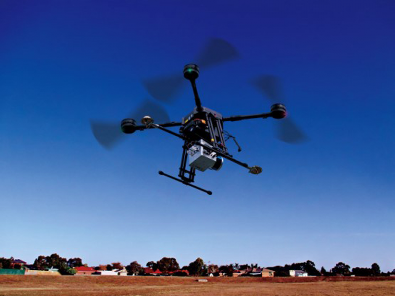 All this makes the technology optimal for the study of the most complex and non-standard objects in the shortest possible time. nine0006
Features and capabilities of laser scanning
UAV airborne laser scanning technology allows not only to quickly examine the surface of an object, but also to identify obvious defects and anomalies.
With airborne laser scanning, you can get the most accurate topography of the ground surface even under dense canopy of trees. The technology helps to determine the location, shape and size of various buildings, engineering structures, technological zones, as well as fix deviations from the norm. Hard-to-reach places are explored, for example, ledges of rocks, quarries and mountain ranges, factory complexes and industrial facilities. Some models of laser scanners are able to study the bottom of shallow water bodies. UAV laser scanning is also designed to compile topographic plans and maps of areas with a uniform background: desert, tundra, snow-covered areas, sandy beaches. The technology guarantees accuracy and high detail, which are unattainable by other methods of surveying the territory. nine0006
The essence and principle of operation
Laser scanning is one of the types of active imaging. A laser is installed on the drone, which conducts discrete scanning of the terrain, as well as all objects located on it. Laser pulses are reflected both from the surface of the earth and from objects located above it: vegetation, buildings, structures. The reflection of the laser from objects is received and analyzed by the sensor. The exact direction and time of passage of the laser beam is recorded in order to calculate the distance between the sensor and the target based on this information. In the future, the point data is processed, taking into account the scanning angle, the laser operating time range, GPS coordinates, and internal positioning information. As a result, the absolute coordinates of each object are determined. nine0006
UAV laser scanning is the best choice
Airborne laser scanning from a drone is deservedly considered the most accurate and efficient method of collecting spatial data.


