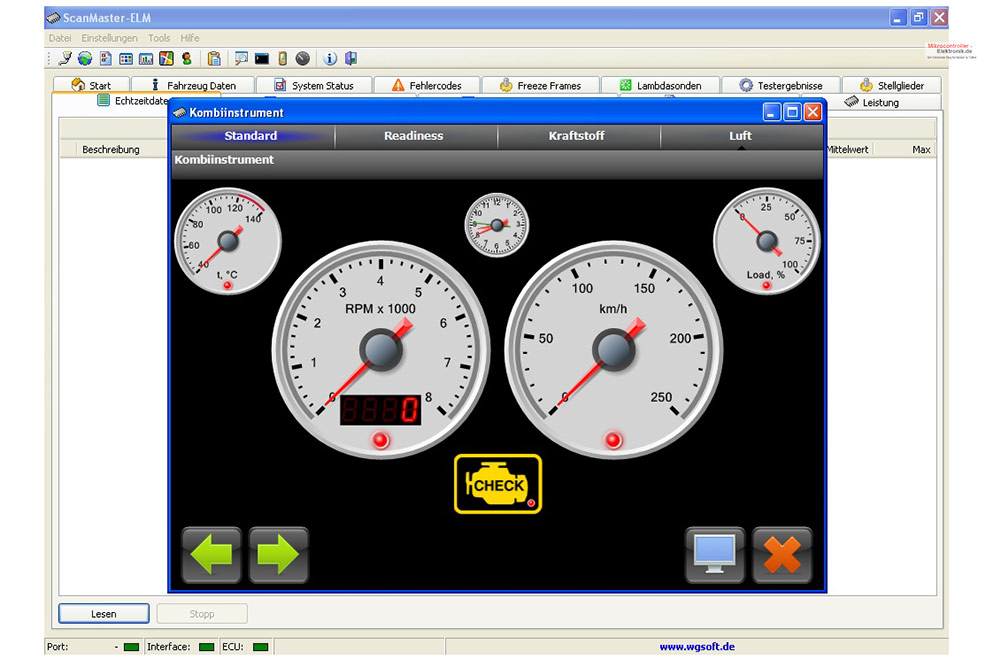
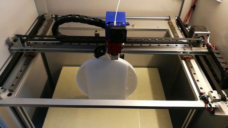
Scanmaster 3d scanner
ScanMaster v2 software – TerraDat 3D Scanning & Reality Capture
With laser scanning, it’s so much more about the scanning hardware – Software is the key. Now available is the latest version of Topcon’s point cloud processing package: ScanMaster v2.0. This software sees the introduction of many new and improved features and can work with scan data from any manufacturer meaning that existing surveyors can take advantage of the many innovative features.
In addition, ScanMaster is now available as a FREE module that enables instrument control, visualisation and data mark-up. This means you can take your scanner into the field and collect data whilst keeping the complete version in the back-office for data-processing. Full Functionality can be enabled via the USB dongle unleashing the true power of our ground-breaking software.
This FREE version of ScanMaster also functions as a powerful viewer that can be shared with customers to allow 3D viewing of point clouds . measurement of distances and areas, annotation and drawing.
The core functionality has been enhanced and primarily features a high performance point cloud engine offering faster indexing, reduced file size, improved visual quality, clarity and rendering performance. In turn this frees up PC memory for the many new and improved sophisticated routines.
ScanMaster v2.0 raises the bar, not only are expected functions such as: Mesh processing, Volumes, Planes, Regions, Cross-Sections and visualisation a standard feature, but unique edge extraction and non-surface-modelled CAD extraction offer the next level of data processing. Couple this with the new instrument and data interaction methods and it is clear that there really are an incredible number of new tools now available.
Key Features of the latest version:
- Superior Performance – Visualisation and rendering with no lag of clouds up to 4.3 billion points
- Automatic edge extraction
- Volume computation
- Deformation computations using volumen meshes
- Automatic noise filtering (traffic, people etc.
 )
) - Automated scan registration
- Automated ground extraction to create topo datasets via region select tool
- Automatic object extraction direct from the cloud (no mesh required)
- Enhanced interface e.g. Planar Zoom function yielding the most accurate elevation views we’ve seen
- Creation of othophotos
- Improved GLS control via remote video or captured images
Feature details:
Mass 3D Point Cloud Acquisition and Manipulation
ScanMaster has been optimized to quickly acquire and manipulate 3D point cloud data. Stream live video to setup the desired scan area and obtain the 3D point cloud data you need.
raverse and Back Sight Capabilities
With the ability to quickly traverse and back sight, ScanMaster streamlines the process of aligning data captured from multiple occupations into a single coordinate system.
Image Capture and Live Video Feed
ScanMaster uses images to streamline data acquisition. Images can also be used to apply RGB data and texture map scanned data. In addition, ScanMaster can stream a live video feed from the GLS-1000 Scanner via WLAN to a remote PC.
Target Scans and Tie-point Registration
With the ability to precisely locate centers of retro reflective targets, ScanMaster offers a flexible and highly accurate alternative to traditional orientation techniques.
Create Mesh Objects and Annotations
ScanMaster can quickly create mesh objects. These mesh objects are triangulated surfaces that pass through a section of data points, that can be used to create cross-sections and profiles. ScanMaster can also quickly annotate desired information such as angles, and distances.
ScanMaster 3D Scanner for sale in Australia
The product is end of line and no longer available
The ScanMaster 3D scanner is a full colour 3d scanning solution which features ane 7 inch USB connected touch screen with stylus, Orbbec Astra Sensor and the Free Reconstructme Software. All packaged in a convenient 3D printers casing with ergonomic handle.
ake your 3D scanning to the next level with the Reconstructme Full Colour 3D Scanner. This incredible setup allows you to see what you are scanning in real time. By having a touch screen mounted to the camera, it allows you effortlessly to scan and construct the 3D models. It is easy to see what has and hasn’t been scanned, without twisting your neck to look at the computer screen.
If you have used other 3D scanning systems, you will appreciate the elegance of the Scan Master System. The entire 3D scanning work flow can be controlled from the touch screen. From starting the scan, inspecting the scan, cleaning the object and saving. This speeds up the scanning process and reduces time to setup for the next scan.
Just pop your laptop into your backpack and scan the world!
Features
Simple menu options allow you to quickly select the size of the volume to a scanned. No complicated commands or settings that need to be specially configured.
Scan in real time with live video feedback
See exactly what you are scanning with the 7” touch screen.
Process the scan within the software
Integrated step by step workflow. Repairing, closing holes, making scans watertight, removing noise. No third party software required. Right from the touch screen!
Save as STL for 3D printing. Output directly to an industry standard format
Offers real time or offline recording
Best suited for medium to large objects. 20cm or larger.
Requirements
Recording only: Intel Centrino or higher. CPU Reconstruction: 2 Gb RAM, Quad core processor. GPU Reconstruction: 2 Gb RAM, Intel Core 2, Cuda 2.0 compatible graphics card, with 1 Gb of memory
Recommended PC: Windows 7 (64 bits), Intel i7, 4 Gb RAM with NVidia GTX 560 or higher.
Recommended Mac: OS X 10.8 or 10.9, Macbook Pro 2012 or Macbook Air 2013.
2x USB 2 ports
Package Includes:
- 3D Printed Parts
- 7” Touch screen
- Orbbec Astra Sensor
- 1.5m USB Cable
Downloads:
Specifications
|
|
3D laser scanning
The essence of laser scanning technology is to determine the spatial coordinates of object points. That is, the device, using a phase or pulsed non-reflective range finder, calculates the distances to all points of the object and measures vertical and horizontal angles. In this case, a three-dimensional image (with XYZ coordinates) is formed in the form of a point cloud (scan, bitmap). The principle of operation is similar to the operation of an electronic total station, but unlike it, the shooting process takes place thousands and even millions of times faster! And this makes terrestrial laser scanning the most efficient and high-performance means of obtaining accurate and complete information about any object! nine0010 That is, the device, using a phase or pulsed non-reflective range finder, calculates the distances to all points of the object and measures vertical and horizontal angles. In this case, a three-dimensional image (with XYZ coordinates) is formed in the form of a point cloud (scan, bitmap). The principle of operation is similar to the operation of an electronic total station, but unlike it, the shooting process takes place thousands and even millions of times faster! And this makes terrestrial laser scanning the most efficient and high-performance means of obtaining accurate and complete information about any object! nine0010 |
The laser scanner is controlled from a laptop computer or from the control panel built into the scanner.
The shooting process itself is quite simple and has the following sequence:
1) zones of mutual overlapping of scans are determined, targets are set;
2) the laser scanner is mounted on a tripod in certain areas;
3) the device is given the density of the point cloud (resolution) and the survey area; nine0021 4) the process of laser scanning of objects starts.
|
Target layout for shooting a simple object |
|
Road target layout |
Even at the stage of field work, it is necessary to preliminarily determine the zones of mutual overlap of scans (so that all the details of the object being photographed can be seen). To do this, prior to the start of shooting, special targets . Further, according to the coordinates of these targets, the point clouds are combined into a single 3D model . It is possible to combine point clouds without targets.
To obtain a complete 3D image of terrain, several shooting sessions (from different positions) are required. This makes it possible to shoot the surface from different points and fix any, even the smallest elements! The resulting point clouds are combined with each other into a single space in the software module. All data at the same time have such characteristics as coordinates, intensity of the reflected signal and the real color of the point. nine0003
As a result of the collected data, we obtain a 3D model , with a high degree of detail, flat drawings and sections, profiles and sections, plans, areas and volumes of surfaces that retain full geometric correspondence of the shapes and sizes of a real object. Among other things, there is the possibility of exchanging graphic data, which makes it easy to integrate the laser scanning technology into the scheme of the software already in use.
|
3D point model of the cathedral |
Overview of Ground Laser Scanners
Today, many companies are developing 3D laser scanners for various purposes. But all modern terrestrial laser scanners have a number of common characteristics:
1. Accuracy of measuring distance, horizontal and vertical angles; nine0021 2. maximum scanning resolution;
3. scanning speed;
4. range of the laser scanner;
5. divergence of the laser beam;
6. field of view of the scanner;
7. used means of obtaining information about the real color;
8. safety class of the laser used;
9. portability and interface features.
One of the world's leading manufacturers of terrestrial laser scanners is Z+F (Zoller + Fröhlich) . Devices brand Z + F are made in Germany, which does not raise doubts about the quality and accuracy of the device! Today, one of the most popular devices of this brand is laser scanner IMAGER5010 . Unlike its predecessors, the scanner has unsurpassed scanning speed, improved accuracy, huge field of view, extended temperature range, color touch screen, light weight and compactness. In addition, the laser scanner has a safe beam, not only for industrial equipment, but also for human eyes! All these differences put the scanner an order of magnitude higher than its peers. nine0003
Color point cloud, scanner Z+F Imager 5010C
High accuracy and scanning speed (more than 1 million points per second) allows you to make measurements on the object in a very short time and at the same time achieved accuracy better than 1mm - this is especially true in cases where it is necessary to avoid the accumulation of errors when registering data obtained from a large number of scanner stops.
Wide field of view (3600 horizontal and 3200 vertical) leaves only a small area under the scanner out of the scanner's field of view. In addition, the scanner is adapted to work in different conditions , from temperatures from -100 to very dusty!
Equally important is the compactness of the device and its complete autonomy from a computer or any devices, and the data is stored on the drive built into the scanner. The color touch screen makes it easy to set scan modes, view acquired data, and perform simple measurements on acquired point clouds.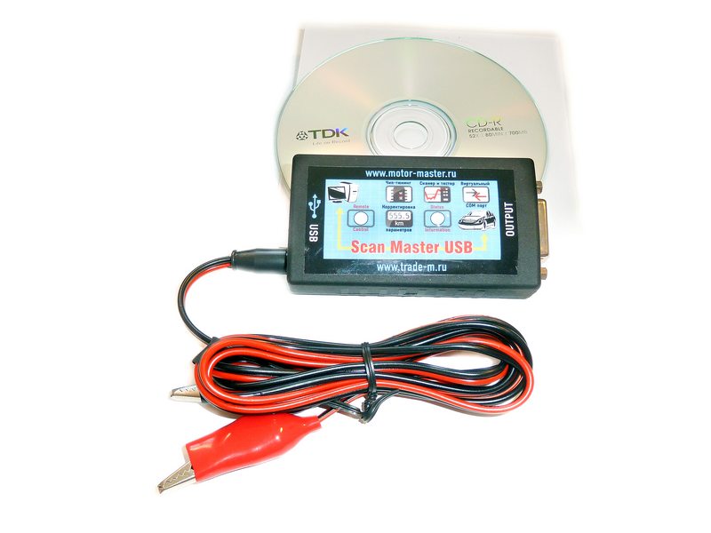 nine0003
After all the work has been done, data has been received from different points, the program LFM Register will help to register them in a single cloud, and LFM Modeller will help to process and convert them into three-dimensional models or flat drawings. In addition, the received data can be transferred to any other software packages, such as AutoCAD, Smart Plant 3D, PDMS and others, to work in them for further design.
An equally popular laser scanner is scanner GLS-1500 manufactured by Topcon (Japan). Japanese instruments have always had the best performance under equal conditions. So, for example, laser scanner GLS-1500 with a lower scanning speed (up to 30,000 points per second), has a greater shooting range (up to 330 meters). This gives the scanner an advantage when shooting in open areas of considerable size. In addition, this does not deprive the scanner of the ability to capture urban and industrial areas, building facades and architectural objects. nine0003
Topcon GLS 1000/1500 Laser Scanner
Equally important is that the scanner is equipped with class 1 safety laser and high millimeter accuracy. Complete autonomy and built-in control panel with data accumulation on a regular SD card, as well as the built-in WiFi module , make the device not only reliable, but also convenient. So, the scanner can be controlled remotely, which is important when shooting in adverse conditions. In addition, using the built-in camera, you can save photos of the subject itself. nine0003
Software Topcon ScanMaster allows you to register the received data, combine them into a single point cloud, prepare data for drawings, perform measurement work, create surface models, profiles, cross sections.
Where is terrestrial laser scanning used?
Terrestrial laser scanning applications are numerous.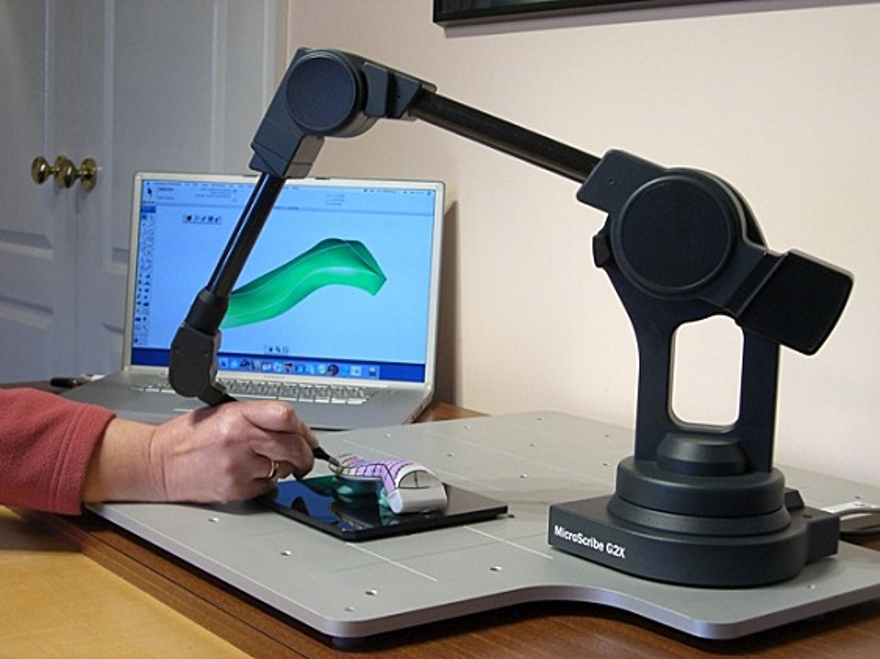 Laser scanning possible to apply:
- in the construction and operation of engineering structures; nine0021 - in the mining industry;
- in the oil and gas industry;
- in architecture;
Color point cloud, Z+F Imager 5010C scanner
- in the development of measures to prevent and eliminate the consequences of emergency situations;
- in the implementation of topographic survey of territories with a high degree of development;
- in shipbuilding;
| nine0002 Laser scanning and calculation of ship cargo tank volumes |
- in modeling various types of simulators;
- in the creation of two-dimensional and three-dimensional geographic information systems for enterprise management;
- in fixing road accidents and crime scenes.
Color Point Cloud, Crash Scene for Exploration, Scanner Z+F Imager 5006
In any field, laser scanning has advantages such as:
- prompt receipt of initial data
- prompt preparation of high-quality and visual design documentation (office processing)
- high-precision and detailed shooting
- increased work efficiency and labor costs
- safe work
- carrying out work without interrupting (stopping) from the process of the removed object
- work in conditions of increased dust, vibration, poor lighting
and much more!
Based on the foregoing and the experience of our company's specialists when using this technology, we can conclude that terrestrial laser scanning technology proved to be not only highly effective, but in many cases as indispensable, allowing in a short time to quickly capture various objects without loss of accuracy and completeness of the collected data. It can be applied in almost any field due to absolute objectivity and the absence of the influence of the human factor. nine0003
It is hard to imagine how much time it would take us to shoot communications with an electronic reflectorless total station, for example, in a slurry pump shop with dimensions of 60 × 30 × 20 meters. Months, maybe a year? With the Laser Scanner , all "field" work can be completed in a few working days.
Which laser scanner should I choose?
The key to success in jobs that require laser scanning technology is the right tool. nine0003
The Topcon and Z+F family of laser scanning systems have the right equipment for your application.
Large format large format scanners. Top Brand Sheet Scanners
Sort:
Name
VERSASCAN 48100 sheet-fed scanner
VERSASCAN 36100 sheet-fed scanner
VERSASCAN 4870 sheet-fed scanner
VERSASCAN 3650 sheet-fed scanner
VERSASCAN 2550 Sheet Scanner
When digitizing archives of sheet documents, situations often arise , when scanning of such originals as machine-building drawings, diagrams, maps, etc. , using traction scanners is impossible, for example, if the original is in poor condition or if high geometric accuracy is required , which pull-through scanners cannot provide. The ideal solution in this case is the VERSASCAN line of large format sheet document scanners. nine0003
Working with VERSASCAN scanners is as easy as regular office copying. Open the lid, place one or more documents on the glass, close the lid and start scanning - that's it! VERSASCAN wide-format scanners allow you to carefully, quickly and extremely accurately scan any sheet originals longer than 2.5 m. A special option is provided for working with transparent materials such as films, tracing paper, etc.
VERSASCAN wide format sheet document scanners are closed optical system (COS) devices, as opposed to open optical system (OOS) scanners or so-called "planetary scanners". In the latter, the scanning element is located at a considerable height from the original, and the ambient light introduces its harmful component into the illumination of the scanned object, leading to distortions.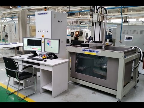 Therefore, they work with planetary scanners only in darkened rooms. In contrast, in VERSASCAN scanners, a special LED light source without ultraviolet and infrared components, which guarantees the safety of the original and the constancy of illumination during scanning, is located inside the scanning head and simply moves with it over the original. Therefore, it does not matter where the scanner is installed. As a result, VERSASCAN, as well as ScanMaster book scanners, can be operated regardless of ambient lighting conditions. nine0003
The hallmark of VERSASCAN scanners is the V3D scanning mode (VISUAL 3D). This is a newly developed technology that allows you to see the volume of the scanned object. The process is based on the application of different object lighting scenarios, when the same area is scanned at different lighting angles on the fly. The software then combines the individual images into a single image. As a result, V3D images obtained with VERSASCAN scanners are excellent 3D copies of almost any structured surface.